


 11.4
11.4 4
4- Old Pelion Hut (Cradle Mountain-Lake St Clair National Park)
- Mount Pelion West (Cradle Mountain-Lake St Clair National Park)
- Mount Pelion East (Cradle Mountain-Lake St Clair National Park)
- Mt Ossa Climb (Cradle Mountain-Lake St Clair National Park)
- Lake Will (Cradle Mountain-Lake St Clair National Park)
Mount Oakleigh
Cradle Mountain-Lake St Clair National Park
Menu
To reach the true summit of Mount Oakleigh an 11.4km side trail is required although the first East peak can be optained via a 7.8km return hike or a 9.8km return hike can be made to the commonly obtained false peak which places you above the famous Oakleigh spires.
Lookouts
Scrambling or Climbing
Navigation Required
Alpine
1286m
Maximum Elevation
604m
Total Climb
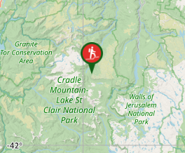
Getting there
How do you get to the start of the walk?
From the track junction with the overland track.
Maps
Which maps cover the area?
Overland Track Maps.
Route/Trail notes
A detailed description of the walk!
From the far side of Pelion Hut the trail heads out along the edge of the Pelion Plains then crosses a bridge over Douglas Creek where the trail departs the Arm River Track. From here you will cross the last of the Plains and tributary creeks until you reach the forested foot of the mountain. You then make your way sharply up through lovely forest. Once you have ascended the plateau you will turn sharply left and start running West along the plateau edge. You will leave the tree line and start enjoying expansive views especially once you summit the first East Peak (from here its 7.8kms return to the start). Once you have enjoyed the views look West along the cliffline and you will see the trail continue down into a often wet marshy valley before it heads back up the otherside to the next high point. This is the false peak where most people turn around and it is directly above the impressive Mount Oakleigh spires (it will be your next destination and once there it will be 9.8kms back to the start). If you choose to head out to the false peak and enjoy the views then the true summit is now North of you at a similar distance as these first two peaks were apart. Luckily the drop isn't as big but the trail is less defined. The true summit offers a different perspective and some good views North. From the true summit it is roughly 5.7 kms back to Pelion hut (11.4kms return eg. Pelion hut to true summit & back).
Permits/Costs
Do you need any permits? What's the cost?
Free
Other References
How can I find more info? Any guide books?
https://parks.tas.gov.au/explore-our-parks/cradle-mountain/overland-track/overland-track-walk-notes#:~:text=%E2%80%8B%E2%80%8B%E2%80%8BBarn%20Bluff,not%20recommended%20when%20under%20snow.
GPS Tracks
- No GPS available for this walk yet.
Where
Click here to load this map.
Comments
Nobody has commented on this walk yet. If you've done it then tick it off and add a comment.