


 1
1 1
1- Mount Oakleigh (Cradle Mountain-Lake St Clair National Park)
- Mount Pelion East (Cradle Mountain-Lake St Clair National Park)
- Mount Pelion West (Cradle Mountain-Lake St Clair National Park)
- Mt Ossa Climb (Cradle Mountain-Lake St Clair National Park)
- D’Alton and Fergusson Falls (Cradle Mountain-Lake St Clair National Park)
Old Pelion Hut
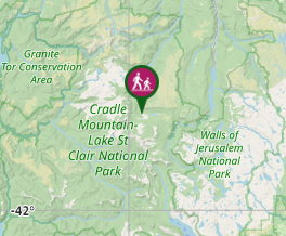
Cradle Mountain-Lake St Clair National Park
Menu
A short side trail to an historic hut. There is also an old copper mine and Douglas Creek just past the hut.
Swimming
Heritage Sites
Alpine
880m
Maximum Elevation
Getting there
How do you get to the start of the walk?
From the track junction with the overland track.
Maps
Which maps cover the area?
Overland Track Maps.
Route/Trail notes
A detailed description of the walk!
A short side trail to old pelion hut. The trail skirts the edge of the Pelion Plains leading down to the hut. Further past the hut there is an old copper mine and Douglas Creek.
Permits/Costs
Do you need any permits? What's the cost?
Free
Other References
How can I find more info? Any guide books?
https://parks.tas.gov.au/explore-our-parks/cradle-mountain/overland-track/overland-track-walk-notes#:~:text=%E2%80%8B%E2%80%8B%E2%80%8BBarn%20Bluff,not%20recommended%20when%20under%20snow.
GPS Tracks
- No GPS available for this walk yet.
Where
Click here to load this map.
Comments
Nobody has commented on this walk yet. If you've done it then tick it off and add a comment.