- Ronny Creek via face track return (Cradle Mountain-Lake St Clair National Park)
- Waldheim Forest Walk (Reynolds Falls Nature Recreation Area)
- Wombat Pool (Cradle Mountain-Lake St Clair National Park)
- Lake Lilla Track (Cradle Mountain-Lake St Clair National Park)
- Crater Lake Circuit (Cradle Mountain-Lake St Clair National Park)
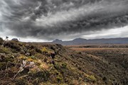
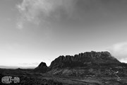
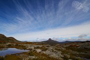
The best-known, and arguably best quality, bushwalk in Australia, the Overland Track traverses the finest of Tasmania's wilderness: rugged mountain peaks, wild alpine moors and deep forests. With a series of side-trips available, no two trips are the same.
Getting there
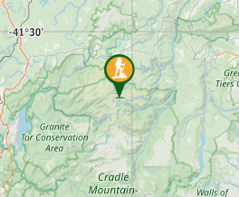
The starting point at Cradle Mountain is a two-hour drive from Launceston on the Bass Highway via Deloraine, turning off at Elizabeth Town to Sheffield, or 1.5 hours from Devonport via Sheffield. From Hobart, take the Midlands Highway through Campbell Town, turn left at Perth then take the Bass Highway, turning left at Elizabeth Town to Sheffield, then turning off to Cradle Mountain.
Maps
The track is covered by the Tasmap Cradle Mountain - Lake St Clair 1:100000 map.
Route/Trail notes
Take some time to research your trip and plan your own itinerary based on the numerous side-trips available along the main route. This is a basic run-down.
DAY ONE: Cradle Valley to Waterfall Valley: 10km, 5 hours
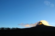
The main track climbs steeply from Ronny Creek to Marions Lookout for a grandstand view, continuing to Kitchen Hut, a tiny emergency shelter. From here the track passes behind the bulk of Cradle Mountain before descending into Waterfall Valley.
DAY TWO: Waterfall Valley to Lake Windermere: 7km, 2 hours
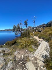
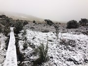
An easy day with ample opportunity for side trips as the track climbs gently out of the valley before crossing an exposed moor then climbing to a ridge for a view of all the track's major peaks - on a clear day - with Lake Windermere in the foreground. The hut is in attractive forest near the lake edge.
DAY THREE: Windermere Hut to Pelion Hut: 14km, 5.5 hours
The track crosses Pine Forest Moor, an open buttongrass plain in the shadow of the massive Mt Pelion West, then enters dense forest where deep mud and tangled tree troots slow progress. The path emerges in a clearing at Frog Flats, the lowest point of the track (720m). Avoid the leeches and climb to Pelion Plains and the New Pelion Hut, the most luxurious shelter on the track.
DAY FOUR: Pelion Hut to Kia Ora Hut: 8km, 3 hours
Climb through ancient rainforest to Pelion Gap, gaining 280m in about 2km. On a clear day the side-trip from here to Mt Ossa, Tasmania's highest peak, is a must; the track is steep but the views are unforgettable. From the gap the track descends to Kia Ora Hut, located in eucalypt forest beside Kia Ora Creek. Kia Ora Falls are a short walk downstream.
DAY FIVE: Kia Ora Hut to Windy Ridge Hut: 9km, 3 hours
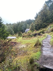
Thirty minutes of easy walking leads to historic Du Cane Hut. The hut, built in 1908, is now an emergency shelter only. The track then heads into magical forest of moss-covered myrtle beech trees to reach a junction, where tracks lead to nearby waterfalls. The main path continues through rainforest then climbs to Du Cane Gap (1070m). A descent through more rainforest leads to Windy Ridge Hut.
DAY SIX: Windy Ridge Hut to Pine Valley Hut: 10km, 3.5 hours
Pine Valley is technically not part of the Overland Track, but the beautiful setting and walking possibilities among the surrounding mountains demand inclusion in the itinerary if you have time. From Windy Ridge, 5km of easy walking brings you to the junction of the Pine Valley track. Turn right and cross several creeks on the way to Pine Valley Hut, set in beautiful rainforest beside Cephissus Creek.
DAY SEVEN: Pine Valley
Pack a day pack and head to one of the magnificent nearby peaks - the Labyrinth (6km, 4 hours) or the Acropolis (6km, 5 hours) are two to get you started.
DAY EIGHT: Pine Vally to Cynthia Bay: 22km, 3.5 hours
Return to the junction of the main track and turn right to reach Narcissus Hut at the northern end of Lake St Clair. From here it is possible to walk around the lake edge (17km) or take the easy option and use the radio in the hut to book a spot on the next boat across the lake.
SUGGESTED SIDE-TRIPS
CRADLE MOUNTAIN SUMMIT
2.5km, 2 hours from Kitchen Hut
BARN BLUFF
5km, 2.5 hours from junction above Waterfall Valley Hut
WATERFALL VALLEY
2-3km, 1-2 hours from Waterfall Valley Hut
LAKE WILL
4km, 1.5 hours from track south of Waterfall Valley
MT PELION WEST
4km, 5 hours from the Pelion Plains
MT OAKLEIGH
8km, 4 hours from Pelion Hut
MT OSSA
5km, 2.5 hours return from Pelion Gap
MT PELION EAST
2.5km, 1.5 hours from Pelion Gap
D'ALTON & FERGUSSON FALLS
1km, 1.5 hours from main track in Mersey Valley
HARTNETT FALLS
1km, 1 hour from main track in Mersey Valley
THE LABYRINTH
6km, 4 hours return from Pine Valley Hut
THE ACROPOLIS
6km, 5 hours return from Pine Valley Hut
Permits/Costs
Bookings are required for each walking season (1 October to 31 May). During the booking period walkers will be required to walk the track from North to South (Cradle Mountain to Lake St Clair), and pay the Overland Track Fee. Bookings open July each year for the coming season.
Other References
To book visit the Tasmanian Parks and Wildlife Overland Track page at www.parks.tas.gov.au. For photos of this hike and more great Aussie walks visit wildsight.com.au and loko up wildsight on Facebook.
GPS Tracks
- No GPS available for this walk yet.
Where




 65
65 8
8
Comments