- Fergy's Paddock Loop (Cradle Mountain-Lake St Clair National Park)
- Narcissus Hut to Cynthia Bay (Lakeside Walk) (Cradle Mountain-Lake St Clair National Park)
- Mt Rufus (Cradle Mountain-Lake St Clair National Park)
- Little Hugel (Cradle Mountain-Lake St Clair National Park)
- Pine Valley (Cradle Mountain-Lake St Clair National Park)
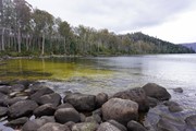
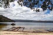
An easy walk to a nice beach, with a nearby "hide" for viewing platypus (best at dawn and dusk).
This easy walk follows the crest of glacial moraine for part of it's route and takes you through eucalypt and then rainforest to the junction of the Cuvier and Hugel Rivers. in Spring and summer many wildflowers, including acacia, waratah, hakea, orchid and leatherwood are in flower. Many birds and other wildlife including wallabies, pademelons, echidnas and tiger snakes make be seen on the walk.
From Cynthia Bay at Lake St Clair, three varied short walks offer a taste of the southern end of the famous Cradle Mountain-Lake St Clair National Park.
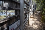
The lamairremener tabelti walk offers an insight into the Aboriginal people who lived around leeawuleena (Lake St Clair) for thousands of years.
The Watersmeet Walk takes you to the confluence of the Cuvier and Hugel rivers. A short walk beyond that is a loop to Platypus Bay, where platypus are sometimes seen. All three walks can be combined for a 4.7km figure-of-eight loop.
Getting there
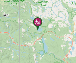
The walk begins from the Visitor’s Centre at Lake St Clair National Park.

Maps
4233 Rufus 1:25K or TASMAP Lake St Clair Day Walk Map (print & digital options available)
Neither is needed as the walk is well sign-posted. Brochure with rough map available from Visitor Centre
Route/Trail notes
As well as viewing platypus, there is a wreckage of a barge on the beach with information about how it had been used in the past.
Permits/Costs
National Park entry fee payable
Other References
http://tastrails.com/platypus-bay/
Tas Parks Lake St Clair "Short Walks" brochure - https://www.parks.tas.gov.au/file.aspx?id=19422
GPS Tracks
- No GPS available for this walk yet.
Where


 4.7
4.7 1
1
Comments