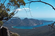
A rewarding 2-3 day hike that combines picturesque bays, turquoise water and majestic views of the Tasmanian coast.
Lookouts
Swimming
Scrambling or Climbing
No Dogs Permitted
Camping Permitted
Coastal
Eucalypt Forest
626m
Maximum Elevation
1200m
Total Climb
Getting there
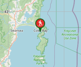
Starts at the Wineglass Bay carpark, near Coles Bay. About 2.5-hours from Hobart or Launceston airports.
Maps
TasMap Frecyinet National Park 1:50,000
Route/Trail notes
Circuit of Freycinet peninsula, best done as a 2-3 day walk. Optional side-trips include Mt Freycinet (highest point of the walk) and Bryans Beach at he southern end of the peninsula. See detailed route notes below.
Permits/Costs
Tasmanian Parks Pass
Other References
https://hikingtheworld.blog/2017/01/27/freycinet-circuit/
GPS Tracks
- No GPS available for this walk yet.


 40
40 3
3
Comments