
Junee Cave Track
Tasmania


Menu
A short walk following the Junee River to the Junee Cave mouth. Which is part of the Junee-Florentine karst area and is connected to Australia's deepest cave in the Niggly/Growling Swallet cave system.
Lookouts
Rainforest
318m
Maximum Elevation
27m
Total Climb

Getting there
How do you get to the start of the walk?
End of Junee Road
Maps
Which maps cover the area?
Maps of Junee Cave State Reserve
Route/Trail notes
A detailed description of the walk!
Follow the trail through the lush forest and then along the Junee River to the Junee Cave mouth and then return to start.
Permits/Costs
Do you need any permits? What's the cost?
Free
Other References
How can I find more info? Any guide books?
GPS Tracks
- No GPS available for this walk yet.
 1
1 30
30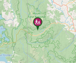
Comments
Nobody has commented on this walk yet. If you've done it then tick it off and add a comment.