Menu
The quickest way to the top via a 4wd road.
Getting there
How do you get to the start of the walk?
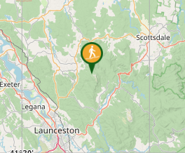
From the top of the Mount Arthur Firetrail off of the Blyths Spur off of Whites Mill Rd
Maps
Which maps cover the area?
Maps of Mount Arthur
Route/Trail notes
A detailed description of the walk!
From where you can no longer drive the car any further hop out and you immediatley join the walking trail and see the Mount Arthur walkers information shack. Head up the sholder onto the plateau and once ontop make your way to the middle of the plateau where there is two out and back trails. One to the summit and one to the North East fire lookout. Once you have done both retrace your steps.
Permits/Costs
Do you need any permits? What's the cost?
Free
Other References
How can I find more info? Any guide books?
GPS Tracks
- No GPS available for this walk yet.


 3.8
3.8 2
2
Comments
Nobody has commented on this walk yet. If you've done it then tick it off and add a comment.