
Carrolls Creek Loop
Bald Rock National Park


Menu
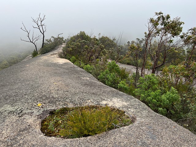
Trailhead at Bald Rock day use area.
Walk includes Little Bald Rock and two creek crossings (sturdy bridges). 4km are on the Bald Rock access road
Lookouts
Picnic Facilities
BBQ
Toilets
No Dogs Permitted
Camping Permitted
Swamp or Wetland
Eucalypt Forest

Getting there
How do you get to the start of the walk?
From Tenterfield take the Mount Lindesay Road north and then turn left into Bald Rock Access Road and follow this for 5km to the car park and picnic area.
From Stanthorpe drive towards Amosfield, then south along the Woodenbong Road/Mount Lindesay Road towards Tenterfield. The road is partially unsealed, with the turnoff into Bald Rock Access Road on the right.
Maps
Which maps cover the area?
Route/Trail notes
A detailed description of the walk!
Permits/Costs
Do you need any permits? What's the cost?
Other References
How can I find more info? Any guide books?
GPS Tracks
- No GPS available for this walk yet.
 19.7
19.7 4.5
4.5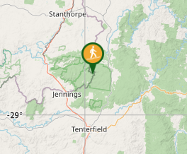
Comments