Little Bald Rock

Bald Rock National Park

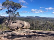
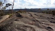
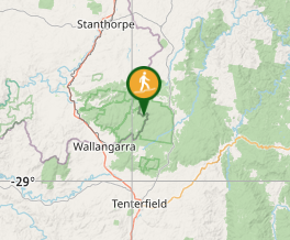
The Little Bald Rock rewards you with scenic views across New South Wales and Queensland, as well as Bald Rock itself. This smaller granite dome provides great views of Girraween and Bald Rock National Parks.

Lookouts
Picnic Facilities
BBQ
Toilets
Scrambling or Climbing
No Dogs Permitted
No Trail Bikes Permitted
Camping Permitted
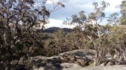
Eucalypt Forest

Getting there:

From Tenterfield take the Mount Lindesay Road north and then turn left into Bald Rock Access Road and follow this for 5km to the car park and picnic area.

From Stanthorpe drive towards Amosfield, then south along the Woodenbong Road/Mount Lindesay Road towards Tenterfield. The road is partially unsealed, with the turnoff into Bald Rock Road on the right.

Maps:

Bald Rock National Park

Route/Trail notes:

From the car park and picnic area take the right hand signposted track, which is also signposted to the Border Walk and Carrolls Creek Walk.  Follow the track/firetrail along the base of Bald Rock all the way to Little Bald Rock. The track passes around the base of the rock to the right, then does a sharp u-turn and climbs gently up the south western spur of the rock to the summit.

The alternative less commonly used and shorter route from the east leaves the main trail (unsigned) on the granite patch on the eastern face. Cross the fallen barbed wire fence to find the track on the far left marked by a cairn of stones. Climb along the left side of a boulder then cross to the right hand side and this leads to the top.

Note: The walking distances provided by National Parks signage, are varied and confusing. The 7.8km quoted is based on climbing the south western spur and returning on the eastern face.

Permits/Costs:

National Park entry fee applies (2022 = $8 per vehicle/day). Park entry fees and camping permits can only be purchased online from National Parks NSW. The campgrounds are just behind the car park. 

Other References/Comments:

Little Bald Rock walking track

Comments

When I first climbed Little Bald Rock in 2017, I could not find the access points to the eastern face. This time around we worked it out from the top and marked the base point with a cairn.

F.A.B. on 21 May, 2023

We couldn’t find the loop section once on the summit so did an up and back return walk which came in at 9km. Nice walk and easy access to he summit. Very windy on the summit ridge today with a storm threatening so didn’t hang around. Nice walk completed well under the NP recommended timeframes so not difficult at all.

Bobbe on 14 Feb, 2022

Decided to take the mountain bikes on this one with the aim of going further out to South Bald Rock though a popped tire derailed those plans meaning we turned round only a few kms after Little Bald Rock. There is two main ways of getting to the top of little bald rock from the East a trail leaves the main trail unsigned on the granite patch just East of the summit and leads to the top this is less commonly used though is closer when coming from Bald Rock Picnic Area along the Little Bald Rock trail alternatively following the main trail which skirts the Northern side of the summit a signed turn off to the summit is present on the Western side of the summit just as you think you have gone past it and are starting to descend. This is the main signed trail up and follows a granite slap up to the top. Saw a pair of noisy Yellow-Tailed Black Cockatoo at the summit as well as a Lyrebird. Good views of the peaks of Girraween.

Lahs on 13 Jan, 2022

Amazing!!

Mackamcb on Jan, 2019

Great little walk through bush and then some good views.

Chantelle on 3 Jun, 2018

Having been confused by the distance markers and where to climb up, I finally got to the top of this one to place another stone on the cairn and enjoy the great views on what I had thought was a sunny day.
However, when I panned around to the east, I was confronted by a huge black thunderstorm cloud heading straight for me. I have never legged it off a mountain so fast in all my life!
I don't mind getting wet, but lightning and granite do not mix, as I witnessed in Girraween NP a week later, with a strike hitting The Pyramid.

F.A.B. on 26 Oct, 2017

Yes even when it is wet great walk!

Laurence Hallam on 26 Sep, 2009

Great walk. Especially if you know the sights of Girraween and can recognise them from the new perspective.

Richard Mason on Apr, 2007

Where

Click here to load this map.

Nearby Walks

Done this walk?

This walk has been ticked 19 times

Aussie Bushwalking can keep track of your bushwalks.

Login/signup to tick this walk off.

Tick walks to keep track of where you've been. You must Login to tick walks. Accounts are 100% free so sign up if you don't have one.