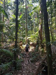
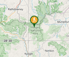
A rainforest walk linking The sheepstation Creek campsite with the Forest Tops campsite in the Boarder Ranges National Park.
Getting there
This National Park can be accessed from either Kyogle or Murwillumbah. Follow the signs from either the Summerland Way north of Kyogle via Wiangaree or the Murwillumbah-Kyogle Rd. The park is 38km west of Murwillimbah and 28km north of Kyogle. Both campsites are located on the Tweed Range Scenic Route. Some roads are gravel.
Maps
Which maps cover the area?
Route/Trail notes
Start this walk from either Sheepstation Creek Campsite or Forest Tops Campsite. Forest Tops is much higher than Sheepstation Creek, so the walk from Forest Tops is much easier than in the opposite direction. A additional loop track to Brushbox Falls branches off this track 900m from Sheepstation Creek. About a third over the way along from Sheepstation Creek is the rosewood Loop - another additional track. Part of the path on the Forest Tops Acton is along a disused forest road. The path is clearly marked, though in some places hard to see due to the amount of leaf litter.
Permits/Costs
THere I see an $8 per day vehicle fee.
Other References
How can I find more info? Any guide books?
GPS Tracks
- No GPS available for this walk yet.


 10.5
10.5 5
5
Comments