Nice walk on a single trail to the top of Mt. Burringbar after which the mountain range is named.
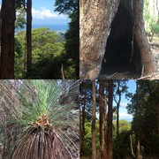
Offers some views through the trees down to the coast.
Getting there
Follow the Tweed valley way from Burringbar north towards Murwillumbah.
On top of the range you see a picknick hut. 250m later on your right is an unmarked gravel road (Coradilla Road).
Follow it until you come to the trail head at the intersection of Coradilla Road and Baranbali Road.
Barnanbali Road is gated and the start of the walk.
Maps
Which maps cover the area?
Route/Trail notes
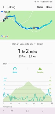
Follow Barnabali Road (= fire trail). At the first fork (about 400-500m in) turn right on a single trail which leads up to Mt. Burringbar.
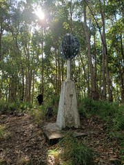
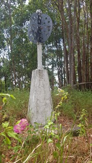
There are some nice but obstructed views through the trees towards the coast and a little 'marker monument' on the top.
Nice wildlife. Suitable for older kids, some short steeper parts.
Retrace your steps back to the car.
Note:
Some maps show this path continuing on and joining back up with Barabali Road.
I would not recommend it unless you are after a real adventure and well prepared. Somewhat dangerous.
Very steep, loose leave litter, gravel and rocks, no path at all. Here and there a blue ribbon on some trees.
If you choose to do this part, follow the ridge down, once the ferns start, contiue with a tednency slightly to the left.
This incresses the difficulty to 'difficult', expirience and GPS a must.
Not suitable for jung kids, or not sure footed person.
Whole loop 3.7km/ 3hrs
Permits/Costs
Do you need any permits? What's the cost? None
Other References
How can I find more info? Any guide books? I don't know.



 Mt. Burringbar (GPX)
 3
3 2
2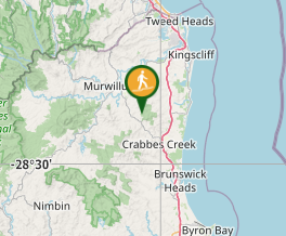
Comments