Hannel's Spur

Kosciuszko National Park

At 1800metres it is the greatest vertical ascent in Australia. It is the same route that Strzelecki took as the first European to climb Kosciusko in 1840. A very tough but rewarding classic route.

Navigation Required
Eucalypt Forest
2228m
Maximum Elevation
1800m
Total Climb

Getting there

From Canberra follow the Monaro highway to Cooma from Cooma travel to Jindabyne and then follow the Alpine Way to Thredbo.

From Melbourne follow the Hume Highway to Wodonda then turn east and follow the Murray Valley Highway to Corryong then on to Khancoban and finally the Geehi Rest Area. About 5.5hours drive time Melbourne-Geehi.

Maps

CMA map Kosciuosko

Youngal 8525-3-S 1:25,000, Chimneys ridge

SV Maps Kosciuszko Alpine Area 1:50,000

Route/Trail notes

The walk started from the carpark below Dead Horse Gap early! Follow the signs up the 4km walk to the main tracl leading to Mt Kosciousko. The metalled wlakway is about 6.5km to the turn off for the main range track. follow this track for about 2km to the wflats of wilkinson vally follow a rough path along the wilkinson creek and cross over after about 500m. A faint trail leads up and down and up, on a wide swing around Abott's Peak, after the turn there is a rocky out crop before Byatts camp.

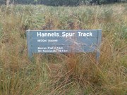
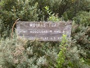
After this camp the plunge begins down, there are rock cairns and trail markers evry so often to guide you and the path is viisible. after about a good hour I reached moira's Flat where I dumped my camping equipment for my sleep that night and refilled my water bottle. There is only one real navigation difficulty which is at 960m app. the route crosses a creek head and heads west and up false trails lead down! Down means STEEP ONCE YOU GET INTO THE GRANITE SECTION and the last kilometre or so down is steep before the sign that states the beginning of the Hannel's spur. This is where I turned around and started back up the trail to Moira's flat. (There maybe some confusion on the walk out from the sign.)

The next day i retraced my steps from Moira's flat via Kosciuoskos summit to Dead Horse Gap car park.

Permits/Costs

A permit was needed to enter the National Park $16.60 per day per car was the cost in summer in winter it was more expensive.

Other References

Snowy mountains Walks. Geehi bushwalking Club. 

GPS Tracks

  • No GPS available for this walk yet.

Comments

easy in terms of navigation and the track is just a soft dirt track for most of it. But hard physically
After 1840m elevation the walk becomes much harder with thick overgrowth alpine herb fields and no clear cut track. From here try to follow the stacks of rocks until you reach the main range walking track.

jacko on 10 Dec, 2020

I set out from the top of Thredbo chairlift about 9.10 on a great, clear but mild day. Weather predictions were good.
By 10 I'd made Rawsons Pass and hiked on towards Mueller's Pass where I veered left off the main range route to find the old vehicular track that runs parallel to it and itself veers left and down to Wilkinsons Ck. When that track seems to peter out that's the opportunity to cross the creek and move on around Abbotts Peak. This was unmarked and I just walked where I thought it easiest (it looks easier on google than it is). I stuck to around the 1900m elevation mark.
Around the peak with still no distinct path but occasional little stone cairns I just headed north to where Byatts Camp appeared to be on my map (I lost my way a bit here thinking I had to find a well marked and sign-posted spot indicating the Camp but to no avail).
After scaling the largeish rocky outcrop I thought may conceal the camp I was ready to turn back when I found nothing but sheltered grassy areas where i could rest and eat lunch. Then I made my way back down to where I had been and a bit of keen looking revealed some more rocky cairns that led me to the wooden sign I'd searched for. From here the path clearing was evident and I was relieved to know I was on track.
Now came 8 kms or so of sometimes quite steep downhill.
It was clear early on that this track needs clearing at least every two years. The rest of my journey downhill entailed climbing some decent sized fallen trees while making enough of a racket to scare away the occasional brown snake.
Th epath was clear enough to see in most places but it won't be long before it closes over. The hike was a great one though apart from the darn left toenail bearing the brunt of constant steep downhill. It'll be blue for months.
I was laying in the Swampy Plains river before 5.30 waiting for my wife to get to Geehi with the car.

Stephen on 24 Feb, 2020

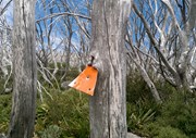
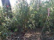
Had been planning to hike Hannels Spur for a couple of years and finally everything lined up! Seems to be a VERY seldom hiked 'route' - as I wouldn't really call it much of a track these days. On a perfect February Saturday morning I left the Geehi Rest Area (campground) at 6:15am for the solo hike upwards. A short, flat 1.4km hike SSE across the open flats, crossing the Geehi river brings you to the base of the spur. The next 3kms from the HS sign are steep but generally well marked with pink flagging tape. When the route turns to the south the definition and flagging of the track/route somewhat disappears for much of the way with only the occasionally orange tree marker. The ~1.5km of the ridge leading up to Moira's Flat has the thickest regrowth for sure and was the most difficult to navigate - just keep going up. A solid days, steep, tough walking and scrambling over fallen trees and various obstacles got me to Byatt's Camp in about 10hours. Arrived at Thredbo at 9:15pm. Despite the regrowth and the intensity this is a classic hike and would highly recommend to others. Planning to go back again soon! I would highly recommend camping at Byatt's Camp (~2100m) at the top if the weather's good - I just didn't have the time on this trip.

Note: Do not underestimate the time required to complete Hannels Spur - it looks somewhat benign on a map or viewing from a distance - but the regrowth, fallen timber combined with the steepness create the perfect storm of forest debris in some places and make the going very slow. Geehi-Moiras Flat take at least 3litres of water per person. There's water at Moira's.

Stew63 on 3 Feb, 2017

Track was vastly overgrown, lost it a few times but it was well worth the effort.

Sudy28 on 5 Apr, 2010

An excellent walk! the highest gain and loss on a walk in Australia.

Laurence Hallam on 16 Feb, 2009

A big walk. If only the national park people recut the trail, as it is overgrown after the fires of 2003 and 2006. We did it in one day (14 hours) from Geehi to Dead Horse Gap.

Paul A MacDonald on 6 Dec, 2008

Where

Click here to load this map.

Nearby Walks

Done this walk?

This walk has been ticked 6 times

Aussie Bushwalking can keep track of your bushwalks.

Login/signup to tick this walk off.

Tick walks to keep track of where you've been. You must Login to tick walks. Accounts are 100% free so sign up if you don't have one.