Mount Larcom Walk

Central Queensland

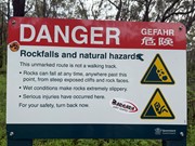
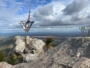
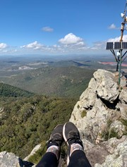
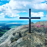
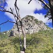
A steep climb up to the Mount Larcom TV relay station. Follow the blue dots and yellow markers and you can't go wrong. The beginning of the track is approximately 2kms and winds towards the base of the climb, lots of loose dirt and grass surrounding the trail. Cross the wooden bridge and the trail is straight up from there. Most of the trail is covered in very loose rock and dirt, lots of tree roots sticking up out of the ground - they make excellent footholds but watch your footing as it can be slippery on the way down. The last section involves some rock scrambling and whilst it is almost vertical towards the peak, three points of contact at all times is easily achieved. Bring plenty of water, at least 2ltrs per person, even in the Winter as this is a fairly strenuous hike. Beware if you have knee issues and the decent is punishing. Your quads will burn with that awesome workout feeling. Anyone can do this climb however some just need to take the full 4hrs turnaround.

Scrambling or Climbing
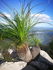
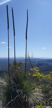
Eucalypt Forest
652m
Maximum Elevation
7776m
Total Climb

Getting there

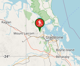
Head in towards Gladstone from the Bruce Highway (A1), follow the signs down to a dirt road to a grassy car park. 4WD probably better, although still very accessible with a small car. Single lane dirt road to the carpark is about 300m long - you could park on the street before this and simply walk to the start of the trail. 

Route/Trail notes

Undefined dirt track. Blue spray painted dots on rocks along the trail let you know you're on the right track. Fairly easy to navigate, just stay on the trail as there are old mineshafts in the area.

Permits/Costs

No permits needed.

GPS Tracks

  • No GPS available for this walk yet.

Comments

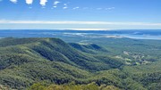
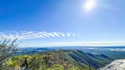
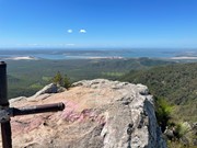
Have been meaning to do this walk for quite a while and finally got a chance. The walk starts off easily enough, a very well marked undulating track up til you get to the riverbed crossing. From here it gets progressively steeper all the way up to the saddle. From the saddle you turn left and head for the peak - the gradient eases off quite a bit until you reach the scrambling section. The scrambling is very easy, and there isn't very much of it. 360 degree views from the top which allows you to see ages in all directions given how flat the terrain is out there. Took me 75mins to the top but I'm sure super fit people could crack the hour mark. Very similar to Flinders Peak, only the steep uphill walking is a bit more sustained and the scrambling is a bit easier.

Vonsnrub on 28 Oct, 2024

Wasn't prepared for this walk. Make sure you take a backpack and water. I wore sneakers and had no water or anything. Next time I'd wear boots. The rocks in the ground kept grazing my Nike's I thought I was going to tear a hole in my shoes. Quite steep. I'm unfit though. Beautiful weather in the winter. Best time to do this climb. Low to mid 20's and awesome Queensland sun almost every day. It would be a struggle with the Gladstone humidity in summer.

Sash77 on 14 Jul, 2024

Lots of fun with this walk, the scramble towards the peak was my favourite part. I found the descent harder than the climb up on account of the loose stones; it’s really easy to slip if you’re not careful where you walk. It took just over 4 hours to complete and the views are 100% worth it

Campbell on 17 Jul, 2023

I thoroughly enjoyed the walk. The track is well worn and clearly marked. A lot of rocks, tree roots and washouts to cautiously negotiate. The views were worth the effort. Took just over 2 hrs to reach the top. Recommend. :)

Michelle on 1 May, 2022

Started this hike around 11 as it took us a couple hours to drive here. I was very impressed and it did not disappoint. Im always prepared with repellent etc but really didnt need it here. It was great terrain. Red orange clay coloured track in the bush. Saw a snake along the way but he was happy for us to walk past. As we were getting closer to the top we were in the midst of a cloud and just before we got to the summit it began pouring down. we got completely drenched and couldnt see down from all the cloud coverage. As we descended the water was rapidly gushing down so I just walked on the outside of the waters. Toads galore came out to celebrate the rain and it really was fun but quite a long way to be going being drenched but it was kinda cool too. I think with the ground wet it helped out descension as the dirt became soft mud not crumbly slippery rock surface. It was easy to sink into. I'll definitely go back to this one again as I really enjoyed it.

Valda on 26 Dec, 2021

As a rather unfit person who likes hiking but has to take many breaks this was quite a challenge for me.
I thought I could just put one foot in front of the other and get it done but I had definitely used my max effort by the time I got back to the car!
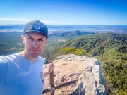
In saying that it was a great walk up. The little bit of scrambling at the end was super fun. It’s was very easy to find foot and hand holes so wasn’t scary just a nice little climb. The view from the top is amazing although not a huge area so I could imagine it being a bit squishy on busy days.
Coming back down was the toughest part for me. It was very slippery I had to go extremely slow.
For reference of how unfit I am it took me about 5 hours to do this walk.
Would absolutely recommend this walk

Benitta on 22 Aug, 2021

This was a challenge. There were many loose rocks and especially on the way down we almost slipped a few times. I was wearing runners, would definitely recommend some sturdier shoes.

However, amazing view at the top, nothing too steep, great forests on the way up.
Would do it again

Pien anne on 28 Apr, 2021

Very hard slog but happy we’ve done it.

Kelvin on 16 Apr, 2021

Nice day for the climb, great views from the summit.
Not too strenuous.

Donho on 20 Mar, 2021

Great walk!

Julia Parker on 3 Sep, 2020

3.5 hours return - 2hrs up 1.5hrs down (my level of fitness is only 5/10)
Winter is the best time of month to do this. Cool start and then ~20deg days are beautiful.
I did the walk on a Saturday morning, there was plenty of other walkers (the car park was almost full) and everyone was super friendly to one another along the track.
I used 2 x 600ml bottles of water which was enough given I did it during the cooler months.
The track is well marked with yellow and blue paint.
It gets windy at the peak so be careful!

Remy on 1 Aug, 2020

I have walked Mt Larcom over 30 times to date. I love it. A 2km walk warm up then from the bridge it's straight up. Well marked path with blue and yellow markers to follow. For first timers, allow the 4hrs to enjoy all that this gorgeous location has to offer. A very short scramble at the top where the views are extraordinary. Then down you go. If you have knee problems don't try it and the decent is punishing on them & your quads will scream with that good workout pain. Literally anyone can do this walk. Some just have to take it slower than others - it's not a race. Take at least 2ltrs of water each. In summer make sure you climb by 6am. It gets very hot. It's a busy place on the weekends. Everyone is friendly. You'll know you're alive both up and down on this one. Enjoy :)

Tess on Aug, 2020

Absolutely spectacular views from the top......well worth the climb! Not a technical climb. Quite easy most of the way, though a bit slippery in places. Small section of scrambling.

Elese M on 28 Jul, 2020

Been a few times good for fitness and to test your body!

Jemma on 15 Jun, 2020

Hard but good

Jemma on 1 Jun, 2020

Challenging hike. Lose gravel and roots make it tricky going up and down. The spectacular 360° view makes it all worthwhile.

Maseelan Naidoo on Apr, 2020

Well marked with blue paint. Some steep bits indeed. Very windy at peak. But walk back is easy. Took me 2.5 hours.

Bing Vandergraaf on 2 Aug, 2019

This climb was quite difficult - very steep, lots of loose rock on the ground, and a great rock scramble towards the end. Amazing 360 views from the top which makes for some great photos! Bring lots of water, even in the winter. The climb took us 1h 40min, descent took 40min.

Jane Mousley on 20 Jul, 2019

I was so not prepared for this walk! It was harder than I imagined but well worth it. The trek is quite steep in some parts but the view at the top is gorgeous. It seemed very quiet which was nice given the narrow tracks at the top.

candycroc on 2018

Where

Click here to load this map.

Nearby Walks

Done this walk?

This walk has been ticked 40 times

Aussie Bushwalking can keep track of your bushwalks.

Login/signup to tick this walk off.

Tick walks to keep track of where you've been. You must Login to tick walks. Accounts are 100% free so sign up if you don't have one.