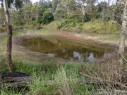
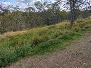
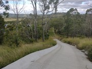
A short walk though urban bushland, descending into a deep gully with a dam at the bottom. This trail is shared by mountain bikes and can be uneven/slippery after rain. The park has many facilities including BBQ, toilet, tennis court, basketball half court, handball wall, lean-to-ride bike skills track and a small playground.
Officially listed as Grade 3/Medium difficulty (rough surfaces + 2 very steep cemented sections leading in/out of the gully), this track is suitable for walkers with a moderate fitness level.
Getting there
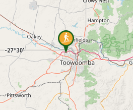
This park is located on Hamzah Drive in Cottswold Hills, one of Toowoomba's western suburbs. Turn down the driveway next to the tennis court to access the small parking lot. The trail begins behind the bike skills track/playground.
Maps
Which maps cover the area?
Route/Trail notes
There is no signed trailhead, but if you walk a few metres behind the bike skills track, you will see the gravel path and what looks like a wide cement drainpipe. Descend the cement path and follow the loop in an anti-clockwise direction. The track passes a small dam and eventually leads up a second, very steep cement pathway. At the top of the hill, keep to the left at the unmarked intersection to return to the carpark (the right fork leads to street access for local residents).
Permits/Costs
Free.
Other References
How can I find more info? Any guide books?
GPS Tracks
- No GPS available for this walk yet.


 1.2
1.2 40
40
Comments