
Menu
Popular Walks
-
Mt Ngungun
(1120 ticks) -
Mount Coolum
(849 ticks) -
Mt Cordeaux
(646 ticks) -
Twin Falls Circuit
(614 ticks) -
Purling Brook Falls Circuit
(593 ticks)
Parent Regions
Sub-Regions
- Amamoor State Forest
- Bellthorpe National Park
- Brisbane City Council Local Walks
- Brisbane Forest park D'Aguilar National Park
- Brisbane Valley Rail Trail
- Coombabah Lakelands Conservation Area
- Daisy Hill Conservation Park
- Eumundi Conservation Park
- Glass House Mountains National Park
- Glen Rock Regional Park
- Gold Coast
- Ipswich
- Jimna State Forest
- Karawatha Forest
- Kondalilla National Park
- Lamington National Park
- Main Range National Park
- Mapleton National Park
- Moggill Conservation Park
- Moogerah Peaks National Park
- Moreton Island National Park
- Mt Barney National Park
- North Stradbroke Island - Minjeeribah
- Parklands Conservation Park
- Springbrook National Park
- Sunshine Coast
- Tamborine National Park
- White Rock - Spring Mountain Conservation Estate
Summary
Boarding NSW and the pacific Ocean, it is not uncommon for hikes to have views of both worlds (ocean and hinterland). Hikes here are typically on the great dividing range.
Popular Walks
-
Mt Ngungun
(1120 ticks) -
Mount Coolum
(849 ticks) -
Mt Cordeaux
(646 ticks) -
Twin Falls Circuit
(614 ticks) -
Purling Brook Falls Circuit
(593 ticks)
Parent Regions
Sub-Regions
- Amamoor State Forest
- Bellthorpe National Park
- Brisbane City Council Local Walks
- Brisbane Forest park D'Aguilar National Park
- Brisbane Valley Rail Trail
- Coombabah Lakelands Conservation Area
- Daisy Hill Conservation Park
- Eumundi Conservation Park
- Glass House Mountains National Park
- Glen Rock Regional Park
- Gold Coast
- Ipswich
- Jimna State Forest
- Karawatha Forest
- Kondalilla National Park
- Lamington National Park
- Main Range National Park
- Mapleton National Park
- Moggill Conservation Park
- Moogerah Peaks National Park
- Moreton Island National Park
- Mt Barney National Park
- North Stradbroke Island - Minjeeribah
- Parklands Conservation Park
- Springbrook National Park
- Sunshine Coast
- Tamborine National Park
- White Rock - Spring Mountain Conservation Estate
History
Any interesting history for the region?
Features
What are the standout bushwalking features?
Access
How do you get there? Include all access points if there are many?
Maps
Which maps cover the region?
Accommodation
Where can I stay there? or near there?
Camping
Council Areas:
- Scenic Rim Regional
- Gold Coast City
- Logan City
- Redland City
- Ipswich City
- Lockyer Valley Regional
- Brisbane City
- Somerset Regional
- Moreton Bay Regional
- Sunshine Coast Regional
- Noosa Shire
Contact details
See Qld National parks website
Walks in Brisbane City Council Local Walks

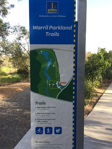
 1.7
km
return
1.7
km
return
 20
mins
20
mins
Possum Forest Trail (Warril Parkland)
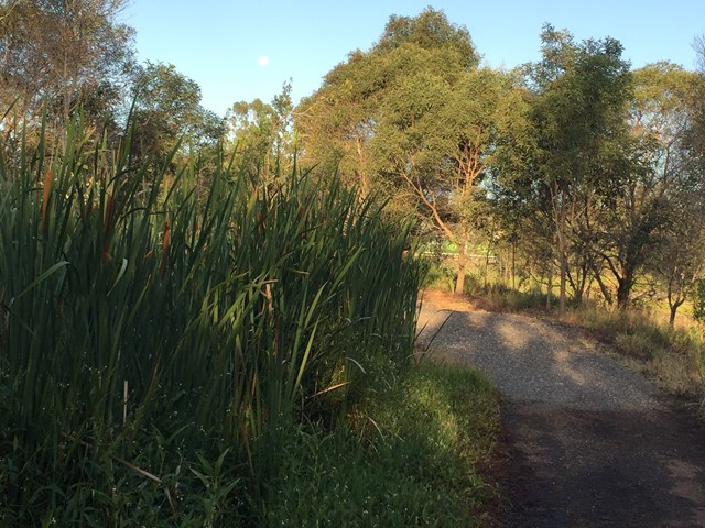
Bushland next to wetland area of Oxley Creek.
 5
km
return
1
hr
5
km
return
1
hr
Rocks Riverside Walk
Walk along the river, plenty of picnic spots, water bubblers (including for dogs) and Brisbane’s largest riverside park at the end.
750
m
return
10
mins
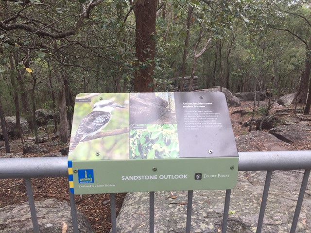
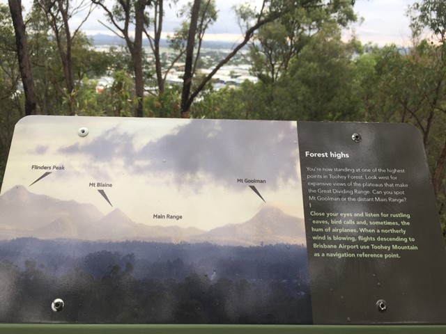
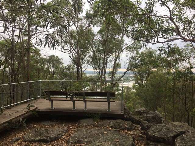
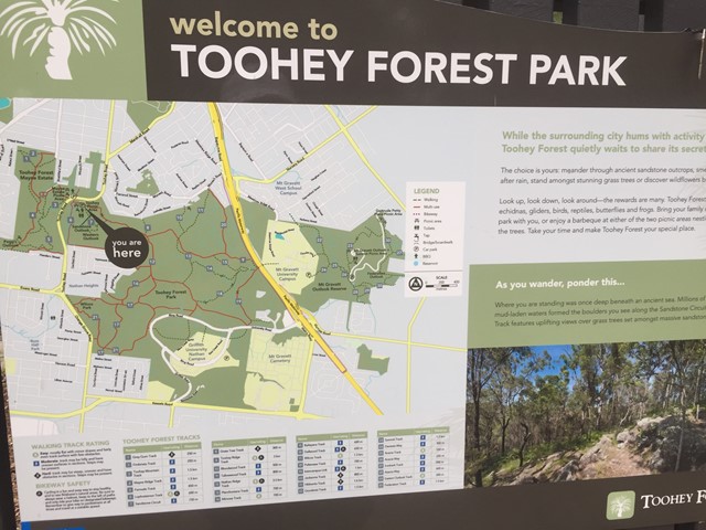
Sandstone Circuit
A short circuit in Toohey Forest Park that takes you to the top of a sandstone knoll the sandstone outlook (117m) and to the Western outlook which offers views of the Flinders Peak group and distant main range.
 4
km
return
1
hr
4
km
return
1
hr
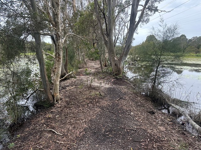
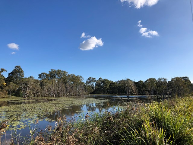
Sandy Camp Rd Wetlands
A flat walk through the lesser-known wetlands.
Wheelchair access is possible but not an easy walk
 4
km
return
1
hr
4
km
return
1
hr
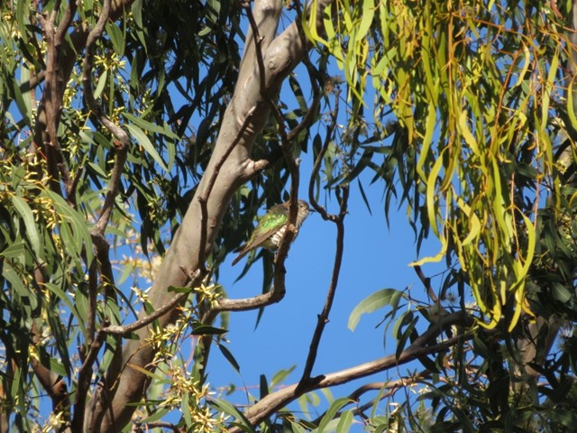
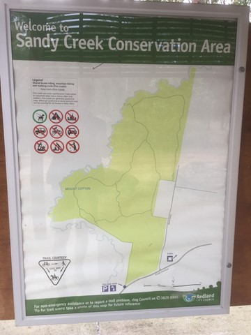
Sandy Creek Conservation Area (Redland Bay)
Management trail through eucalypt bush.
 3
km
return
45
mins
3
km
return
45
mins
Seven Hills Circuit
Sort circuit track that is intersected by the Seven Hills Ridge track and the Seven Hills Gully Track. Wide and clear well maintained track.
 2.8
km
return
40
mins
2.8
km
return
40
mins
She-Oak Track (Whites Hill Reserve)
Enter via Pine Mountain Road, Follow the signs to the summit and look at the views over South Brisbane
870
m
return
20
mins
Slacks Creek Environmental Park
Two loops - Open Forest Walk and Melaleuca forest walk join to make a 20 minute walk 870m long. Paperbarks and butterflies.
 1.4
km
return
30
mins
1.4
km
return
30
mins
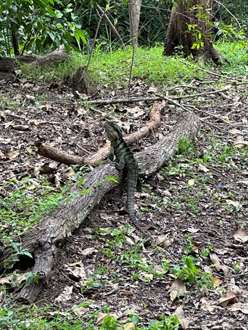
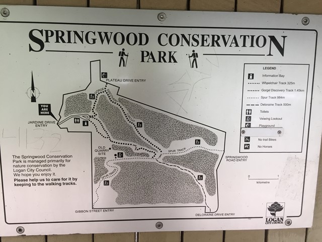
Springwood Conservation Park (Gorge Discovery Track)
Circuit around a wooded gorge. Entrance points from various residential areas.