Byron Creek Circuit

D'Aguilar National Park

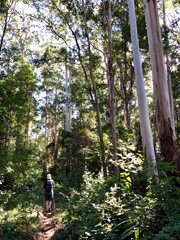
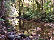
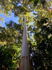
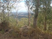
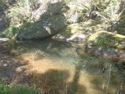
Walk in undulating country with some steep hills to Byron Creek with its crystal clear waters, waterholes as well as mountain top views from the ridges.

Getting there

From Dayboro, drive west on McKenzie Street, passing Dayboro State School. Continue onto Laceys Creek Road and then veer right onto Mt Pleasant Road. Continue along Mt Pleasant Road to the Mount Pleasat Hall and then veer left onto Mt Brisbane Road. Follow Mt Brisbane Road to Chambers Road and turn left to enter the D'Aguular National Park. Ascend Chambers Road to Range Road and turn left. Drive to the next intersection with the road veering right and a gate (Byron Creek Road). Park at this intersection, where there is plenty of room for a few cars.

Maps

Laceys Creek 1:25000, D'Aguilar National Park track map 

Route/Trail notes

From the cars walk through the gate and after about 100m turn right onto the horse trail. Follow the horse trail as it descends into Byron Creek. Upon reaching Byron Creek cross the creek and continue on the trail and continue ahead at the sign towards Diana Bath Road. Shortly after this and before the next creek crossing, is another horse trail intersection. Continue straight ahead and cross the creek again before the trail ascends a ridge to Range Road (Peggs Road at the old Quarry. Return to this intersection and continue straight ahead, and not turn left. The trail ascends for 20 miutes to gain the ridge on A Break Road. Upon reaching A Break Road, turn left and follow A Break Road to Diana's Bath Road. Upon reaching Diana's Bath Road, follow until the intersection with Byron Creek Road. Turn left and follow Byron Creek Road back to the car.

Permits/Costs

No cost

Other References

Various maps and publications including OpenStreetMap had parts of the trail.

Comments

Easy to get 'lost'. Would help with better signage.

Swainey on 23 Apr, 2019

We found the directions not quite right either. We followed a very steep rutted track (by trail bikes) down to the creek. Just before the creek was the Diana's Bath sign mentioned. There was no other creek crossing. We kept our feet dry by walking upstream a short distance where there were plenty of rocks. A short distance after there is an intersection. We took the left as Suzie said. It was a steep climb up to the A Break Road. We followed this left and continued the loop down Byron Creek Road, across the creek and back to the car. Once on A Break Rd, it is just a road bash and there were quite a few 4WDs and trail bikes. The non road section was pleasant through nice forest with birdlife. It took us less than 3.5 hours.

Janette on 20 May, 2018

The instructions were fine to follow but the map does not match up. The instructions do the loop of the map but not the extra bit. You park at the intersection of Range road and Byron creek road.

Be advised there is a small creek crossing it is not deep but it will go over boots (I took mine off as had a towel). Once you cross the creek follow the path to the intersection and turn left to go up the steep incline and continue the route.

There is also a parking option before you turn onto chambers road signed as the horse trail. I assume this would allow you to walk to the horse trail off Byron creek road where we started as per the written instructions of how to get there.

Suzie V on 12 Jan, 2018

We had trouble with this walk. I have a feeling that we didn't start at the right place, though it mostly looked right. We parked when we came to a Y in the road on Chambers Road with a gate on the right hand side road. We followed for 100m where we came to a horse trail on the right. The path descended very steeply. The surface was a bit loose so we had to take care. We crossed two creeks, with a track to the left between the two tracks - not exactly what we were expecting, but close. However, after following the track, we came to Peggs road. That seemed ok too, but there weren't too many options. The route says not to turn left, but go straight ahead. Straight ahead wasn't an option so we turned right. It lead us back to Range Road which we followed back to our car. It wasn't a bad walk, but i don't think it was the correct path. Total distance was 5.5km and it took us 1.5 hours. I would advise not to drive up there without a 4WD. The dirt road was quite uneven in places and we were happy not to be in a conventional vehicle.

Ian and Sue on 3 Oct, 2016

Steep walk in sections. Good open track with nice swimming holes...

GlasshouseBW on 13 Sep, 2015

Where

Click here to load this map.

Nearby Walks

Done this walk?

This walk has been ticked 12 times

Aussie Bushwalking can keep track of your bushwalks.

Login/signup to tick this walk off.

Tick walks to keep track of where you've been. You must Login to tick walks. Accounts are 100% free so sign up if you don't have one.