Upper Byron Creek

D'Aguilar National Park

A lovely walk along the crest of the D'Aguilar Range with a creek to walk along.

405m
Maximum Elevation
550m
Total Climb

Getting there

From Dayboro drive west on Mackenzie Street, which becomes Lacey Creek Road. Follow Lacey Creek Road to the junction with Mount Pleasant Road and veer right to follow Mount Pleasant Road. Continue on straight ahead, where Mt Pleasant Road goes right onto Mt Brisbane Road. Follow Mt Brisbane Road to the junction with Chambers Road and the D'Aguilar National Park sign.

Maps

Mount Byron 1:25000

Route/Trail notes

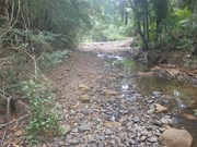
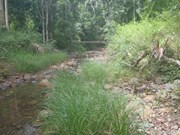
Starting from Mount Brisbane Road, the walk follows Chambers Road to the top of the D'Aguilar Range and Peggs Road. Turn right and continue to ascend. The road flattens out and then descends into Byron Creek. About 200 metres before reaching the creek os a track to the left. Follow this track which descends into Byron Creek. Walk up Byron Creek, past deep waterhole and cliffs to the Peggs Road causeway. Enter onto Peggs Road and turn right and follow Peggs Road and Chambers Road back to the start.

Permits/Costs

No permits or costs for this walk

Other References

No references.

Comments

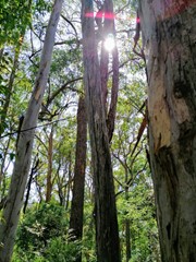
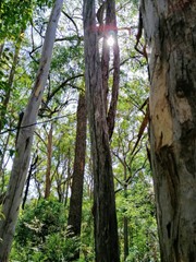
My walking buddy and I did this walk today. We got a bit bushed, entirely because I did not read the directions carefully enough. What follows is me sharing the experience for what it's worth - it is in NO WAY a criticism of the Aussie Bushwalking directions. You might want to check out the Mt Mee Forest Drives and Trails map https://parks.des.qld.gov.au/__data/assets/pdf_file/0025/159028/mount-mee-trail-map.pdf showing 4WD roads in the area. The majority of this walk as described is on these 4WD roads, specifically Chambers Rd and Peggs Rd. That's OK, it's a pretty area with big trees and steep gullies and bell-birds calling, but it's not a walking track as such. Only the loop at the top (shown on Aussie Bushwalking map) where you follow the creek is walking track. In my opinion the Summerset Trail walk starting from the Gantry is a much nicer walk. That said, the starting point per description is a small parking area at the end of Mt Brisbane Rd and start of Chambers Rd, marked with a "P" on Forest Drives map. It's sealed road all the way to that point, any car will get there. If (and only if) you have a 4WD you can drive up Chambers Rd to the start of Peggs Rd, taking a bit of up-hill grind out of it. It's not an overly difficult 4WD road, my Mitsubishi Triton did it easily, a normal car might make it but would likely suffer some damage over the bumps. Ideally you could drive further, up Peggs Rd to the causeway over the creek, and just do the short walk along the creek which is the nicest part of the walk, but parking at the causeway is a bit tight. One final point; leave Dayboro along Mackenzie St, which becomes Laceys Creek Rd, then BEAR RIGHT to Mt Pleasant Rd. That's what the directions say and that's what you need to do! I saw the sign to Laceys Creek Rd bearing left and thought "that's where we need to go" and off we went - and ended up driving the Range Road Forest Drive from south to north (per Mt Mee map). Silly me! We laughed it off, the Triton handled it just fine and we had an unexpected adventure, but if you have a normal car please do NOT try it.

Jim Craigen on 13 Oct, 2023

We only did 11k. Didn't do the creek walk part or a little bit of the side shoot about 1/2 way. Great walk though. Nice creek at the end even though it's quite dry at the moment.

Quentin Andrews on 4 Apr, 2020

Very hot walk, but full of shade and the creek was great!

GlasshouseBW on 31 Jan, 2016

Where

Click here to load this map.

Nearby Walks

Done this walk?

This walk has been ticked 8 times

Aussie Bushwalking can keep track of your bushwalks.

Login/signup to tick this walk off.

Tick walks to keep track of where you've been. You must Login to tick walks. Accounts are 100% free so sign up if you don't have one.