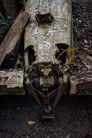
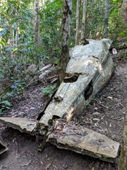
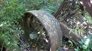
Piper Comanche Wreck

D'Aguilar National Park

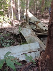
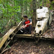
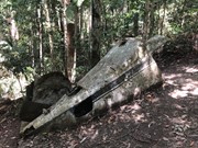
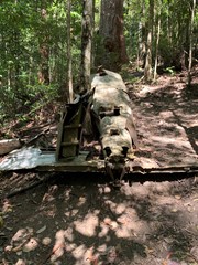
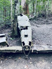
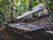
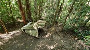
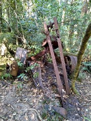
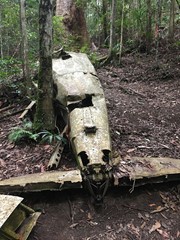
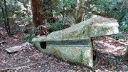
A walk to the remnants of an aeroplane wreck.

Bird Watching
Scrambling or Climbing
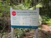
Navigation Required
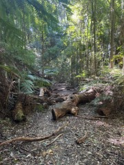
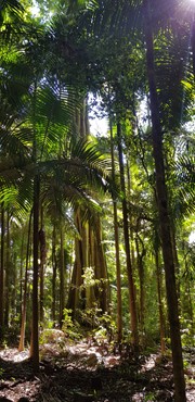
Rainforest
746m
Maximum Elevation
258m
Total Climb

Getting there

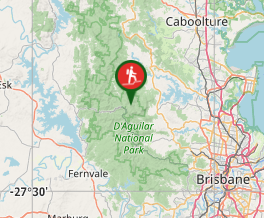
Start at the Lepidozamia Track, 5.5km north of the Maiala picnic ground. 

Maps

D'Aguilar National Park, South D'Aguilar section

Route/Trail notes

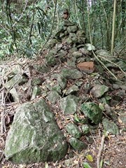
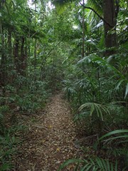
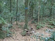
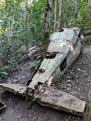
Just after the Lepidozamia track gate take the smaller trail to the east.  Follow this old logging trail for approx. 3km until you see a small cairn of stones.  Follow the faint trail northeast down a rocky and steep hillside for approx. 500 meters.  The wreck is on the northern side of a small stream.  

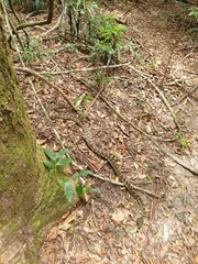
Take care when returning to the top of the ridge after visiting the plane  wreck.  Many walkers come unstuck here missing the turn right back along the main ridge route towards the carpark.  This section of the forest has lots of tree roots and rocks on the ground, so the route is not well defined in this location.  This combined with decoys of pink tape often lead walkers to the South (veering left at the ridge top) towards Love Creek.  Careful navigation is required on this section of the route to avoid becoming lost and spending the night out in the forest.  Multiple search and rescues happen in this area on a regular basis.

Permits/Costs

Nil

Other References

This walk was listed in the Bushpeople's Guide to Bushwalking in South-East Queensland.

Comments

Nice peaceful walk in the rainforest. Very cold first thing in the morning during winter.
I completed the hike return in 3hrs, thats including time checking out the air crash/resting. Track is marked, I know a lot of people have said it’s easy to get lost but if you follow the path and marks along the way you’ll be fine. I also wouldn’t recommend sitting down on the rocks for a rest near the crash… the area is infested with leaches. Wear insect repellent and appropriate clothing.

RJP on 18 Aug, 2024

Outstanding weather for this walk today. Cool and comfortable in the forest. After you find the initial turnoff to the track it's well marked and traveled. There are still some of the older blazes and pink tape markers out there but mostly it would be hard to lose your way.

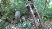
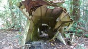
The final section is steep with some loose surface, lots of roots and rocks which might get a bit tricky after rain or if the mountain is clouded in. That makes for a slower trip back, initially. Not too much left of the plane now, but still worth the effort imho

Bring plenty of water. There are no creek crossings on this track

stryker on 20 Aug, 2023

Nice short walk in the rain forrest.

Monte Hague on 20 Aug, 2023

Walked to the plane wreck but did not attempt the walk to the summit. Found the trail in good condition and easy to follow. We really enjoyed this walk.

Em V on 16 Aug, 2023

A very well signed walk, except, ironically, for the trail head. As per previous comments, it's about 30m in on the fire trail to the right. There is currently a stick planted in the ground at a cairn of stones. All ribbons are removed from the walk now - didn't see one. Reiterating point below, the palm forest before the descent to the plane wreck is an easy place to get lost - the route isn't clear. All up about 2.5 hours return with some stops along the way.

ct__ on 30 Oct, 2022

Mostly easy to follow track. The start is hard to find from fire trail. Its about 30 meters past the gate on the right.

Chris on 19 Feb, 2022

Nice track, took around 2.5 hours in total + some time at the plane wreck.
The plane wasn’t too difficult to find, thanks to heaps of signs, marks and red ribbons. GPS was nice to have but mostly unnecessary.
Most of the walk was really easy except that last descent, rocks get slippery after the rain, so be careful and wear quality footwear. As others have mentioned before, lots of leeches on the way, so keep that in mind too.

msrebel on 15 Jan, 2022

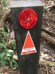
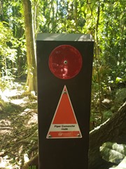
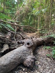
Went with a new GPS as expected navigation to be tricky, but it was easy - lots of 'Piper Comanche Track' signs, pink tape has been removed. Only tricky bit is following the track on the last descent towards the wreck, note the there is a large fallen tree with a gap cut in it to let you through. 2 hours 30 minutes return, check yourself for ticks after the walk.

spiggytopes on 7 Oct, 2021

Nice walk - steep in parts - not sure where the 5hrs comes from 1hr 15 mins there and 1 hr 5 mins back

Lisa on 19 Sep, 2021

Went with a group. Paced myself on way back up, also hiked to summit.

Tiffany on 26 May, 2021

If you lost a knife on this track, get in touch please!

This track was good, very narrow and overgrown at times with it appearing like there are many "forks" in the track (really, they're other trails or just plain false starts). A GPS or compass / map is essential.

The cairns at the point where you turn left is only shin height - don't miss it. Pink tape is pretty sparse before the cairns, but ok afterwards. A large tree has blocked the path so unless you can climb it (~1m), you'll need to go around it and find the track.

Few leeches around. It had rained ~5 days beforehand, but the track is so shaded I'd expect it to stay wet for a long while after rain.
Curtis West on 8 May, 2021

Great walk, only about 1hr 15min each way. We spent a 1/2 hour at the plane and the total trip was 3 hours. Saw one snake, heaps of leeches however, keep checking your boots. The only really difficult part of the hike is the last 500m or so downhill to the plane which can be rocky and slippery. Then of course, climbing back up. There are a few fallen trees you need to negotiate, otherwise nothing too difficult. The sun is mostly blocked out by the trees for the entire trip and the rainforest makes it quite a few degrees cooler.

Jeff Ells on 26 Jan, 2021

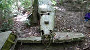
Surprisingly this track is really well marked with heaps of pink ribbon and piles of rocks. I remember doing it years and years ago and it was a bush bash most of the way. Not much left of the plane, looks like just the tail section and someone pinched the ATSB report that used to be attached to the wreckage. Also went to Mt D'aguilar which is only probably a 10 minute diversion. Not much to see there but was nice to tick it off. Saw wallabies, a goanna, a massive skink and many many MANY leeches.

Vonsnrub on 18 Jan, 2021

We got there around 7am and the mountain was still covered in clouds which made for a great misty walk through the forest. The decent down to the wreck was very muddy and slippery as a result. Beware the leeches when it's wet.

Chewie on 3 Jan, 2021

I completed the walk after it had rained and the path was very slippery but still manageable. The track to the plane wreck is currently marked well with pink tape. Using a GPS made life a lot easier but isn't necessary. There were LOTS of leeches.

Peter on 30 Dec, 2020

Reached the downhill to the wreck but saw a brown snake just before it and had stepped over a python a few hundred metres earlier so turned back due to snake activity.

Ton on 30 Dec, 2020

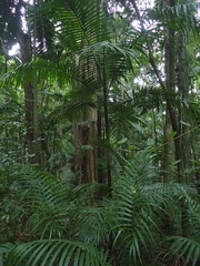
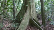
This may be the best walk in the Mr Glorious area. The main track is an easy walk, through rainforest and palms. There many many trees blocking the track. The walk down to the wreck is steep, and not well defined. Marking the way is a good idea. I have never seen pink tape. There are a few very small rock cairns along the way. I spent 20 minutes or so locating the right track back up the hill. Total time was 3.5 hours.
dennis round on 29 Sep, 2020

Track was around 7km there and back, completed in 5 hours. Going down to the wreck and back up was very steep and somewhat challenging. Lots of over grown areas and trees down which block the path. We marked the track with pink tape as it is quite easy to lose the track in some areas. Many of the markers left were not highly visible or had fallen down. At the beginning on the descent to the wreck there is a large stone cairn which stands about knee height - the track also forks at this point - go to your left. Someone has also removed the ammo box as it is no longer in the wreck and couldn't see it anywhere nearby.

KLEEWDO on 24 Sep, 2020

Good walk, recommend to anyone, will do again! Downhill slope to wreck isn’t as bad as it sounds. Not too strenuous.

Scardykats on 29 Aug, 2020

Highly recommended you do this one with someone who has done it before. We completed this a week after some heavy wind and there was a lot of downed trees and most of the pink guiding tape had gone. Regardless a great walk for most levels of fitness although the ascent from the wreck can be a challenge

Ben C on 23 Aug, 2020

Where

Click here to load this map.

Nearby Walks

Done this walk?

This walk has been ticked 114 times

Aussie Bushwalking can keep track of your bushwalks.

Login/signup to tick this walk off.

Tick walks to keep track of where you've been. You must Login to tick walks. Accounts are 100% free so sign up if you don't have one.