Litchfield Track

Mt. Coot-tha

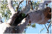
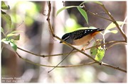
This track is 2.5km one way and is graded as moderate by Brisbane City Council and is well maintained but can have lose stones. The track winds through bushland parallel with the road and is easy to traverse. You will see a variety of Australian native plants and birds. A variety of people, at different stages of trail walking ability, use this track including trail runners.

Bird Watching
Heritage Sites
Picnic Facilities
Toilets
Dogs Permitted
Horses Permitted
Cycling Permitted
Eucalypt Forest

This walk begins approximately 200m from the Mt Coot-tha lookout and is very well signed.  There are three trails beginning at this point 

Maps

Which maps cover the area? A map can be found at:

https://www.brisbane.qld.gov.au/sites/default/files/20190227-_mt-coot-tha-track-map-tagged-final-jan_2019.pdf

Route/Trail notes

Keep to the clearly identified track.

Permits/Costs

No permits/costs.

Other References

How can I find more info? Any guide books?

https://www.brisbane.qld.gov.au/sites/default/files/20190227-_mt-coot-tha-track-map-tagged-final-jan_2019.pdf

GPS Tracks

  • No GPS available for this walk yet.

Comments

Very enjoyable walk with the sun setting.

Wanderlust on 29 Apr, 2024

Fantastic trail to hike/jog/run! Flat test trail on the mountain!

Naomi Bradley on 11 Jun, 2020

Completed this morning as the 9km. It hit option linking ghost hole, powerful owl and the pinnacle track to JC Slaughter Falls picnic area and then back up the Summit Track. Great walk.

Bobbe on 20 Dec, 2019

Completed this as track part of a 9km circuit - started with the Litchfield track, then the Ghost Hole Track, Powerful Owl Trail, Hovea Track and the Summit Track. A great morning out walking.

S K on 20 Jul, 2019

This was a lovely walk and easy to do. The track was well maintained and easily found down the road from the lookout - alongside two other walks. I expected more from the old gold mine location (relics?) as it was a picnic spot. I followed the trail back to the starting location to make it a 5 k walk and added the Honeyeater Trail to it.

Anoogle on 14 Jul, 2019

Where

Click here to load this map.

Done this walk?

This walk has been ticked 24 times

Aussie Bushwalking can keep track of your bushwalks.

Login/signup to tick this walk off.

Tick walks to keep track of where you've been. You must Login to tick walks. Accounts are 100% free so sign up if you don't have one.