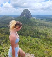
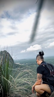
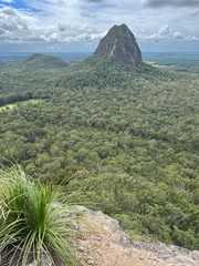
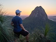
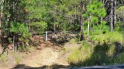
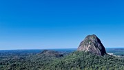
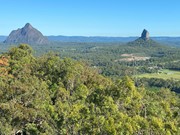
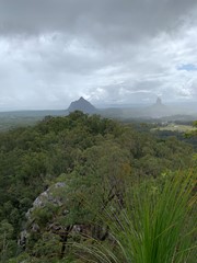
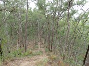
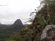
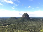
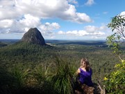
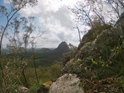
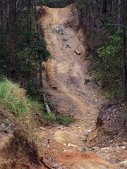
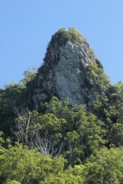
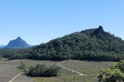
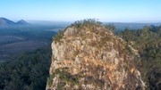
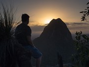
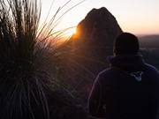
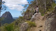
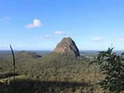
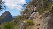
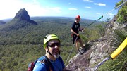
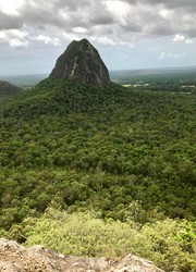
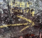
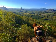
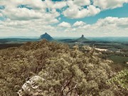
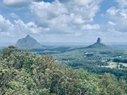
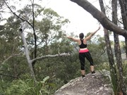
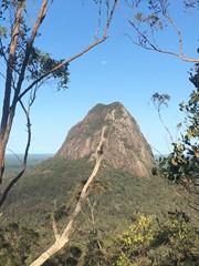
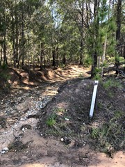
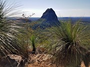
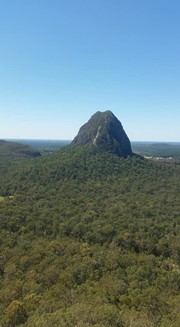
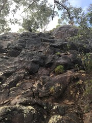
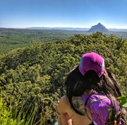
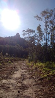
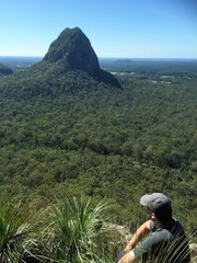
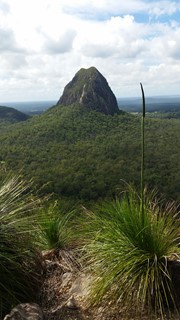
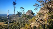
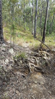
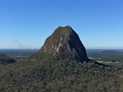
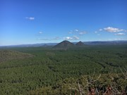
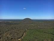
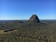
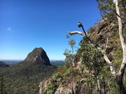
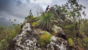
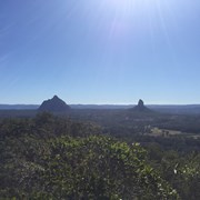
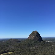
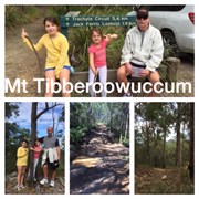
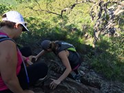
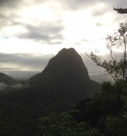
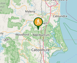
A steep walk to the summit of the mountain, a bit of an uneven but level scramble along the ridge for about 50m with a small 6-8m steep scramble to get to the peak at the end of it. Summit has spectacular views of the surrounding mountains and north to the Sunshine Coast. There are two alternative tracks which meet at the the top of the ridge at a point where an arrow painted on a rock directs you along the ridge to the summit. Take care as both tracks can be slippery after rain due to wet clay/ tree roots and loose shale at the top of the tracks can be a concern in any weather as well.

Lookouts
Scrambling or Climbing
No Dogs Permitted
No Camping Permitted
Eucalypt Forest
213m
Maximum Elevation
155m
Total Climb

Getting there:

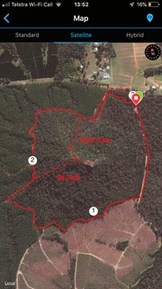
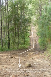
From the Bruce Highway travelling north turn into Steve Irwin Drive and turn left just after Mt Tibrogargan over some railway lines into Barrs Rd (which eventually becomes Marsh's Rd).  Follow this to the new Mt Tibrogargan carpark, or park 200 metres further along, across the road from a gated 4WD track designated T-212, which is the start of the track up the Northern face. A second track up the South-Western face can be accessed by turning left at the intersection of Marsh's Rd and Old Gympie Rd and then taking the second gated 4WD track on the left off Old Gympie Rd. Drive towards the base of Mt Tibberoowuccum until you find a safe place to park on the side of the 4WD track. The road has recently been graded (August 2019) and is suitable for conventional vehicles. Several off-road parking spaces have also been created right at the start of the track. You will find the start of the SW track where the the 4WD track takes a sharp bend to the left (North) and also intersects with one coming up a steep gully from the right. Alternatively, you can access this same track from the Tibrogargan car park by following the service roads and 4WD tracks around the Eastern and Southern sides of the mountain for a little over 2 km. For more detail, see the following Route/Trail notes.

Maps:

Glass House Mountains

Route/Trail notes:

Northern track:

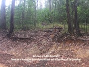
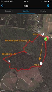
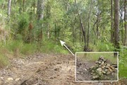
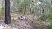
From the new Mt Tibrogargan car park go back out to Marsh's Rd and head left. Continue for 200 m along the road before entering the gated 4wd track marked as T212 on your left. Head right at each fork and follow the track for about 300m. After coming up a large dip in the track, keep a lookout on the left side of the track for a small cairn marking the start of the climb. From here it is easy to keep to the track all the way to the top. When you reach what appears to be the summit that is obscured by trees (and both trails converge) follow the ridge towards Mt Tibrogargan (East) and scramble up a 6-8m knob to the absolute summit. Retrace your steps to the bottom or descend via the south ridge to the 4WD trails as detailed below. 

South Western track:

Follow the gated service road at the southern end of the new Mt Tibrogargan car park for 500-600m and then take the first 4WD track to the right (designated T-215 if the sign is there). Follow this for a  a further 1.5 km, keeping the mountain on your right. Follow the 4WD track till you get to the south western side of the mountain and look for an intersecting 4WD track on your left coming from Old Gympie road heading up a moderate incline. When you get to the top of the incline you will see the  track ascending the mountain straight ahead. It is marked with a couple of 600mm high Koppers logs set in the ground. Follow this up for about 15-20 minutes until it levels out and keep walking carefully East along the ridge till you get to a rocky bluff and an relatively safe and easy scramble to the top. Excellent views from here. To descend retrace your steps or come down the Northern track to meet up with the T-212 4WD track and back to Marsh's Rd and the nearby Tibrogargan carpark. If you elect to retrace your steps down the mountain, when back at the 4WD track at the foot of the mountain, you can either turn left or right and follow the 4WD trails around the base in either direction till you are back at either the start of T-212 or T-215 and continue back to the car park. The North Western 4WD track around the base is much more difficult than the one around the South of the mountain which is really just an enjoyable walk with nice views across to Mt Beerburrum and the Jack Ferris lookout.

The South western track can also be accessed by turning left at the intersection of Marsh's Rd and Old Gympie Rd and then taking the second gated 4WD track on the left off Old Gympie Rd and driving / walking back east toward the foot of the mountain. You will need to park off-road. 

Permits/Costs:

None.

Other References/Comments:

The Peak Baggers Guide to the Sunshine Coast ( although parking information out of date)

Comments

Awesome views from up top!

Shmoopty on 6 Oct, 2016

Nice hike

Jin Kim on 24 Sep, 2016

The trail isn't very well marked. We stumbled across it by accident whilst exploring the Glasshouse Mountains in our 4WD. This was the fourth time climbing Mt Tibberoowuccum. It's tough going if you're unfit (me). The going can also be tricky if the ground is wet so take care.

Jazz The Boxer on 21 Aug, 2016

A little tricky to find - look for the small '212' sign about a few hundred metres west of the Trachyte Circuit overflow carpark (not the Tibrogargan car park (just about opposite the large newish house). There is a 4WD trail here - follow it, and it will head uphill and eventually curve right . Keep an eye out for a pile of stones on the left 60 metres or so after the curve, the trail for the summit starts here. It's not super defined but it is fairly clear. You'll come across a second pile of stones in a few hundred metres so you know you're on your way. Not a particularly hard climb - the Beerburrum path is physically more demanding - but there is a little bit of rock climbing to be done at the end, but nothing too hard. The descent from the peak looks a little scary on first look but you have a couple of alternative routes to get down, I'd suggest the loose rock and gravel of the path further down is more hazardous.

Vat on 17 Aug, 2016

Couldn't find the track so I literally went straight through the scrub, lots of loose rocks which was pretty challenging, reached the summit - views totally worth the effort though! Found the marked track upon decent, made for a much easier hike! Oops.

courtlalala on 29 Jul, 2016

Got a bit lost trying to find and ended up up going up the old fire trail apparently. It was a good walk though and the rock climbing at the very top was fun for everyone except my 8 yr old who didn't make it as she's not very coordinated.

Karen on 26 Jul, 2016

Went up via the Barrs rd entrance at the 'T212' 4wd track.
From the trachyte carpark go back out to the road and turn left, follow this until you find the 4wd track with the T212 sign. Turn right at the first junction (3-ways) and follow until you see the rock cairn on the left side of the track. Follow all the way up.
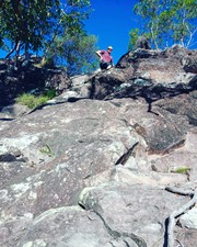
Far easier and quicker than the route going up the south side of the mountain (although you dont get to see 4wd's getting bogged.)

dalehikes on 22 May, 2016

We had a lot of trouble finding the track, and it would have been much easier if we had read everyone else's comments first. We started looking for a track off to the left of the Trachyte Circuit, but couldn't find one. We ended up walking the entire Trachyte Circuit before having another look. While doing this we found another couple looking for it too. We followed them up the 4WD track that others have talked about, and obviously didn't go far enough. The other couple were checking online and found a blog that suggested that the way up was via a track directly off Barrs Rd, about 100m up from the carpark, so we decided to try that. There is a driveway there. We were unsure if it was a private driveway at first because there is a number on it - 212. As we couldn't find any other entrances, we took this track and followed it to the right when the road divided. We went around a bend to the right, then up a hill. On the sides of the track there are three small piles of rocks - two on the left and one on the right. Between the two on the left is the start of the track that we took up. It was quite steep - strenuous going up, and slippery going down. Care is needed, particularly near the top before the track levels out as there is a lot of loose shale. We didn't see where the other tracks were, but ended up at the top. The views are great. This track is probably a little over 1km each way.

Ian and Sue on 14 May, 2016

Track up was a little tricky to find but a great hike and great view

AdamK on 30 Apr, 2016

Attempted to solo this mountain today. Nearly fell off the trail. Nearly fell off the ridge. Got spooked by the big scary rock dome and turned around before climbing to the summit proper. Only discovered the well-formed track after I'd bushwhacked to the top through the steep sand and undergrowth. Nearly fell off the well-formed track on the way down. 10/10 would imperil self through poor planning again.

Perhaps better off going via Barrs Rd and keeping the mountain on your left, which seemed shorter than the way I went (watch out for the 4WD track). That dome at the end is bigger than it looks from the parking lot.

SkipK on 16 Apr, 2016

Awesome little hike.

We did the return along the alternate track to the right after leaving the summit.

Easy to follow, and fast!

Lachlan MacDonald on 30 Dec, 2015

Did this as a circuit, there's several routes up and down the mountain, it's just a matter of finding your way back to the carpark or the road if you choose to descend a different way. Heaps of mosquitoes, pleasant views.

Alice on 24 Nov, 2015

Great fun! we (family of 5, youngest is 6) didn't meet anyone on the actual summit path, but thoroughly enjoyed watching the little bit of 4WD action along the roads used for that purpose. The difficulty was certainly not high - nothing too scrambly although a little loose toward the top, but as a few have commented it's not signposted or tourist-ised yet so we advise reading the direction suggestions (we followed F.A.B.'s).

Mark on 11 Oct, 2015

23min ascent
14min descent

Simone Klemm on 5 Aug, 2015

This is a bit of fun for everyone. Used directions from fellow walker blog.
Entering from the car park and following trail anti clockwise till reaching a cross road with 4WD track. Take this 4WD track right till you get to a rubble fire trail. You can turn right and follow this to the top with a roundabout way using faint bush trail. HOWEVER, if you had kept going along the 4WD trail and kept the mountain to your right for another 5min, you would come across a more used trail to the top (we descended down this so much easier). The 4WD tracks were in use so watch out and stay close to the sides (amazing watching them navigate the HUGE ruts).

F.A.B. on 5 Jul, 2015

Bit steep midway with lots of loose rocks southern side. Beautiful view from the top. We went back a few weeks later with the 4wd and drove the challenging tracks aroud the base of the mountain. Loads of fun!

Peare on 15 Apr, 2015

Bit steep midway with lots of loose rocks southern side. Beautiful view from the top. We went back a few weeks later with the 4wd and drove the challenging tracks aroud the base of the mountain. Loads of fun!

Peare on 15 Apr, 2015

Completed this walk using the same route as Grumps. Went up through the overgrown scrub and descended down the natural watercourse (which looks like a well used track). What fun! I climbed this as part of my 7 summits in one day challenge.

dalehikes on 12 Apr, 2015

Follow phill drivers directions to get to the track. Quite overgrown but still a nice steep walk. Combined this with the trachyte and Tibro circuit to do 11 km

Kate on 25 Jan, 2015

Great hike but careful after rain , rocks quite slippery !

J on 14 Aug, 2014

Where

Click here to load this map.

Nearby Walks

Done this walk?

This walk has been ticked 227 times

Aussie Bushwalking can keep track of your bushwalks.

Login/signup to tick this walk off.

Tick walks to keep track of where you've been. You must Login to tick walks. Accounts are 100% free so sign up if you don't have one.