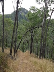
This trail forms the backbone of all trails in the Conservation Estate, and connects the two picnic areas. It caters for hiking, horse riding and recreational touring (mountain bike riding). At 38 km return, this trail becomes challenging. Experienced walkers would need to start early in the morning to complete a return trip, requiring at least a 10 to 14 hour day. Note that the conservation estate is open between the hours of 6am and 6pm. Alternatively, a 19km one way walk could be considered for those who can organise travel/accommodation arrangements at the other end. Rugged mountain scenery, views to the coast from Mt Flinders, creek crossings and diverse landscapes such as dry rainforest and heath will reward you.

No Dogs Permitted
No Camping Permitted
Eucalypt Forest

Getting there

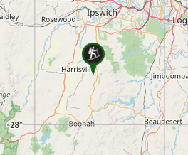
Ipswich Boonah Rd (Off Cunningham Hwy) to Carmichaels Rd (Entry to Hardings Paddock Picnic Grounds

Maps

Access to a map for this trail is available on the Ipswich City Council website (www.ipswich.qld.gov.au)

Route/Trail notes

This walk is 19km one way and will take you approx 7hrs (one way) so make sure that someone is at the other end to pick you up. This trail is popular with Horse Riding so be wary of horses. 

Permits/Costs

PLEASE NOTE THERE IS NO CAMPING ALLOWED IN THE ESTATE. Be sure to have someone pick you up at the other end. 

Other References

https://www.facebook.com/BoonahIpswichTrail

Comments

I tackled part of this walk today, the Hardings Paddock to Flinders Plum and back part. Awesome hike, nice and tough with minimal people around once you get past the Goolman lookout. However. Don't try this if you just want a leisurely stroll through the bush. Also it's probably best to go with one or two others of similar fitness as you will be isolated for a few hours. If you do go alone make sure you have a good sense of direction, enjoy your own company, and are confident in your hiking ability.

The walk starts easily enough, but soon you will be climbing a long, steep hill. It then goes relatively easy for a bit until you get to the Goolman look out where it goes steep again up to the lookout. Not a problem if you want to skip this part, as at the base of the lookout climb there is a left turn through a white metal gate, which is where you want to be going to head to Flinders. You'll then walk down a gentle incline and then you will need to take a right turn, then shortly there will be another right turn putting you on a U turn pretty much. Just stick with this trail for the next couple of hours. There will be a lot of up and down hills for a while, but just stay with it and trust the map and you'll be fine. You will go past Mt Goolman on the east side and you’ll see Ivory’s Rock to the west. Be aware, Mount Goolman and Mount Blaine look pretty similar, so don’t think you’ve arrived at Mount Blaine already, because you might start to freak out when you see the trail taking you away from it. Soon enough you’ll get to the Mount Blaine Saddle where you can either attempt to climb Mount Blaine, or continue on to the Flinders Plum picnic area. Just be aware, you will need to negotiate some rather steep hills to and from the picnic area.

If you are planning on doing this trip, it may be easier to start from the Flinders Plum end while you have fresh legs, as the hills in that direction a fair bit steeper. You will need good shoes and socks, and plenty of water and snacks, especially in hotter months. I went through 4.5 litres, however I was using a Camel Pak and tend to sip a lot more often than if I were getting a bottle out of my bag. Also take some band aids with you because if you are prone to blisters, it will be an excruciatingly long walk back.

Nittus on 10 May, 2020

Tried to walk from Harding's paddock. Signage at confusing near Goolman's lookout. The signs don't match the trail names. That said beautiful walk beyond the lookout turn-off. Until I reached a DO NOT PROCEED PAST THIS POINT warning sign just past the water hole south of Spowers road fork. Wild dogs in the area, so it would have been nice to know that at Harding's before setting out. Only got 11km done. But will be back. Really green after the rains.

clm7 on 23 Feb, 2020

Went from Fl Plum with 20kg pack. Starts off steep and undulates a fair bit. Used more water than I expected. Very little wildlife spotted this time.

SunJunkie on 6 Apr, 2018

Went from Hardings Paddock to Flinders Plum picnic area including the Mount Blaine Summit Trail. Just over 13km and three hours it took. The Goolman Trail wasn't too hard with some moderate inclines and just as many declines. Would definitely be a little more taxing going from Flinders Plum to Hardings Paddock. Plenty of signage and easy trail to navigate as it is an off road vehicle track the whole way. Mount Blaine Summit was a little taxing at the end but well worth the views it provided. Very good idea to have a pick up at the other end, although if you manage it right the return trip from Hardings Paddock to Mount Blaine Saddle and back would be about 24km in total which would take about 6 hours at a good steady pace. Will be trying this option next time now I have seen the trail. Didn't do from Flinders Plum around Flinders Peak part of the track though which would make up the extra 7km or so but probably one that could be done in a return trip from the picnic area if you don't have a pick up at its completion. Hope this info helps.

Grant on 11 Feb, 2017

Have done the Hardings to Flinders Plum section...very hard with lots of hills to tackle

Brettels71 on Oct, 2015

Where

Click here to load this map.

Nearby Walks

Done this walk?

This walk has been ticked 8 times

Aussie Bushwalking can keep track of your bushwalks.

Login/signup to tick this walk off.

Tick walks to keep track of where you've been. You must Login to tick walks. Accounts are 100% free so sign up if you don't have one.