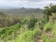
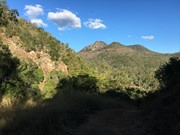
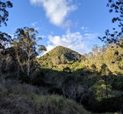
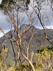
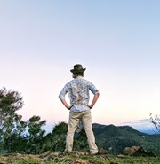
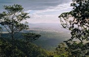
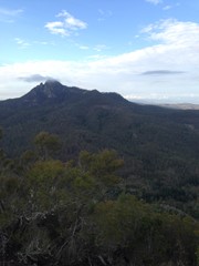
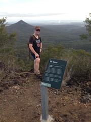
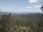
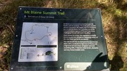
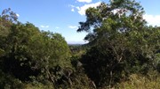
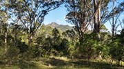
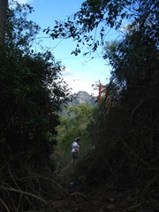
Needing a moderate level of fitness you will pass through Spotted Gum and Ironbark forests, Brushbox and heathland. Keep an eye out for koalas, wallabies and the magnificent Red-tailed Black Cockatoos that call this area home.

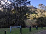
Entry is from Flinders Plum Picnic Area

Take a short hike to the foot of Mt Blaine.

Bird Watching
Picnic Facilities
Eucalypt Forest

Getting there

Follow the unsealed Mt Flinders Rd, PEAK CROSSING until the end.  There are a few water crossings so you may not be able to make it through if it has rained heavily in the last couple of days

Directions

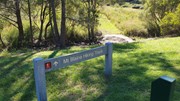
Walk North of the toilet block and you'll see a sign for Mount Blaine which crosses as small creek. Follow the fire trail up for about 1km until you get to a sign for the Mount Blaine Summit Trail. The path to the summit is right next to this sign, don't keep walking along the fire trail at this point.

Return to the car park.


Other References

http://www.ipswich.qld.gov.au/about_ipswich/parks_reserves_precincts/parks_search/index.php?id=89

http://www.ipswich.qld.gov.au/documents/health/flinders-goolman_trails_guide.pdf

GPS Tracks

Comments

The heading says Mt Blaine Base Trail, but actually the description is all about the Mt Blaine Summit trail

Jeff on 9 Jul, 2023

This should be about the walk to the saddle, not the walk to the summit.

Jeff on 9 Jul, 2023

Steep fire trail.

Wanderlust on 10 Apr, 2023

According to the Council website this track is closed as of May 2022 but some who have been there recently say it's open. I would also say the 2.5 km and 90 mins just refers to the hike to the saddle. More like 6 km and 3.5 hrs. to the summit.

Jeff on 8 Oct, 2022

The walk to the saddle is along a fire trail - fairly easy. From there to the top it's quite overgrown and lots of loose rocks. Lots of Lantana. There is a nice flat top with good views in all directions and a fun cache. I was unable to find the Southern track down, so had to go back down the Northern track via the saddle. With the amount of rain we have had in the past few months everything is growing like crazy. See also https://www.aussiebushwalking.com/qld/se-qld/ipswich/ipswich---flinders-goolman-conservation-estate/mt-blaine-summit-trail

Chris on 12 Feb, 2022

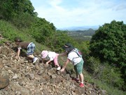
A great little intense circuit close to Brisbane. Up the northern and down the southern path is the way to go. Very unstable on the descent, lots of loose rocks and soil. Your legs can recover on the easy stroll along the fire trails back to the car park. Your efforts will be rewarded with panoramic views

Helen Winter on 29 Aug, 2021

Follow a firetrail up into the saddle of Mt Blaine. From there, turn right and follow along to the fence where you again turn right to head up the mountain. Extremely unstable boulders/rubble mark the next part of the trail, before a steep, steep ascent to the top. Short but steep!

ct__ on 5 Jul, 2021

Super fun little climb. Little foot traffic but lots of spiders.

Amanda J on Jun, 2021

Great walk, missed the path but bushbashed my way up with my mate. Loads of Golden Orb Spiders. I think the best path up to the summit is scrambling up the scree and loose rocks. We took the path to the right (of the scree) and found a way up, but we had to crawl through bramble and scrub.
Great training walk for bigger walks. Will do Flinders Peak next week

Matthew Buxton on 17 Jan, 2021

Wonderful views from side track of Flinders Peak and Mt Blaine. We detoured to Mt Catherine for a very peaceful picnic with nice views. Very steep and loose gravel in some places but well worthwhile. We tied this in with the Sandy Creek Track for an easy going shorter set of walks with our three children.

Family Blunt on 6 Jun, 2020

Did the summit circuit going up the northern face and down the southern face. I'm pretty unfit compared to most people here but I managed it, although it was tough going. View of Flinders Peak and surrounding area from the top is 100% worth it.
The northern face is extremely steep and exposed, but the southern face less so, definitely agree with the other comments to go down that way.
Finding the track on the southern side is only tricky at one point, when you're near the bottom you'll get to a large area of small boulders, make sure you stick left here and you should see a sign through the trees on the far left side.

Sophie P on 5 Jun, 2020

Great hike. As others have said, golden orb spiders everywhere, but also heaps of beautiful wrens on the fire trails and whip birds as you ascend. Mount Catherine is a worthwhile side trip of about 15 minutes. From here is a great view to Blaine, got me pumped to keep going. I headed up the northface, very scrambly lots of leg work. Not many spots to stop and enjoy the view. Beautiful views of Flinders from the top. Check out the geocache on top. Headed down the southern face which I think is marginally easier, though I got a bit lost towards the very end, think a couple of new tags/markers are in order. Loved the hike, preferred this over Flinders.

Tanya on 9 May, 2020

Beautiful hike, great leg workout but definitely worth it. Took about 20 minutes to scale the mountain. Can be quite hairy in some places shoes with good grip are definitely required. One of my favourite hikes so far!

Ling on 6 Oct, 2019

Good hike, feels a bit off the beaten track and has a nice view of Flinder’s Peak from the top.

Karla on 25 Aug, 2019

Lots of hills, great thighs workout. There is a small trail off to Mt Catherine, which is very narrow but looks far easier to climb than the Mt Blaine summit. Some lovely shady spots and loose rocks.

ebbers on 28 Jul, 2019

Great hike. You can either go up the northern face where the signed entry to Mount Blaine is or walk down from the car park to the Skyline track and enter the southern face. The southern face was a lot easier to climb down as the northern face is just a dirt track with a couple of rocks which is steep with nothing to hold onto has you go down. The Southern face is clearly marked with markers for you to follow on the way up and down.

Kelli on 12 Jul, 2019

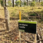
Absolutely marvelous hike, quite strenuous in places and a tough scramble to the summit at the end. I especially liked the short break off the trail to the left halfway up, to Mt Catherine. From here you can see panoramic views of Flinders Peak & Mt Blaine, which makes summiting Blaine more interesting. Make sure you turn left at Mt Blaine Saddle to get to the summit, but off-track to the right are expansive views off the northwest face. I didn't leave early enough and was caught in the dark, which was extremely dangerous at the summit scramble.

Angus Small on 28 Jun, 2019

Nice walk that gets the heart pumping. Beautiful clear day today.

Glenn on 6 May, 2019

Shortish walk but a lot of effort. Sturdy boots required for gravelly / rocky sections. Great view of Flinders from the summit.

Jimmy H. on 10 Mar, 2019

Great little walk. Nice strenuous walk - we didn't have a lot of time so this fit into our morning perfectly. The rock scrambling was fun - glad we had our hiking boots on! Didn't see the golden orb spider someone mentioned (thank God - I've had a fear of them for 30 years when one fell on me hiking!) Didn't get to check out a lot of wildlife since we were so busy watching our feet!

Madonna Guy on 28 Sep, 2018

Where

Click here to load this map.

Done this walk?

This walk has been ticked 83 times

Aussie Bushwalking can keep track of your bushwalks.

Login/signup to tick this walk off.

Tick walks to keep track of where you've been. You must Login to tick walks. Accounts are 100% free so sign up if you don't have one.