Menu
A side track from the Illinbah track up to where a lookout on the old graded walk system used to be
Getting there
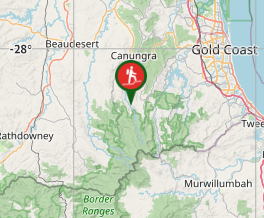
Drive to the end of Illinbah Road. This is bitumen for most of the way, but the last couple of kilometres are gravel (suitable for two-wheel drive vehicles). You will come to a gate, and park near here (off the road, of course).
Maps
QTopo Pyramid Creek/Illinbah Clearing
Route/Trail notes
This walk starts at the alternative entrance to the Illinbah Circuit, on the track to the Illinbah Clearing. Go through/over a couple of gates, following the track (the old Illinbah Road - the public can use this even though it goes through private property) over two crossings of the Coomera River (a few signs show the route for walkers). Eventually, the track seems to peter out in a paddock, but then head for a large gate very clearly delineating the boundary of Lamington National Park. Once you reach the main gates on the boundary of the national park, track west, following the park boundary and a fence (there is a lot of scunge, so gaiters and gloves are a good idea), then towards where the boundary of the national park turns south(ish) (along the top of the ridgeline), the rainforest turns to open eucalypt forest. Follow the ridgeline up to the first "summit", where there are good views. Notably, where QTopo says the Bimboolba Lookout is seems to be beneath the top of the ridge and about 80 metres lower than where the good views are, but I couldn't find it - perhaps there's been a landslip! You can then retrace your steps back to the main Illinbah Track. If it's a hot day follow the track about a kilometre, and just short of the Illinbah Clearing campsite, there's a great swimming hole.
Permits/Costs
No permits/costs
Other References
N/A
GPS Tracks
- No GPS available for this walk yet.


 4.5
4.5 2
2
Comments
Nobody has commented on this walk yet. If you've done it then tick it off and add a comment.