Stretcher Track

Lamington National Park

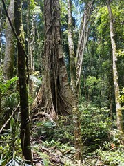
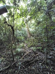
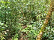
Long considered a "classic" walk in South East Queensland this walk retraces the route taken by the rescue party for the survivors of the Stinson plane crash. It is not maintained by QPWS and is extremely overgrown once the main plateau is reached. A compass and a topographical map is essential as visibility is extremely limited in the rainforest even if you are not walking through low cloud and the track is to all intensive purposes non existent on the plateau.

Getting there

How do you get to the start of the walk? Follow Mt Lindesay Hwy south from Brisbane past Beaudesert and veer left onto Christmas Creek Rd opposite the Laravale general store. Follow this for about 27km to the Stinson Park Campground on left. This is a good spot to spend the night as the first days walk will need as much time as you can give it. This campground is managed by Beaudesert Shire council.

Maps

Which maps cover the area? Sunmap Topographic Map Lamington 1:25 000 scale.

Route/Trail notes

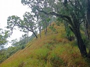
A detailed description of the walk! Drive up Gap Ck Rd opposite Stinson Park Campground to a locked gate. We found a good carpark beside the road about 200m before this gate. From the locked gate follow a 4WD track uphill on private property past a hut. Continue following this 4WD track down a slope and around onto a ridgeline. Follow this ridgeline almost to the top before veering left across toa saddle. Follow this new ridgeline through a fencline and up a steep hill to the plateau. It is here that the rainforest closes in andthe track becomes impossible to discern in most places. Follow this ridgeline up and down until eventually reaching a track heading north south. When I did this walk with my 10y.o. son we did not make it this far before dark and had to find a small clearing to camp overnight. There is no water available on this plateau so ensure you carry plenty. The track south heads up hill to Point Lookout a couple of hundred metres away. The track north heads downhill around 600m to the Stinson Wreck campground. Water is available down a track on the western side of the ridge. The Stinson wreck is down a steep track on the eastern side of the ridgeline. We did not make it to this campground until lunchtime on day 2 and we ended up walking out in the dark along Christmas Creek. The track from here, although very steep in places, is relatively straightforward from a navigation viewpoint as it is fairly well trodden. Upon reaching Christmas Creek a short detour to the right leads to the site of Westray's grave, one of the initial survivors of the plane crash but who died trying to get help. The end of the walk is when the track meets Christmas Creek Rd. Ideally you have left a vehicle here to avoid the long walk back to the start along Christmas Creek Rd and Gap Creek Rd.

Permits/Costs

Do you need any permits? What's the cost? Permit to camp at Stinson Campground on Christmas Creek. A permit is required from QPWS for a bush camp at Stinson Wreck camp site.

Other References

How can I find more info? Any guide books? Take a Walk in South East Queensland by John & Lyn Daly provides detailed information on this walk

GPS Tracks

  • No GPS available for this walk yet.

Comments

To be super clear, for most of the roughly 9km across the top of the ridge there are precious few sections of "track" remaining. The rest is not light "bush bashing". It is a thicket of vines almost constantly laced through with about 5 different types of stinging nettles.

It took me about 12 hours of actual moving time to travel 9km on this section of the "track".

My GPS trace pretty much aligns with the track on paper.

It being a rainforest, everything is wet. Everything is also full of thorns that will shred most camping style wet layers. Expect everything to get drenched.

Erik on 31 Dec, 2022

Many fallen trees make following pink ribbons difficult. Don’t push on if you lose the track! Stay on the track (for lack of a better word - because its more of a weakness in the lattice work of lawyer vines etc...)

Daniel Farquhar on 23 Oct, 2020

Did this walk over the weekend, all in all the track is in pretty good shape. For the most part you can discern a track, only complications are tree falls over several parts of the track which require a bit of circumnavigating to find the trail again. Tape as been well placed throughout the whole track, making navigation a hell of a lot easier and puts the mind at ease you're on the right track.
This walk is a decent slog though, especially with overnight gear. It took us 7.5hrs to get to the Stinson Wreck Campground, 2 hours to descend to the end of Christmas Ck Rd, and because I'm a numpty who left my cars keys in our other car another 1.5hrs to get from the end of Christmas Ck Rd back to the end of Gap Ck Rd.
Compass/GPS I feel very essential, if not simply for peace of mind. Sometimes the trail gets very unclear and it was handy to check our bearing to keep heading in the right direction. The trail is marked on QTopo for reference.
As others have said, be aware of Stinging Trees (the young ones have quite a bite!), Lawyer Vine and the Native Raspberries. They cause a bit of grief from time to time, especially the vines.
Definitely recommend this walk though, however it's not for the faint hearted.

Muzbags on 26 Oct, 2019

Just completed this walk unsure as to the state or existence of the track. I'm pleased to say the track still exists albeit overgrown. It was a steep hike up to the top of the ridgeline and this took some time. The track is then reasonably clear up to the turnoff for running creek falls. It then gets a little overgrown with fallen trees to crawl around and Lawyer Vine and stinging trees to dodge. At times the track was really clear and at other times it seemed to disappear. Luckily we had a partial GPX, map and compass and were able to figure out where we were and where we needed to go when the track disappeared. The track was also well marked with tape though of course there were spots where tree falls hid the tape. All up it took us around 8 hours including meal stops to get to Point Lookout campsite. We started at around 8.30 in the morning but if you're worried about not making it before dark you could leave earlier or take advantage of a couple of unofficial campsites at some of the high points along the track. The next day we visited the wreck and exited via Christmas Creek (a car shuffle was essential). It's a really worthwhile walk even with the slow progress and overgrown track as it gives you a really good appreciation for what the stretcher bearers did. Hard work but worth it. Just a note about Gap Creek Road: it has deteriorated considerably and while it is still possible to take a 2 wheel drive in you will have to leave the vehicle a lot further back along the road. A 4 wheel drive is recommended.

Triantiwontigongolope on 28 Apr, 2017

Walked to the Stinson Wreck from the Christmas Creek side of the Stretcher Track. GPS said 14km total taking 5 hours car to car. Pretty steep, recommend walking poles.

Alice on 17 Oct, 2015

Challenging walk, can really test your navigational skills. Rainforest has claimed back the track making it extremely slow going. Ensure compass, topographical map, plenty of water and good quality torches as may require walking out in the dark.

Grumps on 2010

It gets dark early in the rainforest and we just made it to the overnight camp site near the wreck. A thought provoking location knowing the Stinson story, there is not much of the wreck left but there is a memorial. Descended out the next day via Westray's grave.

Agent86 on 8 May, 1994

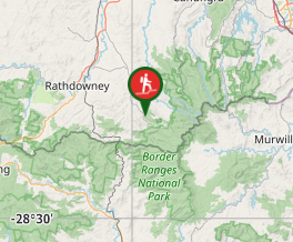
Where

Click here to load this map.

Nearby Walks

Done this walk?

This walk has been ticked 11 times

Aussie Bushwalking can keep track of your bushwalks.

Login/signup to tick this walk off.

Tick walks to keep track of where you've been. You must Login to tick walks. Accounts are 100% free so sign up if you don't have one.