- Mt Barney North Peak (Mt Barney National Park)
- Mt Barney via Logans Ridge and return via Gorge (Mt Barney National Park)
- Mt Barney via Gorge and down Peasants Ridge (Mt Barney National Park)
- Mt Barney - East Peak - Up Logan's - Down South (Mt Barney National Park)
- Mt Barney East Peak - South-East Ridge up and South Ridge down (Mt Barney National Park)
We did this as a day walk, starting at Yellow Pinch carpark around 7AM and arriving at Lower Portals about 4PM. We were told by a professional guide we bumped into at Yellow Pinch carpark that we wouldn't be able to complete our planned route in 1 day. We completed it easily in about 9 hours and taking plenty of stops, but we're experienced hikers and you need to hold a good pace. Most people would probably prefer to break it up into a 2-day walk.
A couple things you need to know first up:
1. This route starts at Yellow Pinch Carpark but finishes at Lower Portals Carpark, so you either need to pre-arrange a way to get back to your car or you have an extra walk at the end from Lower Portals back to Yellow Pinch.
2. A rope is needed to descend a couple short sections of the couloir on the western side of Leaning Peak. This is a very steep scramble through thick grass and over a few small cliffs, so only attempt if you are comfortable with doing this, as once you pass the first cliff you're pretty much committed to continuing the descent because it's difficult to get back up.
Getting there
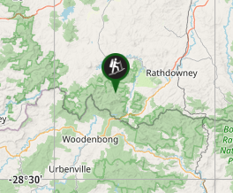
Start from Yellow Pinch Car Park, Upper Logan Rd, Mount Barney QLD.
Maps
QTOPO "Mount Lindesay" 9441-31
Route/Trail notes
Start at Yellow Pinch carpark, follow the firetrail to the base of SE Ridge and ascend SE Ridge to East Peak (I'm not describing this ascent in detail here because it's described elsewhere). This took us about 3 hours carrying light day packs and we were holding a good pace. Allow more time if you want a more casual climb or if you're carrying overnight packs.
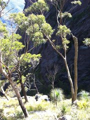
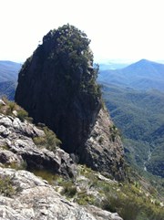
From East Peak, walk west along the peak until the northern face flattens out a bit and then descend the north face onto the ridge to North Pinnacle. The traverse across to North Pinnacle is pretty quick and easy, but can require some bush bashing in sections if you don't pick a good route.
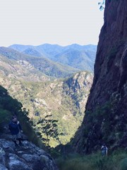
From North Pinnacle, continue north until you hit the base of the southern face of Leaning Peak. It's important to go all the way to the cliff face on the south side of Leaning Peak, because if you pull off any earlier to descend to Barney Gorge you will hit large cliffs. From the base of Leaning Peak, head west down the steep grassy couloir. We kept right on the grassy section as long as we could, because the rocky chasm that runs adjacent was very slippery. Near the end of the grassy section we used a rope to help get down a short cliff with no good holds, and again on another section further down. Follow the chasm down until you hit Barney Gorge.
Rock hop down Barney Gorge until you hit Barney Creek, then follow Barney Creek East until you reach lower portals. Watch out for the track to your left that goes around Lower Portals, or alternatively you can swim across Lower Portals like a couple of us did. An alternative to descending via Barney Gorge if you want to return back to Yellow Pinch carpark would be to turn back up Barney Gorge from the base of the couloir and rock hop up to Rum Jungle for an overnight camp and then descend via South or SE Ridge.
Permits/Costs
None, unless you plan on camping overnight, in which case you need a camping permit, which you can get online from QPWS here:
https://qpws.usedirect.com/QPWS/Facilities/SearchView.aspx
Other References
I haven't seen any reference to this specific route anywhere else, but Robert Rankin's "Secrets of the Scenic Rim" provides good notes about most of the common Barney Routes.
GPS Tracks
- No GPS available for this walk yet.
Where


 16
16 1
1
Comments
Nobody has commented on this walk yet. If you've done it then tick it off and add a comment.