- Mt Barney East Peak via SE Ridge, traverse North Pinnacle to Leaning Peak, descend to Barney Gorge and Lower Portals (Mt Barney National Park)
- Mt Barney via Logans Ridge and return via Gorge (Mt Barney National Park)
- Mt Barney via Gorge and down Peasants Ridge (Mt Barney National Park)
- Mt Barney - East Peak - Up Logan's - Down South (Mt Barney National Park)
- Mt Barney East Peak - South-East Ridge up and South Ridge down (Mt Barney National Park)
This challenging route offers all the views normally associated with a climb up Logan's Ridge without the extremely precipitous sections. There are a few exposed sections where a rope may be handy, particularly if the rock is wet.
Getting there
From Brisbane travel along Mt Lindsey Highway past Beaudesert and 1km beyond Rathdowney. Turn right into Boonah - Rathdowney Rd. Travel for seven kilometres to Barney View -Upper Logan Road turn off. Turn left and travel for 11.7km to the Yellow Pinch picnic ground. There is no camping at Yellow Pinch Picnic Ground. Camping is available at Mt Barney Lodge as are homesteads and cabins.
Maps
Mt Lindesay Topographic 1:25 000 scale.
Route/Trail notes
Leave carpark and return 600m along Upper Logan Rd to Barney Lodge turnoff. Head west across the grassy paddock to an old gravel logging road and follow it southwest and west uphill to a gate. Continue west then north west along the road following the crest of a ridge. Head through a second gate and continue downhill to a third gate and the national park boundary. The road continues uphill in a westerly direction and narrows to a footpad. Upon reaching a small rock cairn at GR 715 722 turn right away from Logan's ridge and contour north-west, then west. Cross a gully and a low ridge before descending into Rocky Creek below a small cascade. There are views here straight up the creek to North Peak. This is the last chance for water until returning to rocky creek not far upstream from here on the descent. Climb the opposite bank to the top of North Ridge and continue uphill bypassing a cliff on the left hand side before eventually reaching the crest of a knoll where the view extends to North, East and Isolated Peaks (North East Rock).
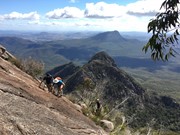
Descend about 20m to a narrow saddle, climb another steep knoll and descend again on the left of the ridge to another saddle. Climb staight uphill over rocky ground to the base of a cliff. I climbed up on the right hand side of this and then climbed up a rocky chute where the route is very steep.A little further you will pass some smooth rock slabs on the RHS with views into the bed of Rocky Creek.
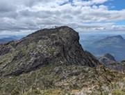
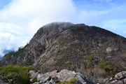
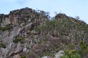
The route now leads to a distinct cleft between North Peak and a finger of rock to the right. Aftder reaching the saddle at the top of this cleft turn left for the final steep climb to the summit. It is possible to climb to the top of the finger of rock but the view here is probably not worth the extra effort. The views from the summit of North Peak are spectacular, particularly on a clear day.
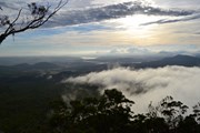
Head west from the summit looking for a distinct route leading south beside a cliff. You will need to move right and left to avoid thick scrub before finally reaching the saddle. There is only room for a small tent here but a bivouac bag would fit better. The views from here at sunset and sunrise are superb.
Locate an obvious route leading east downhill from the saddle through stunted tea trees. Bypass a rock slab on the left and continue downhill choosing the path of least resistance. You will need to skirt around a rocky outcrop before descending back into the gully. At the next sloping rock slab you will normally be able to collect water. Continue down the gully rock hopping and descending a waterfall. A rope will come in handy at some of these sections as the rock can get very slippery. Continue downhill until eventually reaching the spot where you entered the gully yesterday. Retrace your steps back to Upper Logan Road and Yellow Pinch Car Park.
Permits/Costs
You will need to get a bush camping permit from QPWS.
Other References
Take a Walk in South-East Queensland by John & Lyn Daly.
GPS Tracks
Where
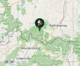



 North Peak (GPX)
 10.7
10.7 6
6
Comments