- Bohgaban Falls (Lamington National Park)
- Denham Falls walk (South East Queensland)
- Apple Tree Park North and South Trails (Springbrook National Park)
- Apple Tree Park to Little Nerang Creek Falls (Springbrook National Park)
- Little Nerang Creek and Purlingbrook Falls circuit (Springbrook National Park)
What starts out as ordinary walk leads to some great rock hopping, swimming and gorge exploring
Getting there:
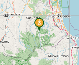
Opposite Numinbah Valley School of Arts (2136 Nerang Murwillumbah Road)
Maps
QTopo Numinbah Valley
Route/Trail notes
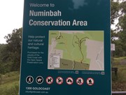
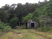
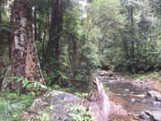
Follow the Great Walk Trail for about 2km to an intersection with two gates and a large sign that says: "Numinbah Valley Conservation Area". To the left and downhill, the Great Walk continues towards Springbrook, but go straight ahead and uphill (south) along a 4WD track (Chesters Road). A few hundred metres along the track, power lines cross overhead, and to the west is a great view of Egg Rock and the Numinbah Valley. Further along, a track runs downhill to the left (old street number on a post: 365), ignore this (unless you'd like to go an check out a quaint old shed) and keep right (most worn path). Then, further along you will reach a second fork (old street number on a post: 400). Take the left branch and keep going to the end of the track (with a sign saying: "Return to Carpark 2.5km" and "Waterfall Creek Trail 2.6km return"). Follow the Waterfall Creek Trail and make your way down to the creek. After a kilometre or so the track starts to follow the creek closely, and you can get in at any point you like (remembering where you did for when you come back). Head upstream, rockhopping at first, but then you will start to encounter a series of small gorges - some of these you can skirt around and stay dry but it's much more fun getting wet and either paddling or swimming (make sure you've got your old sandshoes and a waterproof bag). Eventually, the "gorgey" section finishes and then the creek becomes more a series of cascades and waterfalls; go as far up as you like, but eventually you'll reach a waterfall that's a bit high to climb with ease. Head back by retracing your steps.
Permits/Costs
None.
Other References/Comments:
Chester Road goes all the way back to the Nerang-Murwillumbah Road, but you can't bring your car up (which is unfortunate) because there's a locked gate.
GPS Tracks
- No GPS available for this walk yet.
Where



 13
13 5
5
Comments