Conondale Great Walk

Conondale National Park

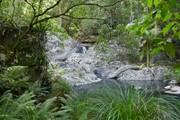
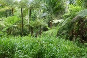
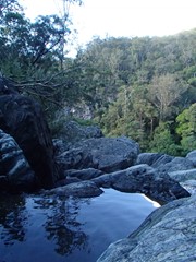
Ancient rainforest, cascading waterfalls, crystal clear creeks, tall open forest and expansive views.

Bird Watching
Picnic Facilities
BBQ
Toilets
4WD Required
No Dogs Permitted
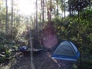
Camping Permitted
Rainforest
Eucalypt Forest

Getting there:

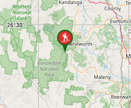
From Kenilworth travel south on the Maleny Kenilworth Road for 7km before turning right onto Booloumba Creek Road. Travel a further 5km along this road to the entrance of the park. From here on, the road is unsealed and you will need a High Clearance 4WD as there a number of creek crossings. After 1km you will reach the Day Use Area on the right, where you can park.

All the walks start from here, although they can be accessed from the three camping areas.

Maps:

Conondale National Park Map

Route/Trail notes:

Day 1: Booloumba Creek section - 11k

The major track entrance facility is located at the Booloumba Creek day-use area where the Great Walk starts and finishes. Essential orientation, safety and minimal impact information is provided at this point, as well as information on the area’s natural and cultural values. This area provides low-key, vehicle-based camping nearby and day-use facilities beside the creek including toilets and barbecues and a number of short-walk opportunities.

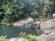
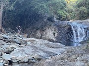
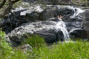
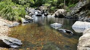
The first section leads from Booloumba Creek day-use area along the banks of Booloumba Creek, via rock cascades and pools to the iconic Booloumba Falls Lookout. The Great Walk continues on to the Wongai walkers’ camp.

Day 2: Mount Gerald – Peters Creek section: 17k

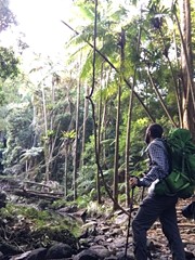
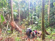
The second leg climbs steadily, beside trickling streams and forested ridges to Mount Langley, the highest point of the Mary and Brisbane River catchments. The track continues through rainforest in the high country to the Tallowwood walkers’ camp in the headwaters of Peters Creek. Along the way walkers can catch glimpses over the Conondale Range to the distant coastline.

Day 3: Peters Creek – Summer Falls section: 15.2k

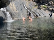
The third leg of the Great Walk winds through rainforest in the Peters Creek catchment area before crossing Sunday Creek Road and descending through more open forest along Summer Creek. Aptly named, Summer Falls walkers’ camp is located in an area that provides an easy access point to the dramatic Summer Falls.

Day 4: Mount Allan – Booloumba Creek section: 12k

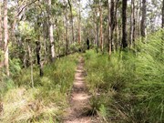
The final leg continues through the northern open forest country, ascending Mount Allan. Walkers are able to climb the Mount Allan fire tower for extensive 360 degree views over the Conondale Range and beyond. This provides a unique opportunity to visually retrace the Great Walk route and place the walking experience into perspective within the broader landscape. The old fire tower is a legacy of the forestry era and culturally significant (currently closed for access). The 5.5km (oneway) section of completed track linking Booloumba day-use area with Mt Allan is open to walkers.

Permits/Costs

None. There are various camping options within the park, that require you to buy a permit. See:

Conondale NP Camping

Other References/Comments:

Conondale National Park

GPS Tracks

  • No GPS available for this walk yet.

Comments

This is great hike. You can park your car and you return to it going in a circuit which is rare for such a long walk. There is plenty of water with the streams and waterfalls which is important for a long walk so you can clean yourself in the cold water and refresh the legs!
We skipped passed Wongai walkers camp and went all the way to Tallowood in one day which was a long uphill grind at times. We were in bed by 6.30pm that night but the rest of the hike was much easier. A highlight was camping at Summer Falls. I recommend to bring plenty of bushman's spray or cream and apply to legs and socks and boots so the leaches leave you alone.

Hogey Bear on 18 May, 2023

Took the clockwise route as per National Parks suggestion although anticlockwise does seem more popular and might try that next time although it would make for a steep descent on the last day. Rained second day which brought leeches out - would advise bringing DEET & a groundsheet/tent footprint as campsites quickly get muddy. Appreciated my new gaiters! Nice walk with some lovely forest, treeferns in misty rain a highlight. Some decent size logs blocking the track in several places, be prepared to clamber/pole vault/limbo/bushbash. Firetower currently closed but was too knackered to tackle Mt Allan on the last day anyway. Definitely worth a revisit.

Pendinghiker on 8 Jul, 2021

This time of year (mid-September) it was not too hot during the day and the nights were cool (not needing a sleeping bag every night). I think it was around 29°C days around Jimna but the higher altitude on the trail and the canopy cover makes for a nice temperature. Creeks quite dry but good swimming at Booloumba Falls. Large pool at Summer Falls but not running. Keep your food bag in the tent away from possums and other critters that will tear a hole in your backpack.

Erin on 21 Sep, 2020

This was my first solo multi-day hike and boy was it good.
I chose to go in the last day of winter (as suggested on the Great Walk page) which meant I saw no leeches and didn't get any ticks, though wearing long pants and sleeves also helps.
While it is possible to do the hike in two days, why would you? Take the time and enjoy the scenery and the birds. I walk at a reasonable pace and generally take half the amount of time suggested on the map, even with regular stops to look and listen. This was good as it allowed me to arrive at the next camp, setup, have lunch and then explore the waterfalls that are close to each camp site.

The track is well marked, with the only way you could miss a trail sign is if you weren't paying attention, or it was missing, which was not the case when I did it. There is only one sign on the way from Tallowwood to Summer Falls which seems inaccurate as it states 9.9km, imply you have walked 7km, when this is not the case.
On section two (Wongai to Tallowwood), there is a bit of debris across the track to navigate but that just adds to the sense of hiking through the rainforest, and is in no way an inconvenience.

Be sure to take toilet paper with you, as both Wongai and Summer Falls were out of toilet paper; Wongai due to its proximity to Booloumba Falls carpark area and Summer Falls due to its popularity as an overnight hike (I'm guessing).

In terms of distance, the is accurate, as you would expect. Using GPS alone is severely hampered by the dense tree canopy, so don't rely purely on a simple GPS for distance or navigation and instead take a fit-for-purpose unit. You might have good coverage and satellite lock at the entrance, but this changes quickly once you enter the dense forest.

Overall, this is an excellent walk through some amazing vegetation with plenty of animals to see and hear.

LeaveOnlyShadowsThere on 27 Aug, 2020

Bit of a boring walk, scenery doesn't change and waterfalls are not as impressive as those in other parts of SEQ.
Made the mistake of attempting to complete the hike in 2 days. As I didn't have a 4WD, had to start from Charlie Moreland Day Use Area and take the Mount Allen track. This added more kms to the hike than planned.
Finished day 1 at 6:30pm (Charlie Moreland to Tallowood)
Day 2, we were rescued by a woman who offered to drive us the rest of the way. If we didn't take offer would have hiked about ~35km in a day and finished at about 8pm.

At Tallowood, mauled by possums who wanted our food. Be weary of them.

Conclusions: don't attempt to complete this hike in 2 days if you are starting from Charlie Moreland. Might be okay if starting from the official beginning point.

Andy on 21 Jul, 2020

I walked 4 days in the rain. Beautiful Conondale great walk but do not walk in the rain. TOO MANY LEECHES!!

Tina23 on 29 Apr, 2019

Lots and lots and lots of leeches, and it rained pretty much the whole way. But it was an amazing family bonding experience. Loved it!

EchidnaScout on 26 Apr, 2019

I have the opposite view of other commenters in that the wetter first 2/3 of the walk is my favorite part, I find these parts of the forest absolutely stunning. The advantage with the Summer falls camp area is that it is next to water where as the previous two sites are not but there are some beautiful spots on the water along the way to enjoy on those days.

Quite a few day walkers use the first two thirds of the first day, visiting Artist Cascades and/or Booloumba Falls but then the trails are very quiet after that. This does come with there being lots of trees across the trail, but the remoteness of the forest is part of the charm.

We used mosquito repellant spray to repel and when needed remove leeches and that worked well.

I was quite surprised to find drop toilets stocked with plenty of toilet paper at each of the remote camp sites. The is plenty of water in tanks at each site but having a treatment method would definitely be recommended, the water at the second site is a bit discoloured by leaf-litter in the collection gutter. There are quite a few creek locations where very clean water can be collected and treated too; these are obvious on the map.

John on 28 Dec, 2017

Great Walk. We did this walk in three days. The scenery was awesome and even found lots of raspberries between Walkers Camp 2 and 3. There were a few ticks and leeches around!

SabrinaBlaas on 12 Dec, 2016

This was a great walk. Do the track in the CW direction (as recommended). The track gets better as it goes on. Be prepared for the camp cites some are a bit small - even for a 2 person hiking tent.

Would recommend it.

stephen mitchell on Aug, 2016

Summer Falls camp site is excellent, I'd just walk it backwards and stay there for a night if I did it again. Very wet so there were a tonne of leaches, try and walk it when it's dry. Distances are correct and not difficult, I did it in 2 days and made it to camp both days by 3

Peteski on 27 Mar, 2016

WELL ! ! great walk ! heaps of Fauna -- now to the nitty gritty ! ! who surveys the track ? Found distances to differ HUGE .. Topo and ALL Web advises the following -- S1 11K -- S2 17K - S3 15.2 K - S4 12 K -- after DR and GPS (x2) checks -- found "anomalies" -- Actual Distances -- confirmed via re-calibrated / tested Garmin 64 on GPS + GLONASS -- S1 17.9 KLM -- S2 21.9 KLM -- S3 22 KLM --- S4 13.8 KLM EQUALS 75 KLM -- an extra 19 KLMs --- Pretty bad -- our leisure hike turned into a second half sprint to make camp ON THREE OCCASIONS -- anyone else had issues with distances for other great walks. Concerns me greatly about accuracy of other "Great Walk" distances.

Ted n Jo on 21 Jan, 2016

went into this not knowing what to expect and fell in love with the last camp sight (summerfalls) would highly recomend doing it just to hit summer falls and spend a day or two there. you can do it backwards or even take the short cut from the road and skip mt allen, but i think its worth doing it propperly the first time, makes it worthwhile and i think i apprehate it more because of the effort required.
the track itself was very poorly maintained in places and had to climb over and around trees. but all in all well worth doing would highly recomend. could smash it out in two days if you pushed it a little

jai on 20 Dec, 2014

Great walk. Good campsites. Great challenge.

Craig Buchan on 9 Jun, 2014

17-20 April 2014. Beware: lots of leeches during day 1 and 2 after the wet weather (by lots I mean one every 10x10cm patch in places). During our hike the track felt poorly maintained - trees across the trail, had to wander off the trail several times to find it.
Summer Falls campsite (day 3 night) makes up for it: very nice cliffs, beautiful falls with dipping/swimming holes, dry ground (without leeches!), open forest.
Overall feeling: won't do the walk again unless after a month of no rain; Summer Falls site is the next long weekend destination (accessible from the 2WD road crossing the 4th day trail section about 4k from the Summer Falls campground).

S_V on 17 Apr, 2014

17-20th. leech pit. not worth it really, last two days were nice. Summer falls is spectacular, and can be accessed as a day walk ... do that

B_T on 17 Apr, 2014

Lots of leeches. Almost got lost because there are so many forks with all the fire trails. Quite flat. The final segment is the most scenic by far, and the final campsite is the nicest by far.

tbattistel on Apr, 2014

23-25 Oct Really nice little walk. I didn't have 4wd so parked at Charlie Moreland and walked in via the fire trail. That meant around 23k first day to Wongai camp. 2nd night @ tallowood was lovely. Bit of light rain. At Summer Falls by 10am next day so continued through and back to Charlie Moreland by 2.30pm. After reading other walker comments, strongly recommend reading national parks blurbs re best times to walk...to avoid disappointment. October was a great time to walk, but I'd say anytime other than the wet season would be good. I'm taking my 10 yr old next weekend for her first multi-day hike. Imagine we'll take the 4 days this time, staying all three campsites. P.s. Don't walk in from Charlie Moreland unless you have to. Steep, boring, cleared land, cows. If you do, start real early/return late to avoid the sun.

Miki on 23 Oct, 2013

Where

Click here to load this map.

Nearby Walks

Done this walk?

This walk has been ticked 32 times

Aussie Bushwalking can keep track of your bushwalks.

Login/signup to tick this walk off.

Tick walks to keep track of where you've been. You must Login to tick walks. Accounts are 100% free so sign up if you don't have one.