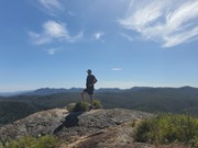
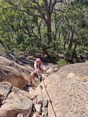
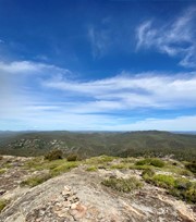
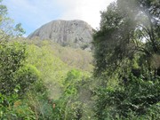
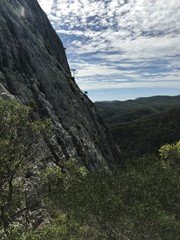
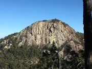
I have found this gem a challenging summit but only because the two times I have been up has been off-track. There is a track but I haven't been on it all the way. Awesome views of over Mt Walsh National Park and also west towards Coalstoun Lakes. Certainly some steep rocky sections and would not advise if wet or inexperienced.

Lookouts
Bird Watching
4WD Required
Scrambling or Climbing
Navigation Required
No Dogs Permitted
No Camping Permitted
Eucalypt Forest
591m
Maximum Elevation
261m
Total Climb

Getting there

Four wheel drive only.

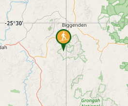
Turn left onto Lords Rd 6km south of Biggenden on the Ban Ban Springs rd (Isis Hwy). 

Maps

Which maps cover the area?

Route/Trail notes

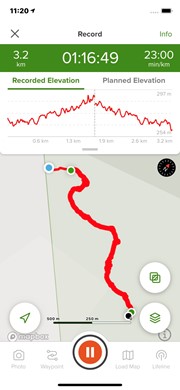
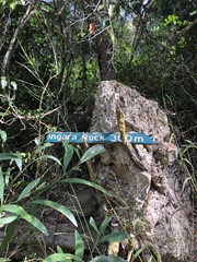
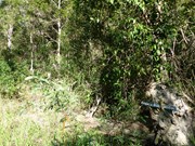
I would suggest taking the fire trail on the left as you enter the car park. Follow it down across the creek & up to the pinch on the ridge. Take the track from there that goes down into the creek. When you cross the 2nd creek look for the trail on your right in the first 20m. The original sign has rotted and start to the walking track can be overgrown and easily missed. Orange ribbons ( 3 of them ) are at the start now, should not miss it. 

Permits/Costs:

None.

Other References

https://seecq.wordpress.com/2014/06/27/coongara-rock-mt-walsh-national-park/

https://www.npsr.qld.gov.au/parks/mount-walsh/about.html#Coongara_Rock

GPS Tracks

Comments

Does anyone know where the large cave is

Cohenlm20 on Apr, 2022

Walk is accessed from a 4 wheel drive track along Lords Road. Car parking area is identified by a small open area with signs indicating no vehicle access. Follow the 4 wheel drive track that continues on the left. The track follows the ridge down into a creek and then up a small pitch and down into a second creek crossing. Be aware there is a small gully that sometimes contains water. This is not the entry point. When you cross the second creek, the entry to the track is 15 -20 metres from the creek to the right. There is a sign identifying the start of the ascent, however, it is overgrown with lantana. To avoid missing the track, after the crossing the entry is indicated by an indistinct track. The track takes a path straight up towards the rock face. The first part of the track is overgrown and leads up towards a rocky gully. Walkers should look for tape; however, there is a logical path. Care should be taken as parts of the ascent is rocky. The track continues vertically until the start of the rock face. From the top of the track the track traverses along the left of the rock face. This part of the track involves scrambling and climbing. and continues around to the back of the rock. The last 20-30 metres to the summit is across open rock faces. Care needs to be taken if wet.

David Eke on 8 May, 2021

Between the 1st creek crossing and the 2nd one there is also another small creek crossing. I thought that was the second one and started going through the bush after that one but then understood that it must have been a wrong way. Go further, you will easy identify the 2nd creek crossing. I've uploaded the GPS track, this one leads to the entrance to the top. There are also freshly painted poles and someone put the sign to make it visible. Unfortunately because of my initial wrong road, i spent too much time and didn't climb to the top because it was getting dark and i went back to my car.

ovel on 11 Jul, 2020

Great Walk. Need 4x4 or high clearance to get to Parking spot at base of the walk. The entrance to get up to the mountain is well hidden and to push through scrub to get onto track up to the mountain. It is 20m on the right after the 2nd creek. You can also do a cicuit around the ridge at the bottom of the mountain.

Andrew on 18 Apr, 2020

Amazing and So secluded. Very grateful to of gone with someone who had done it previously, so knew how to get there. Not for inexperienced walkers.

Hayley Fourro on Oct, 2018

Nice hike, faint overgrown track but simply follow the orange ribbons and you'll be fine. Once you've crossed the 2nd creek look to right to notice the track. The sign has roten off it's post but some kind person stuck up a rock ( see pic attached )

J on 28 Oct, 2017

Where

Click here to load this map.

Nearby Walks

Done this walk?

This walk has been ticked 14 times

Aussie Bushwalking can keep track of your bushwalks.

Login/signup to tick this walk off.

Tick walks to keep track of where you've been. You must Login to tick walks. Accounts are 100% free so sign up if you don't have one.