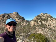
If you've ever climbed Mt Walsh and stood out on the huge north bluff. You'd have looked down at the " four sisters " and drooled at the rocky boulders and peaks beyond.
This new track that my friends and I are marking out, turns Mt Walsh summit into an awsome through walk.
Getting there:
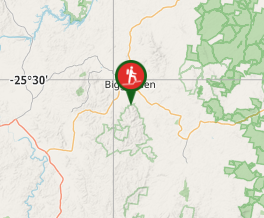
Start as per the normal Mt Walsh ascent. Mt Walsh is close to the country town of Biggenden which has all facilities including 2 pubs which both serve great food and cold beer.
Maps:
Which maps cover the area?
Route/Trail notes:
Climb Mt Walsh as normal. Once you reach the top, turn right along the ridge. But instead of veering right and slightly down (north) towards the bluff. Veer left and over the back (north west). Head down the gully marked with red and white reflective tape. The gully follows the cliff line diagonally down to the first of the rocky outcrops. The track passes below the left western side. You can make a tricky detour to the top of the first sister with some scrambling.
Follow the track onwards up the western edge of the tallest second sister. There is a nice little camp site near the top and a brilliant lunch cave on the eastern side of the huge boulder at the top.
Follow the track down and up the last 2 sisters.
Then head down the rocky slope aiming towards the carpark. Follow the red and white tape and also the rock cairns. The track veers left north then turns right across the face and diagonally down towards the grassy hill back to the carpark. The track can be hard to follow once in the grass. There are markers and rocks placed in trees. But if all else fails, just aim for the carpark. The more people that take this awsome track, the clearer it will become
Permits/Costs:
None
Other References/Comments:
How can I find more info? Any guide books?
GPS Tracks
- No GPS available for this walk yet.


 6
6 5
5
Comments