
Menu
Suggested searches
Your search found 2293 results...

 2.5
km
return
2.5
km
return
 45
mins
45
mins
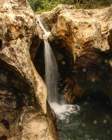
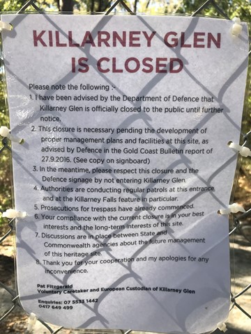
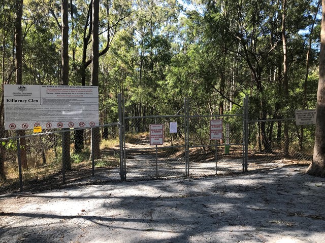
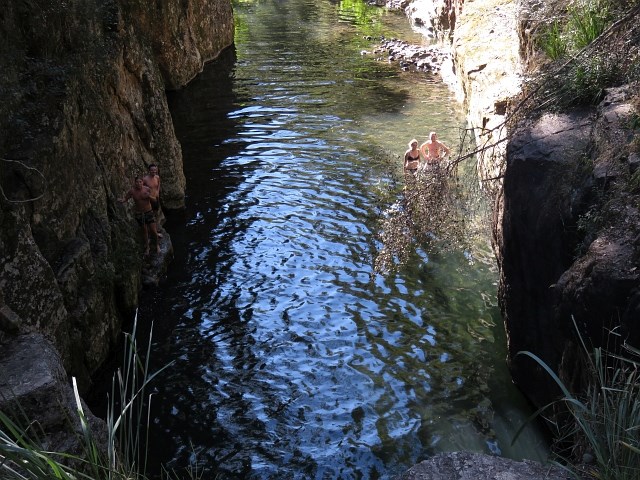
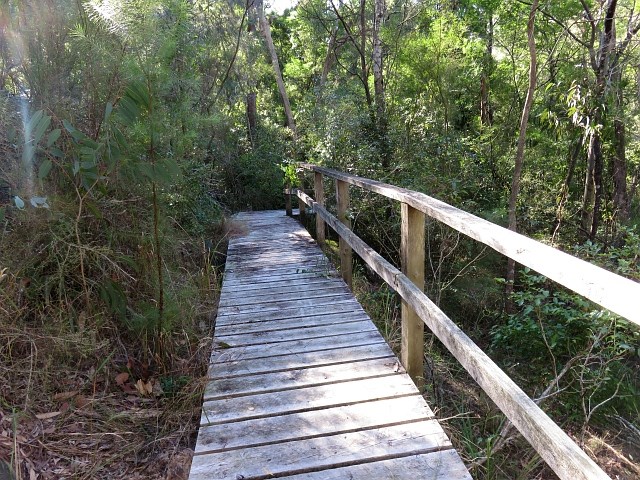
Killarney Glen - PERMANENTLY CLOSED
South East Queensland
Killarney Glen has been permanently closed. This page is maintained to allow members to record previous visits to this walk.
 10
km
return
4
hrs
10
km
return
4
hrs
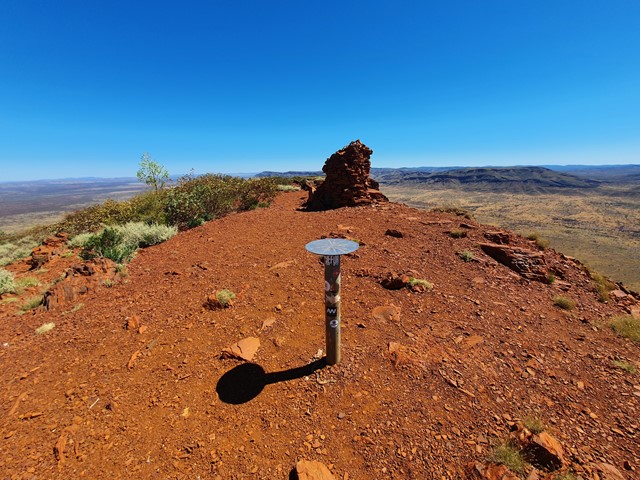
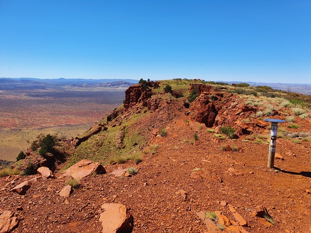
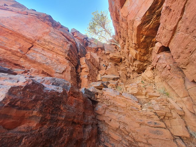
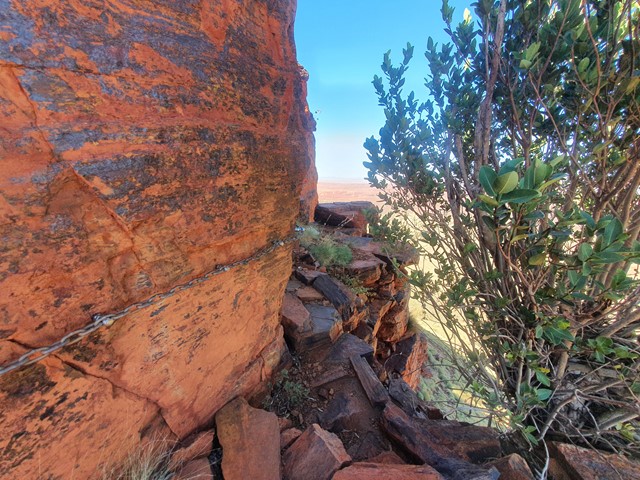
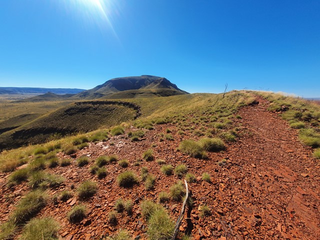
Mount Bruce
Karijini National Park
Mount Bruce is the second-tallest peak in Western Australia at 1235m and lies about 36km west of the park office. The walking tracks on the mountain provide a great opportunity to view the Marandoo Mine Site located to the south. The easiest walk is the Marandoo View which is a 500m walk and takes about 30 minutes round trip. For a slightly harder walk, you can take the Honey Hakea Track which is a 4.6km round trip that is about a 3 hour journey.
 20
km
return
7
hrs
20
km
return
7
hrs
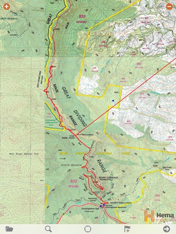
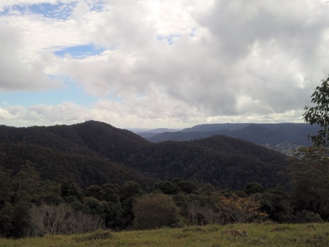
Cunninghams Gap to Laidley Creek Falls
Main Range National Park
I've always loved the view of The Ramparts to the north of Cunninghams Gap when driving up Main Range, and have done the walk from the Gap to Bare Rock on a couple of occassions. This is only a short walk on a well-graded track, and not too much of a climb. The view at the end makes this a great short walk all by itself. However, I've always wondered what lay beyond. There's a map and a reasonable description of the route from Bare Rock to Laidley Creek Falls in "Take a Walk in South-east Queensland" (John and Lyn Daly) - refer page 257 Cunninghams Gap to Mount Castle. There's also a description in the out of print (but online) Bushpeople's Guide to Bushwalking in Southeast Queensland (Sylvesters Lookout to Mt Cordeaux)http://www.southee.com/Bushwalking/Ch15-MistakeMountains.html#label025. Several blogs indicate that it is a difficult walk with no views. I decided to investigate for myself (and without available walking buddies for the day - by myself) last weekend (14 May 2016). I never intended to walk through to Laidley Creek Falls, just investigate conditions beyond Bare Rock with a view to doing the walk through later in winter. Following are my observations.
 6.9
km
return
3
hrs
6.9
km
return
3
hrs
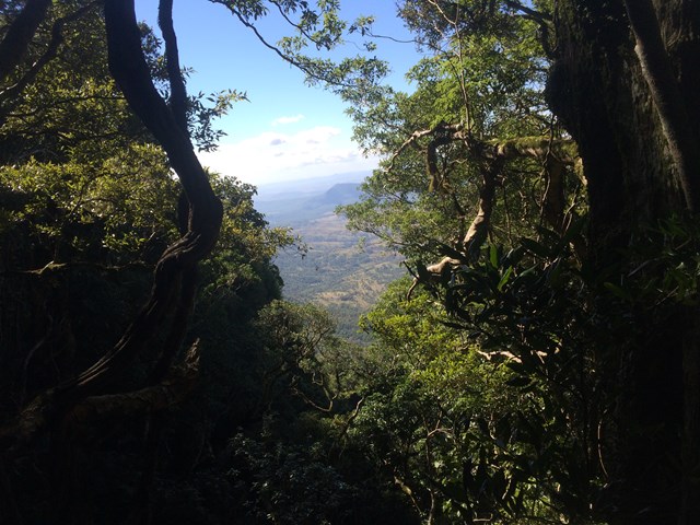
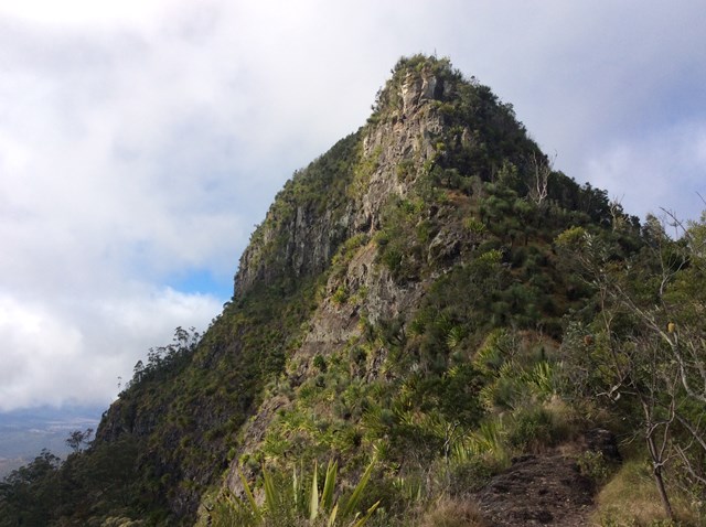
Brindle Creek Walking Track
Border Ranges National Park
A beautiful walk starting at Brindle Creek Picnic Area, Border Ranges National Park. Stunning rainforest with well maintained track. Numerous easy creek crossing and a waterfall with large boulders you can sit on for a relaxing lunch break mid walk. The track is moderate (easy in many places).
If you love waterfalls and ancient rainforest, then you can’t go past Brindle Creek walking track in the high country of Border Ranges National Park. Following the creek line, this medium walk passes through unspoilt wilderness from Brindle Creek picnic area to Antarctic beech picnic area in the north-east of Border Ranges National Park, near Kyogle.
Passing the turn off to Helmholtzia loop, you’ll think you stumbled into a timeless rainforest wonderland. Here you’ll see huge hoop pines and massive ancient Antarctic beech trees whose trunks grow thick and hairy with lichens and fragrant ferns. Keep your eye out for the huge helmholtzia lillies that thrive in the damp moist air. This high mountain plateau is a cloud factory all year round and you could be enveloped in mist even in the middle of summer.
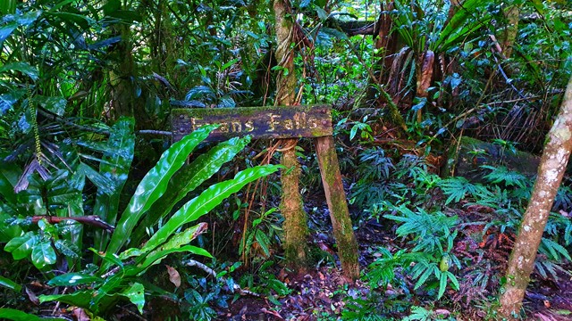
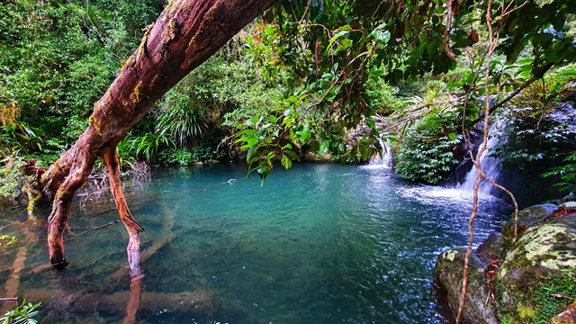
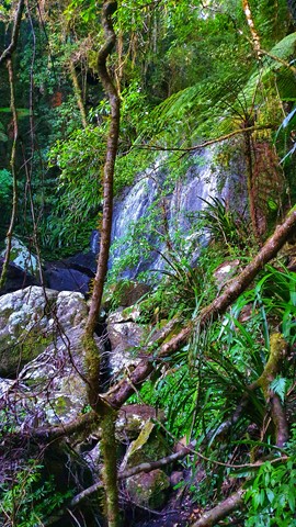
Unpack a picnic beside picturesque Evans Falls where the swimming hole below the waterfall is ideal for a dip. Further along at Selva Falls, clean mountain water cascades over large moss-covered boulders.
 400
m
return
30
mins
400
m
return
30
mins
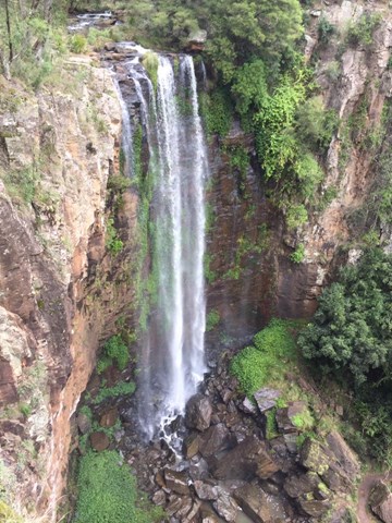
Cliff Circuit
Main Range National Park
This walk takes you to the top of Queen Mary Falls, which is part of the headwaters of one of Australia's longest river systems, the Murray–Darling. Great care should be taken when viewing the gorge below. Supervise children closely.
 10
km
return
3
hrs
10
km
return
3
hrs
Schultz Track
Kondalilla National Park
This walk can be accessed via Schultz road, in Witta, and appears to be a 4x4 telegraph track (frequently crossing through a power line area). It includes wet and dry Schlerophyll forests, and is Ideal in spring when it isn't too cold. Also, don't go after heavy rain, as creek crossings may be flooded.
 12
km
return
8
hrs
12
km
return
8
hrs
Mowburra Peak
Mt Barney National Park
A slightly less travelled walk up a steep grassy ridge and then disappear into rain forest to get to a small cleared rocky slab with wonderful views out to Mt Barney.
 10
km
return
3
hrs
10
km
return
3
hrs
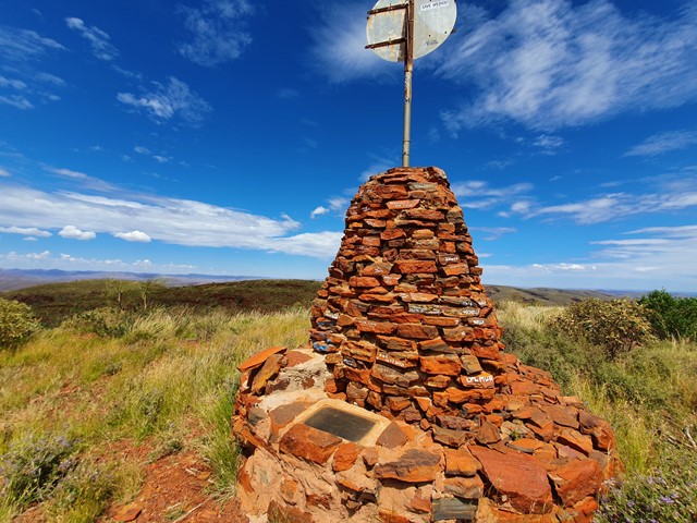
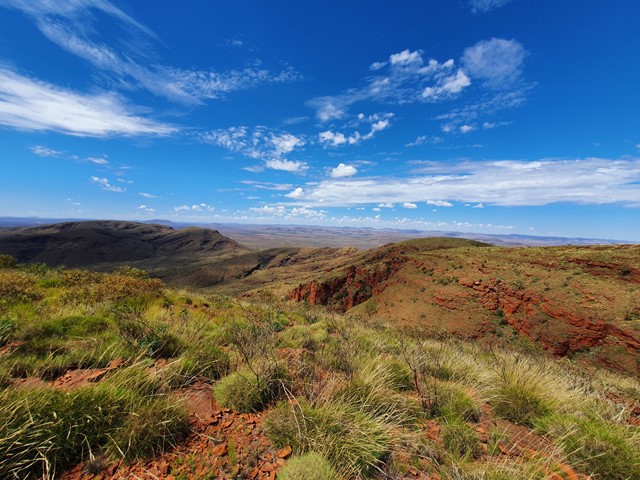
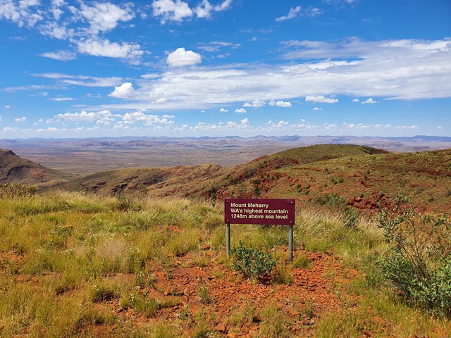
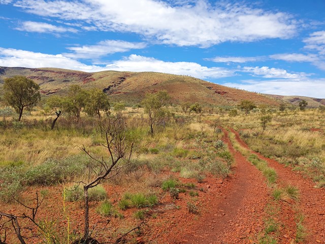
Mt Meharry
Karijini National Park
Highest mountain of WA at 1249 m.
You can actually drive to the top but would require a 4WD.
 4
km
return
90
mins
4
km
return
90
mins
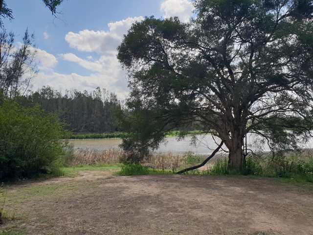
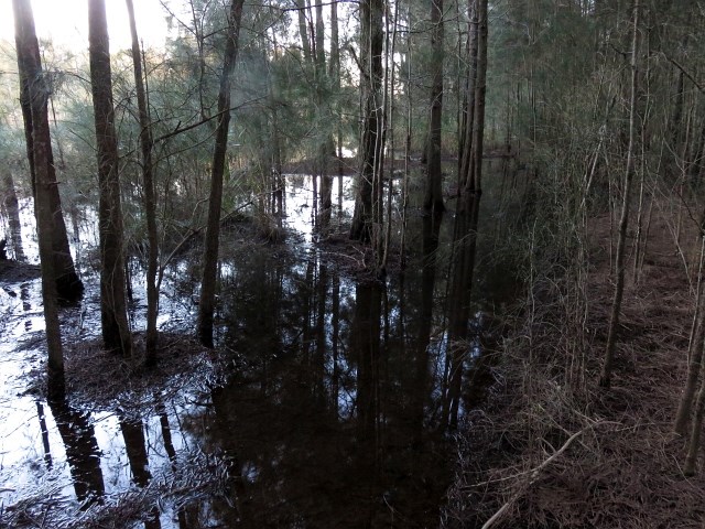
Longneck Lagoon
New South Wales
A track which hugs banks of the small permanent freshwater wetland, has one very big attraction: birds. Over 140 species have been recorded at the park, with at least 42 species using the wetland on a regular basis (seven of which are protected by international treaty).
 5
km
return
2
hrs
5
km
return
2
hrs
Mitchell Park Loop
New South Wales
Situated in Cattai National Park this loop incorporates several smaller tracks.