
Menu
Popular Walks
-
Dove Lake Circuit
(99 ticks) -
Wineglass Bay
(85 ticks) -
Cataract Gorge
(71 ticks) -
Overland Track
(56 ticks) -
Mount Amos
(55 ticks)
Sub-Regions
- Bruny Island
- Cradle Mountain-Lake St Clair National Park
- Dip River Regional Reserve
- East Coast Tasmania
- Franklin-Gordon Wild Rivers National Park
- Freycinet National Park
- Maria Island National Park
- Mount Field National Park
- Mt Roland face walk
- Reynolds Falls Nature Recreation Area
- Southwest National Park
- Tasman National Park
- Wellington Park
- West Coast Tasmania
Summary
With 3 UNESCO sites Tasmania sure has it's fare share of walks and lookouts.
Popular Walks
-
Dove Lake Circuit
(99 ticks) -
Wineglass Bay
(85 ticks) -
Cataract Gorge
(71 ticks) -
Overland Track
(56 ticks) -
Mount Amos
(55 ticks)
Sub-Regions
- Bruny Island
- Cradle Mountain-Lake St Clair National Park
- Dip River Regional Reserve
- East Coast Tasmania
- Franklin-Gordon Wild Rivers National Park
- Freycinet National Park
- Maria Island National Park
- Mount Field National Park
- Mt Roland face walk
- Reynolds Falls Nature Recreation Area
- Southwest National Park
- Tasman National Park
- Wellington Park
- West Coast Tasmania
Other Information
UNESCO Sites
- Tasmanian Wilderness
- Macquarie Island
- Darlington Probation Station
Contact details
Tasmania Parks & Wildlife Service
http://www.parks.tas.gov.au/
Regions
...
Walks in East Coast Tasmania

 4
km
return
4
km
return
 1
hr
1
hr
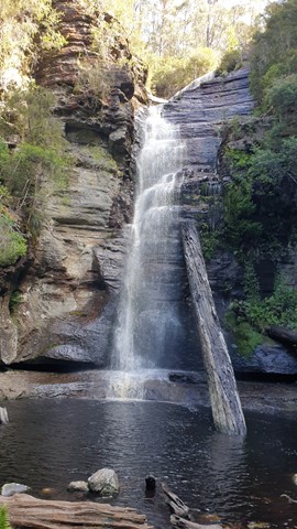
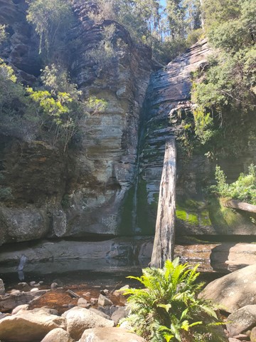
Snug Falls
One way walk there and back to see Snug Falls. Easy, well maintained trail. Start is at elevation 270m, Snug Falls at elevation 190m.
Access via Snug Falls Road (branching left from Snug Tiers Road), with the trailhead just up the hill slightly from the designated parking area.
 700
m
one-way
30
mins
700
m
one-way
30
mins
South Sister
A lookout that give 360 degree views north to St Helens and the Bay of Fires, west to Ben Lomond National Park and south to Bicheno and Freycinet National Park.
 1
km
return
20
mins
1
km
return
20
mins
The Gardens - Bay of Fires
Short circuit walk through a conservation area (sand dune, boulders, beach).
 2
km
return
2
hrs
2
km
return
2
hrs
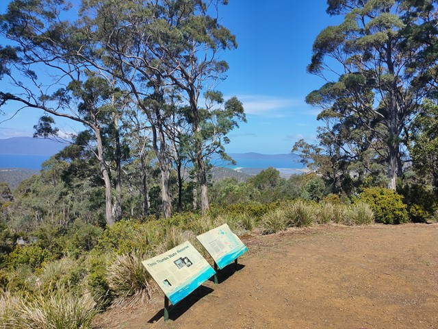
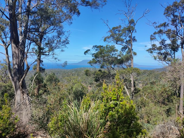
Three Thumbs
Walking up and down 3 “thumbs” hills. Rocky terrain in parts. Imagine it would be slippery in wet conditions.
 1.7
km
return
30
mins
1.7
km
return
30
mins
Whalers Lookout
An easy walk to an awesome couple of lookouts over Bicheno.
2.2
km
return
40
mins
Donaghys Hill
40 minutes return, 2.2km
Grade 2: Suitable for most ages. The track has a hardened or compacted surface that may have a gentle hill section or sections and occasional steps.
Supervise children, unprotected track edges. No fires allowed—this is a Fuel Stove Only Area.
A valid parks pass is required for entry to Tasmania's national parks.
Located on the Lyell Highway (A10) between the Franklin and Collingwood rivers.
You’ll want to take your camera on this wonderful walk. Apart from being a great leg stretch for those driving the Lyell Highway between Derwent Bridge and Queenstown, this walk offers superb wilderness views.
The 1.1km one-way track climbs gradually through forest and scrub to a high lookout perched on rocky Donaghys Hill. From there, in clear weather, you can look down into the Franklin River valley and out to the impressive Frenchmans Cap and its neighbouring peaks. Return via the same track.
 1
km
return
20
mins
1
km
return
20
mins
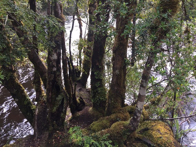
Franklin River Nature Trail
Walk through the rainforest, partly along the Franklin River. National Park pass required.
 23
km
one-way
4
days
23
km
one-way
4
days
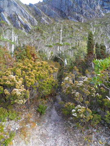
Frenchmans Cap
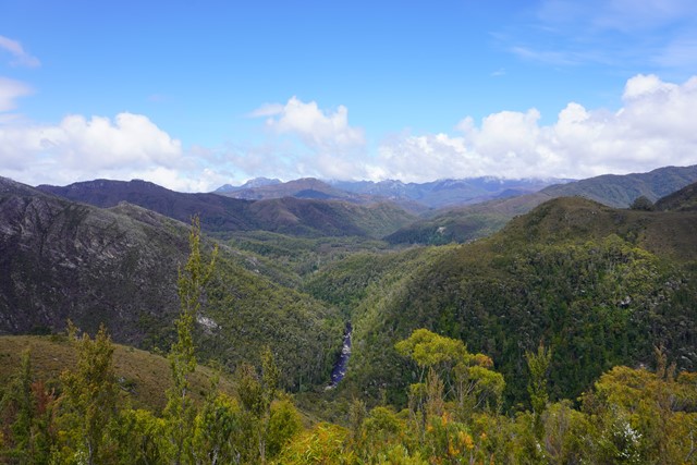
A brilliant walk through some characteristic Tasmanian wilderness. Well-defined, well-maintained tracks, as well as scrambling and cairns at the summit. Breathtaking views, a variety of ecosystems, and comfortable trail huts. Well worth the walk!
 500
m
return
30
mins
500
m
return
30
mins
Heritage Landing Forest Walk
A short walk most commonly accessed via Macquarie Harbour Cruises.
28
km
return
2
days
Lake Rhona (via Rasselas Track)
Lake Rhona is classified as a "hung lake" which is 900 meters above sea level and is the result of Ice Age Glaciers. This a hard 2 day 28km hike within the Wild Rivers National Park in the South West wilderness area of Tasmania. Situated in the midst of the Denison Ranges, the Lake’s beautiful pink/white quartzite sands surrounded by dominate ridges make it a truly unique Lake. The track follows flat button grass marshland for a majority of the way before a short hard climb of 400m to the final section below the Lake. This is your typical Tasmanian bush bashing walk. You will be muddy, scratched, bruised and weary at the end of each day. The track is exposed for most of the way.