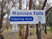
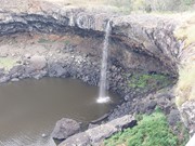
The Wannon Falls are a punchbowl waterfall located in the Southern Grampians and fed by the Wannon River that has its head waters in the Grampians mountains.
Waterfalls
Picnic Facilities
BBQ
Toilets
Dogs Permitted
Camping Permitted
Eucalypt Forest
136m
Maximum Elevation
12m
Total Climb
Getting there:
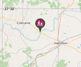
Head out of Hamilton north west on the Glenelg Highway (B160) and after about 19 kilometres as you approach Wannon take the sign posted road down (Camerons Road) on your left to the car park.
Maps:
Route/Trail notes:
From the car park wall straight down to the lookout.
There appears to be an option to walk around the top of the falls to the far side but that was not investigated.
Permits/Costs:
None.
Other References/Comments:
Nearby are the Nigretta Falls that are also worth a visit.


 446 Wannon Falls (GPX)
 276
276 15
15
Comments