
Menu
Popular Walks
-
Mt Ngungun
(1120 ticks) -
Mount Coolum
(849 ticks) -
Mt Cordeaux
(646 ticks) -
Twin Falls Circuit
(614 ticks) -
Purling Brook Falls Circuit
(593 ticks)
Summary
The Sunshine State
Queensland has a wealth of bushwalking opportunities including multiple World Heritage Listed rainforests such as the Daintree and Lamington National Park, great coastal and island parks like Fraser Island and Hinchinbrook Island.
Popular Walks
-
Mt Ngungun
(1120 ticks) -
Mount Coolum
(849 ticks) -
Mt Cordeaux
(646 ticks) -
Twin Falls Circuit
(614 ticks) -
Purling Brook Falls Circuit
(593 ticks)
Sub-Regions
Other Information
World Heritage Areas
- Fraser Island
- Gondwana Rainforests of Australia (Lamington NP, Springbrook NP, Mount Chinghee NP, Mount Barney NP, Main Range NP)
- Great Barrier Reef
- Riversleigh
- Wet Tropics (Daintree NP, Barron Gorge NP, Cedar Bay NP, Girringun NP, Wooroonooran NP)
Contact details
Queensland Parks and Forest:
https://parks.des.qld.gov.au/
Regions
The link below provides a region map of QLD as a reference to what council zones are included in the 7 geographic regions of QLD.
https://en.wikipedia.org/wiki/Regions_of_Queensland#/media/File:Qld-regions-map.gif
- Far North Queensland
- North Queesnland
- Central Queensland
- Mackay, Isaac and Whitsunday
- Wide Bay Burnett
- Darling Downs South West
- South East Queensland
Walks in Carnarvon National Park
(Central Queensland)
 200
m
return
200
m
return
 10
mins
10
mins
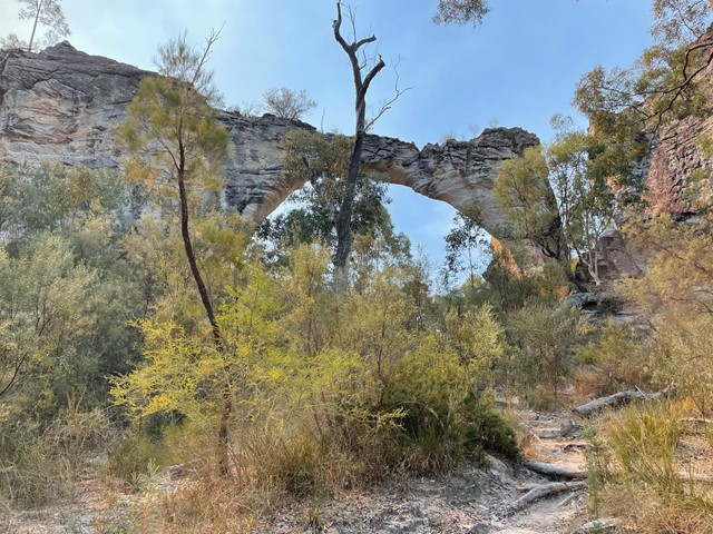
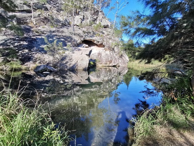
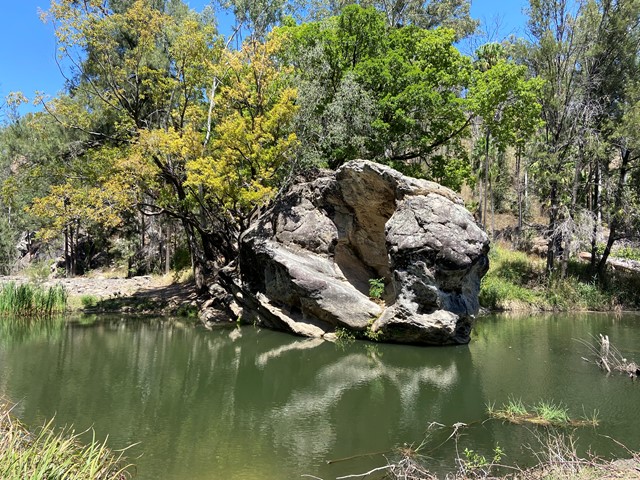
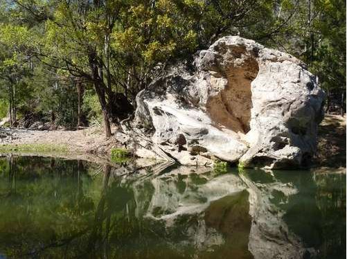
Marlong Arch Track
Discover a towering yet narrow natural archway, shaped over time by wind and water, and unique from every angle.
 80
m
return
5
mins
80
m
return
5
mins
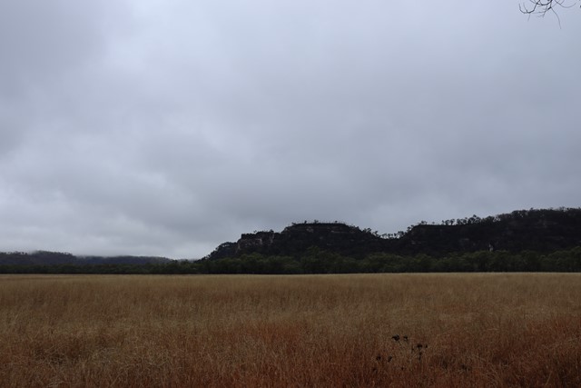
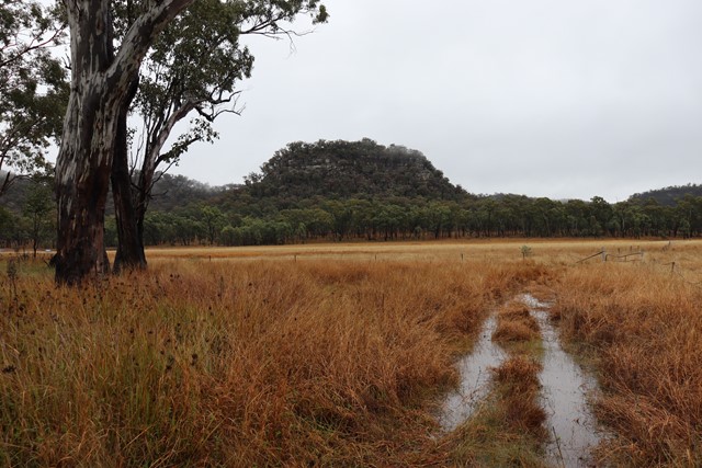
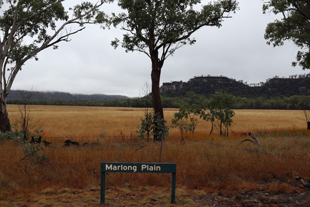
Marlong Plain
A stop on the Mount Moffatt Circuit Drive the natural grassland of Marlong Plain is especially lovely as the sun sets. You can walk down to the edge of the plain for views of distant sandstone cliffs and ridges.
 4.7
km
return
2
hrs
4.7
km
return
2
hrs
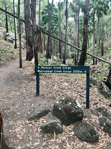
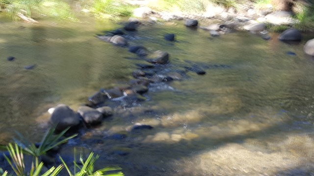
Mickey Creek
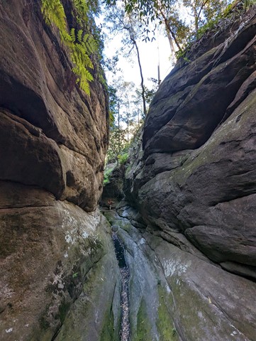
Wander along Mickey Creek and into narrow side gorges where the walking track becomes a rock-hopping adventure. Swamp wallabies are often seen resting here. Rocky sections of this track are slippery and caution is needed on creek crossings. The formed track ends 1.5km from the Mickey Creek car park.
 7.5
km
return
3
hrs
7.5
km
return
3
hrs
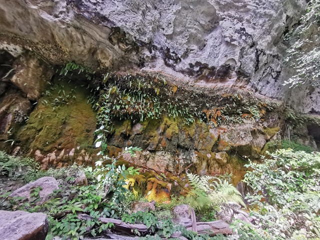
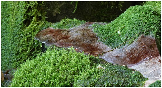
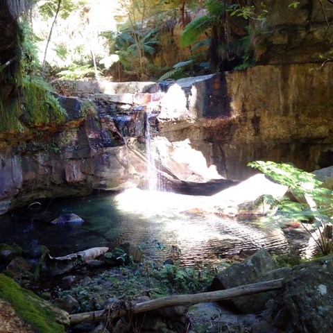
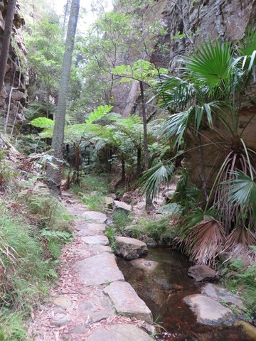
Moss Garden
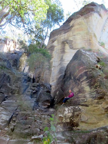
Water drips constantly from the sandstone walls of the Moss Garden, supporting a lush carpet of mosses, ferns and liverworts. Beneath tree ferns straining for sunlight, a small waterfall tumbles over a rock ledge into an icy pool.
 1.6
km
return
45
mins
1.6
km
return
45
mins
Nature Trail
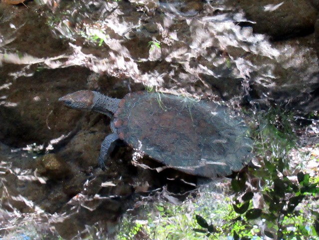
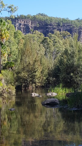
This short stroll along the shady banks of Carnarvon Creek provides a snapshot of the plant life on the gorge floor. You can see turtles basking in the sun, and if you're quiet enough you may see the elusive platypus. Dusk and dawn provide the best opportunities for watching wildlife.
 900
m
return
30
mins
900
m
return
30
mins
Rock Pool
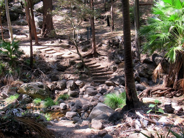
The Rock Pool has been carved from the bed of Carnarvon Creek by the turbulent water of past floods. Rest in the shade of fig and casuarina trees and watch for platypus and turtles. Stop at the first pool if you must but there is a much bigger and deeper second pool just downstream. The picnic area includes toilets but no longer has a gas barbecue. This is the only place in Carnarvon Gorge designated for swimming.
 8
km
4
hrs
8
km
4
hrs
Salvator Rosa
Spy glass peak and surrounding sandstone features make this walk very interesting for photography. The natural wall near the peak appears as if man made.
1
km
return
30
mins
Takarakka Lookout
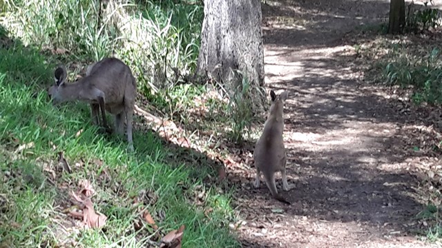
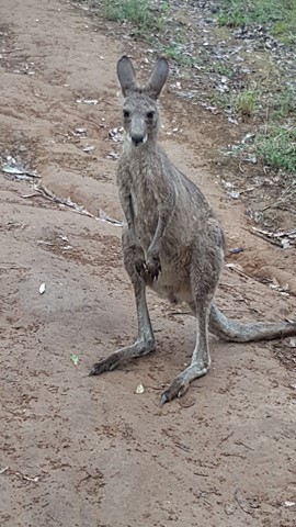
A great opportunity to climb to the lookout with views over to the entrance to Carnarvon Gorge some 4km away. Great place for a evening drink while watching the sun set in the distance. Don't be surprised to meet a few of the 'locals' on your way.
 1.4
km
return
30
mins
1.4
km
return
30
mins
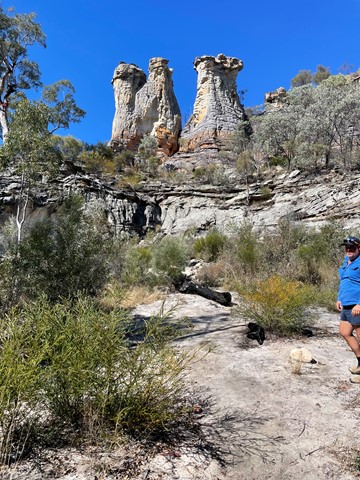
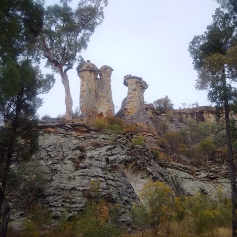
The Chimneys - Mt Moffat
Nice easy walk to some stunning sandstone rock features.
 4.2
km
return
1
hr
4.2
km
return
1
hr
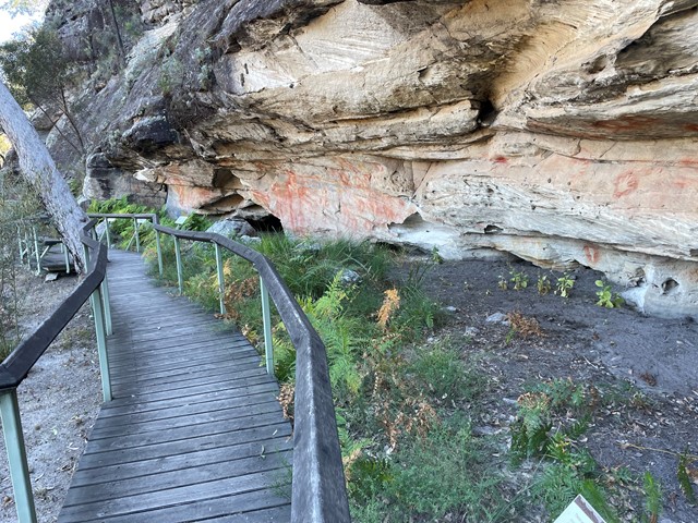
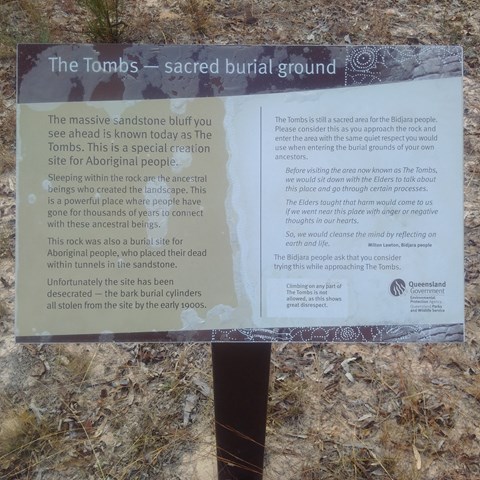
Tomb Art Site - Mt Moffat
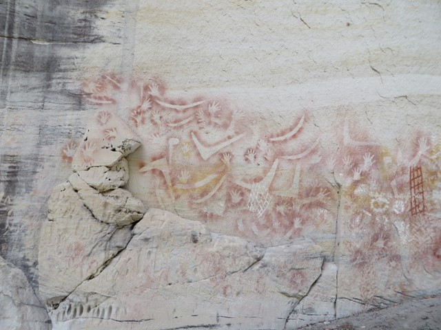
More than 400 stencilled motifs (images) decorate the walls of a sandstone shelter below the bluff of sandstone known as The Tombs. The Tombs once contained burial chambers for local Aboriginal people. Skeletons were wrapped and bound in bark burial cylinders. Sadly, by the end of the 20th century, the site had been robbed of this material, leaving little evidence of an elaborate mortuary culture. Take a close look at the rock art from a boardwalk with seats.