
Menu
Popular Walks
-
Mt Ngungun
(1120 ticks) -
Mount Coolum
(849 ticks) -
Mt Cordeaux
(646 ticks) -
Twin Falls Circuit
(614 ticks) -
Purling Brook Falls Circuit
(593 ticks)
Summary
The Sunshine State
Queensland has a wealth of bushwalking opportunities including multiple World Heritage Listed rainforests such as the Daintree and Lamington National Park, great coastal and island parks like Fraser Island and Hinchinbrook Island.
Popular Walks
-
Mt Ngungun
(1120 ticks) -
Mount Coolum
(849 ticks) -
Mt Cordeaux
(646 ticks) -
Twin Falls Circuit
(614 ticks) -
Purling Brook Falls Circuit
(593 ticks)
Sub-Regions
Other Information
World Heritage Areas
- Fraser Island
- Gondwana Rainforests of Australia (Lamington NP, Springbrook NP, Mount Chinghee NP, Mount Barney NP, Main Range NP)
- Great Barrier Reef
- Riversleigh
- Wet Tropics (Daintree NP, Barron Gorge NP, Cedar Bay NP, Girringun NP, Wooroonooran NP)
Contact details
Queensland Parks and Forest:
https://parks.des.qld.gov.au/
Regions
The link below provides a region map of QLD as a reference to what council zones are included in the 7 geographic regions of QLD.
https://en.wikipedia.org/wiki/Regions_of_Queensland#/media/File:Qld-regions-map.gif
- Far North Queensland
- North Queesnland
- Central Queensland
- Mackay, Isaac and Whitsunday
- Wide Bay Burnett
- Darling Downs South West
- South East Queensland
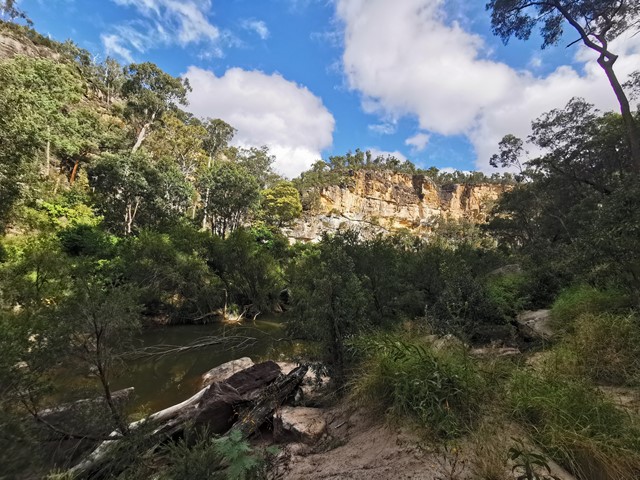
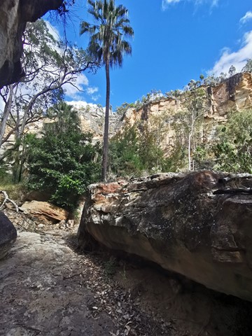
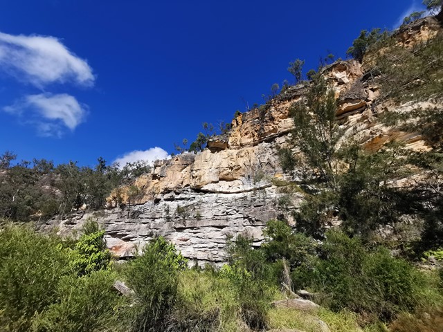
Walks in Carnarvon National Park
(Central Queensland)
 9.8
km
return
9.8
km
return
 4
hrs
4
hrs
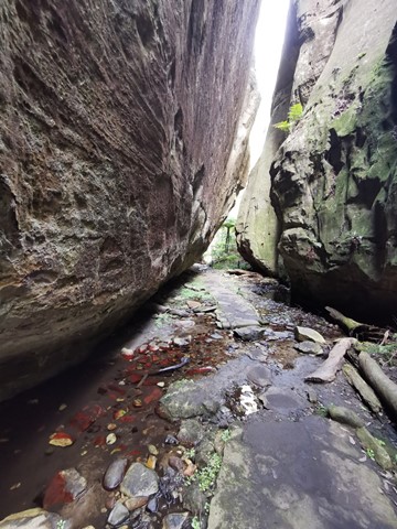
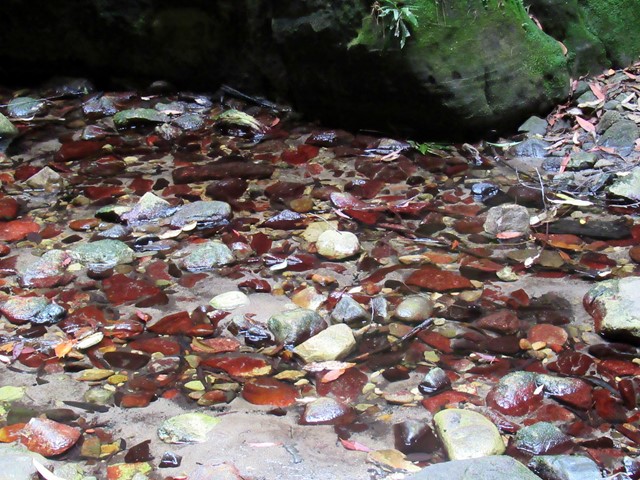
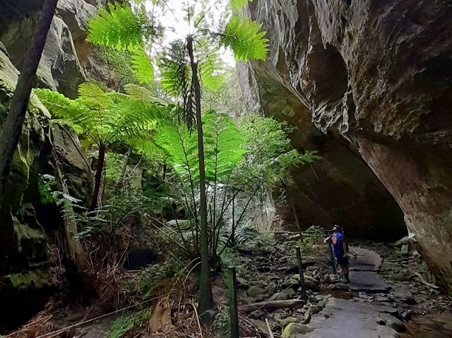
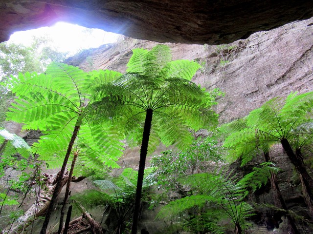
Wards Canyon
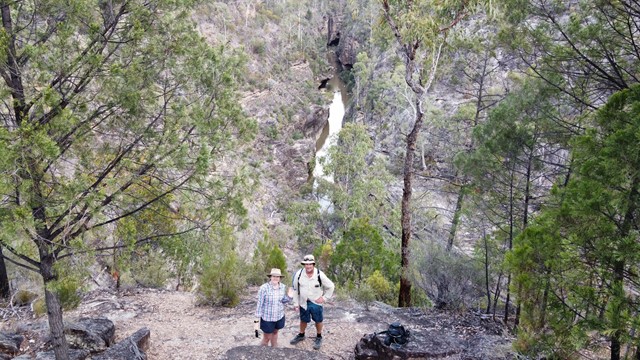
Ward's Canyon is a cool place to visit on a hot day. It is home to the world's largest fern; the King Fern Angiopteris evecta. These impressive green 'dinosaurs' have strong links with the ancient flora of Gondwanan origin. A short, steep rise up through spotted gums leads to the lower falls and then further into the shaded canyon.
 3.1
km
return
1
mins
3.1
km
return
1
mins
Warrumbah Creek
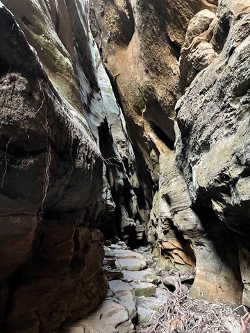
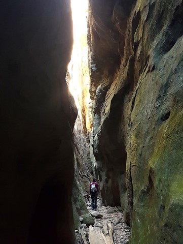
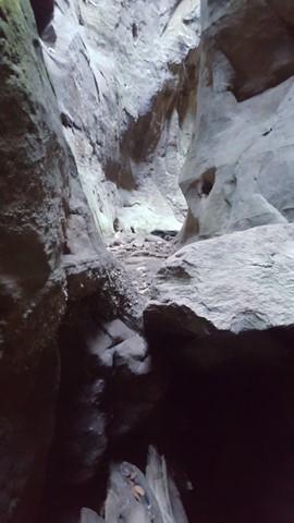
Similar to Mickey Creek, this is a scramble up the creek course, crisscrossing the creek and finding your own way around and over boulders, along ledges and through narrow crevices.
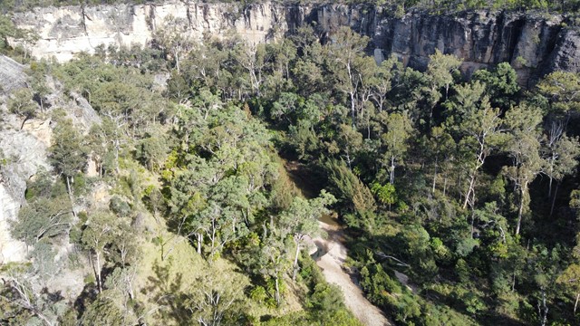
Walks in Expedition National Park
(Central Queensland) 800
m
30
mins
800
m
30
mins
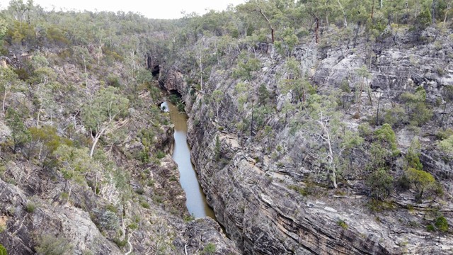
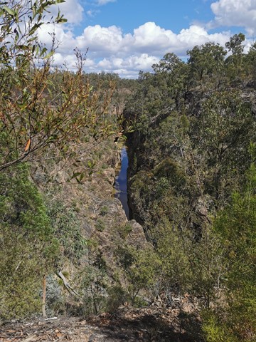
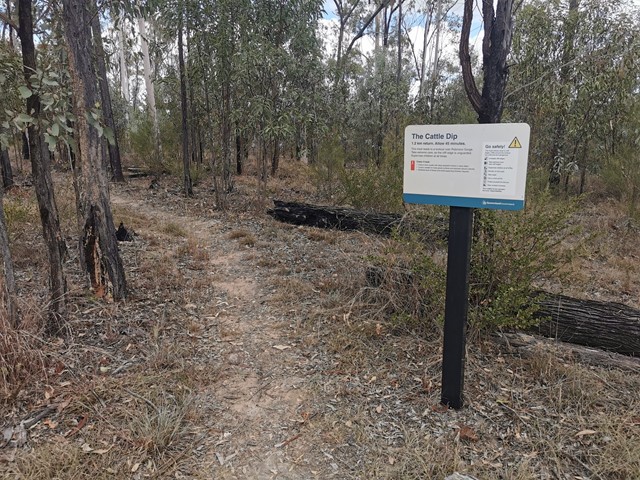
Cattle Dip Track
An easy walk through open woodland to look out over the "cattle dip" - a spectacular permanent, aptly named water hole in Robinson Gorge. No access from the lookout to the water hole without climbing gear.
 460
m
return
30
mins
460
m
return
30
mins
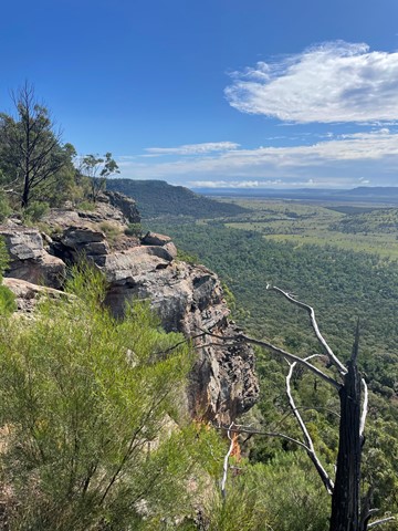
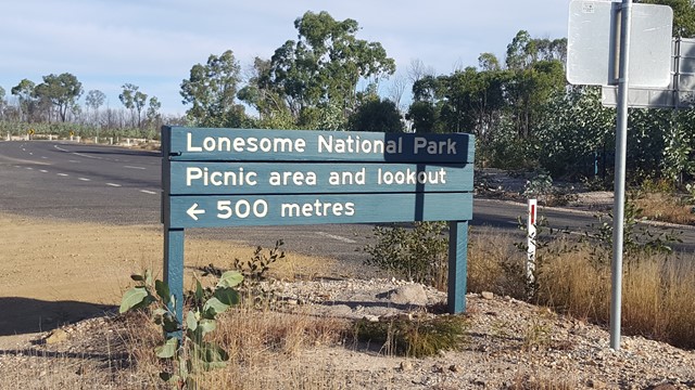
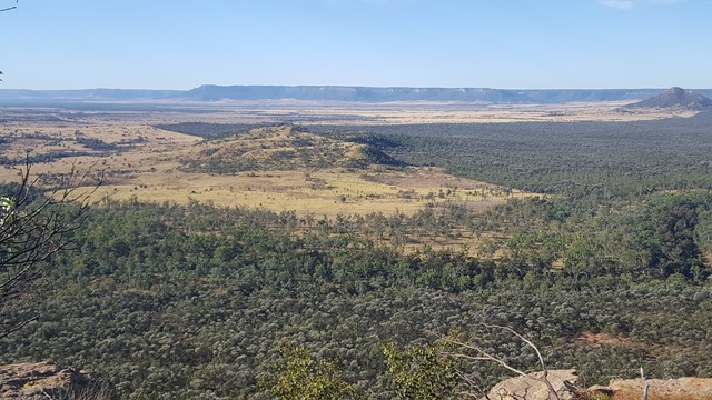
Lonesome Lookout
This high vantage point provides fantastic views up along the Arcadia Valley and across the Dawson River to the unreal Expedition National Park's sandstone escarpment: to Pyramid Hill, Sphinx, Castle Hill and Battleship.
 15
km
4
hrs
15
km
4
hrs
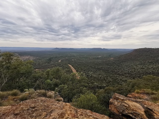
Lonesome Trail
Expedition National Park - Lonesome Section. Good views of Arcadia Valley to the north. Remote walk.
 4
km
return
90
mins
4
km
return
90
mins
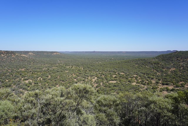
Robinson Gorge Access
This walk turns off just before the gorge lookout and takes you down to the floor of the gorge. This part of the walk is very steep but some helpful person has chiselled a few small steps into the rocks to make the descent easier. Once at the bottom you can spend as long as you like hiking in either direction up and the gorge.
 4
km
90
mins
4
km
90
mins
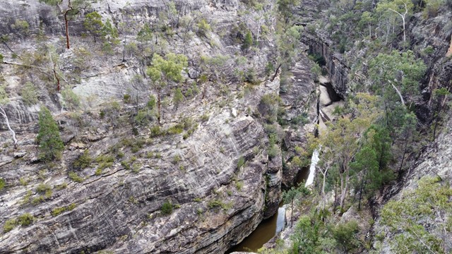
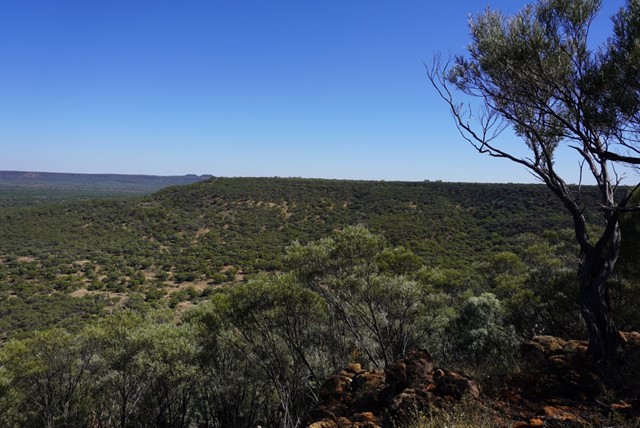
Robinson Gorge Lookout
An easy walk from Starkvale camping ground, through open woodland on a well-defined track to get views of the sheer sandstone cliffs of Robinson Gorge. Look down into the gorge from unfenced cliff edges - care is needed.
 3.6
km
2
hrs
3.6
km
2
hrs
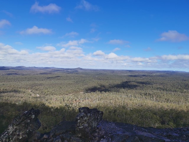
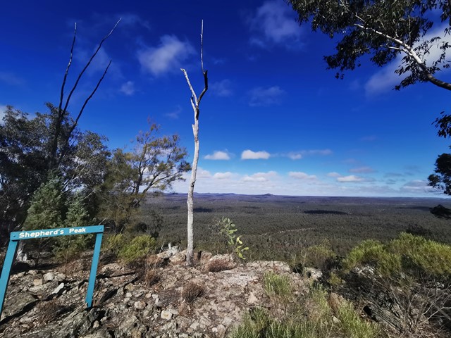
Shepherds Peak
This walk begins at Starkvale camping area and goes through open woodland with a well-defined trail. The first part of the walk is easy with a slight incline which changes once you get to the start of the climb up Shepherds Peak. Parts of this climb are very steep although there are some steps on the steeper parts but a fair level of fitness is required to get to the top. Care should be taken once at the top as the edges of the cliffs are unfenced. But the panoramic view of the gorge is breathtaking, especially early in the morning.
Walks in Idalia National Park
(Central Queensland)
2.7
km
return
90
mins
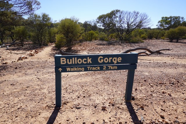
Bullock Gorge
Bullock Gorge walk—2.7km return (Allow 1–2hrs)
Grade 3
The start of Bullock Gorge walk is 14.7km north of the Monks Tank camping area. Rock markers define the walk along the Gowan Range’s ridge top through bendee shrubland. Take care here, as there are steep gorges on either side.
Look for small diggings of echidnas on the track. Watch the sun rise or set over spectacular gorges and look for yellow-footed rock-wallabies. While sitting, you have a wallaby’s eye view of the herbs they seek among the forest of trunks. Remember, bring a torch for sunset walks.
 4.4
km
3
hrs
4.4
km
3
hrs
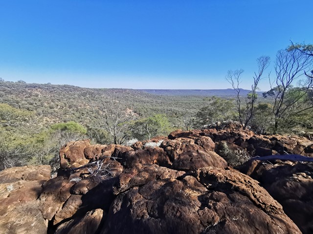
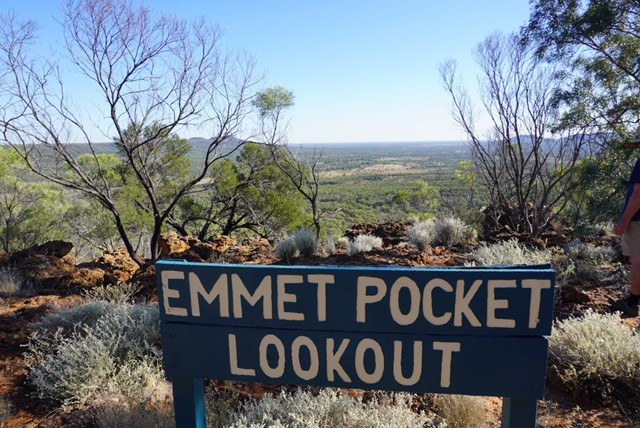
Emmet Pocket
Emmet Pock is in Idalia National park whick is 113kms south west of Blackall. This is a difficult walk with steep grades up and down the gorge walls but is well worth the effort. I found walking poles were worth there weight in gold. There are four walks to do while in this park all easier than this one.
Emmet Pocket walk—4.4km return (Allow 2–3hrs)
Grade 5
Beginning at Emmet Pocket lookout this steep meandering track leads into a gorge where the plains of the outback spread out before you—laid out like a map. Trees mark the waterways that stretch from rocks to river channels.