
Menu
Popular Walks
-
Mt Ngungun
(1121 ticks) -
Mount Coolum
(850 ticks) -
Mt Cordeaux
(646 ticks) -
Twin Falls Circuit
(614 ticks) -
Purling Brook Falls Circuit
(593 ticks)
Summary
The Sunshine State
Queensland has a wealth of bushwalking opportunities including multiple World Heritage Listed rainforests such as the Daintree and Lamington National Park, great coastal and island parks like Fraser Island and Hinchinbrook Island.
Popular Walks
-
Mt Ngungun
(1121 ticks) -
Mount Coolum
(850 ticks) -
Mt Cordeaux
(646 ticks) -
Twin Falls Circuit
(614 ticks) -
Purling Brook Falls Circuit
(593 ticks)
Sub-Regions
Other Information
World Heritage Areas
- Fraser Island
- Gondwana Rainforests of Australia (Lamington NP, Springbrook NP, Mount Chinghee NP, Mount Barney NP, Main Range NP)
- Great Barrier Reef
- Riversleigh
- Wet Tropics (Daintree NP, Barron Gorge NP, Cedar Bay NP, Girringun NP, Wooroonooran NP)
Contact details
Queensland Parks and Forest:
https://parks.des.qld.gov.au/
Regions
The link below provides a region map of QLD as a reference to what council zones are included in the 7 geographic regions of QLD.
https://en.wikipedia.org/wiki/Regions_of_Queensland#/media/File:Qld-regions-map.gif
- Far North Queensland
- North Queesnland
- Central Queensland
- Mackay, Isaac and Whitsunday
- Wide Bay Burnett
- Darling Downs South West
- South East Queensland
Walks in Fitzroy Island National Park
(Far North Queensland)
 4
km
return
4
km
return
 3
hrs
3
hrs
Summit Track
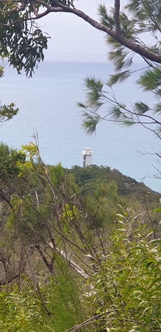
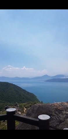
Track to the summit of Fitzroy Island with fantastic 360 degree views at the top. It’s a 3.6km return track (375m) and requires moderate level of fitness due to steepness. Track is located within Fitzroy Island National Park.
Walks in Wooroonooran National Park
(Far North Queensland) 19.5
km
one-way
19.5
km
one-way
Goldfield Trail
The Goldfield trail follows a 19 km historic path through the rainforest of Wooroonooran National Park. It crosses numerous picturesque creeks and climbs over a low saddle between Queensland’s two highest peaks, Bartle Frere and Bellenden Ker.
 1.6
km
return
1
hr
1.6
km
return
1
hr
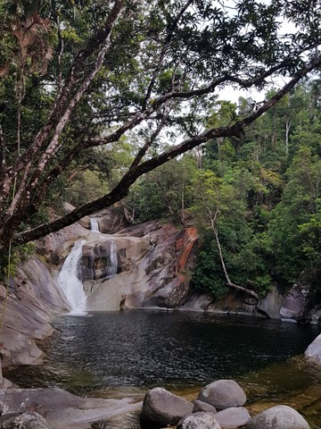
Josephine Falls
A short walk through Wooroonooran National Rainforest along a small creek that leads to the base of the Josephine Falls and a natural waterslide.
 3
km
return
90
mins
3
km
return
90
mins
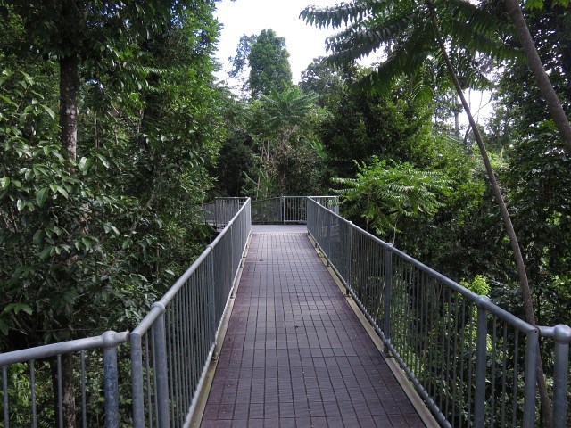
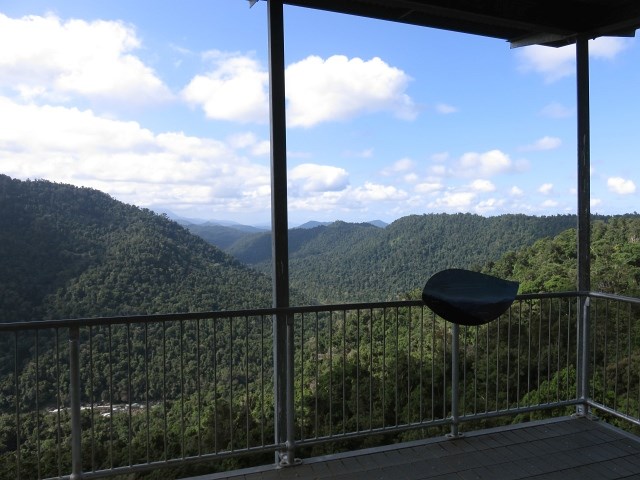
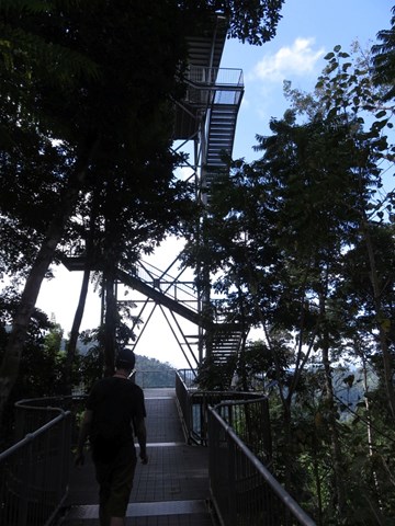
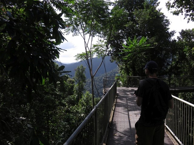
Mamu Tropical Skywalk
Take a walk in the clouds in Wooroonooran National Park just 15 minutes out of Innisfail. Elevated walkways, a cantilever, and observation tower offer visitors the exhilarating experience of being high in the rainforest canopy, along with providing spectacular panoramic views of World Heritage rainforest landscapes.
 15
km
return
12
hrs
15
km
return
12
hrs
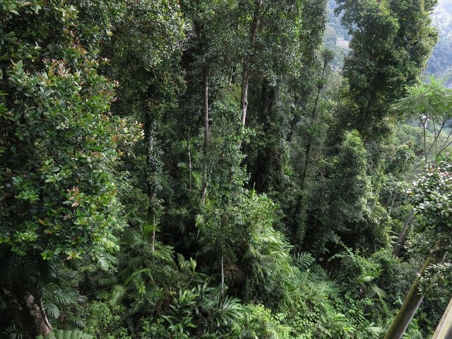
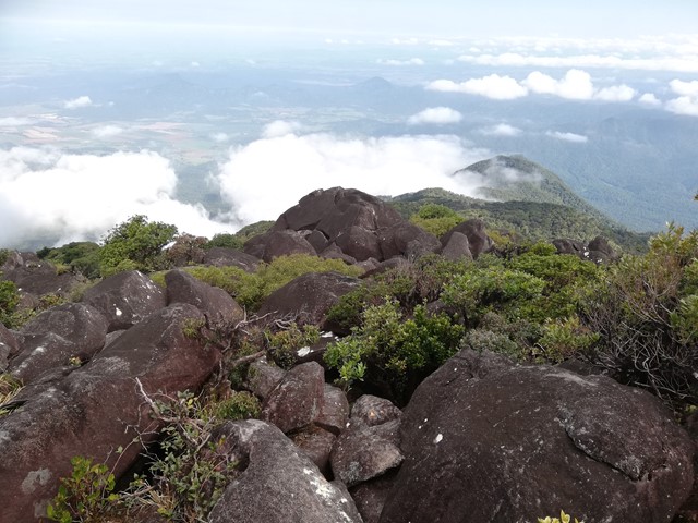
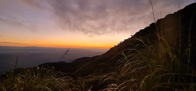
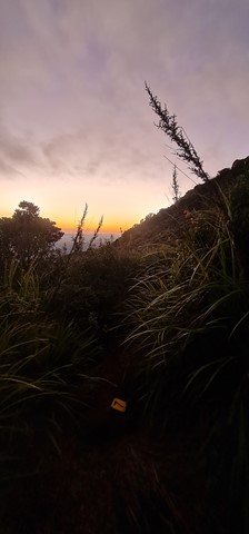
Mount Bartle Frere - Eastern Approach
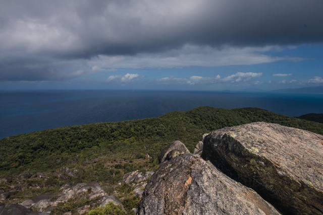
Mount Bartle Frere is Queensland's highest mountain. The eastern approach is a serious undertaking - after the Hannel Spur route up Mount Kosciuszko (1,800m elevation gain), it has the second most elevation gain of any summit in Australia (1,500m). Objective hazards include the boulder field below the summit which, due to the fact that orographic lifting means that the summit spends the majority of time in the cloud, is usually wet and slippery.
 16
km
return
12
hrs
16
km
return
12
hrs
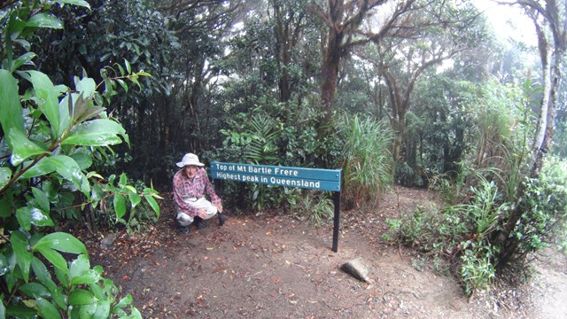
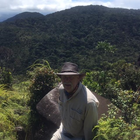
Mt Bartle Frere - Western Approach
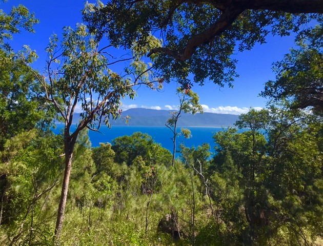
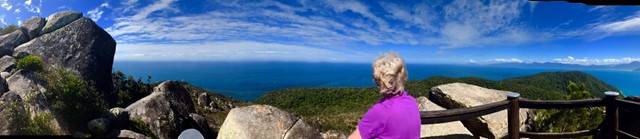
Climb to the summit of Queensland's highest mountain (1,622m) provides a challenging way to explore this part of the World Heritage-listed rainforest of the Bellenden Ker Range. This is not a race, so allow yourself two days to walk (recommended), climb and enjoy this trail. The fabulous summit views include the township of Innisfail and the coast to the east, and to the west, the undulating landscape of the Atherton Tableland.
 4.5
km
return
90
mins
4.5
km
return
90
mins
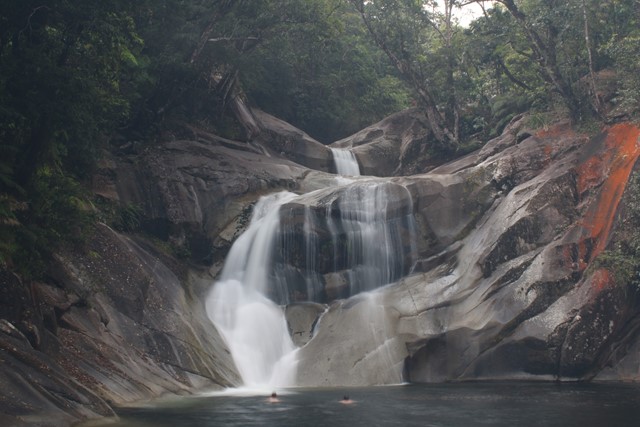
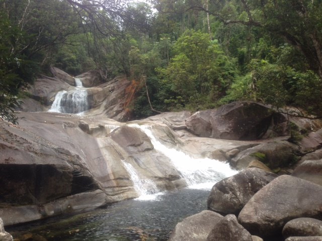
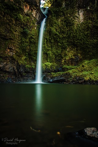
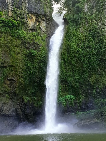
Nandroya Falls
Nandroya Falls is a spectacular 50m waterfall along Douglas Creek that drops from a basalt parapet. The walk takes you through thick jungle rainforest with lots to see and avoid.
 4
km
return
1
hr
4
km
return
1
hr
North Johnstone River Lookout
Along the Palmerston Highway this walk offers spectacular views of the North Johnstone River
 1.4
km
return
45
mins
1.4
km
return
45
mins
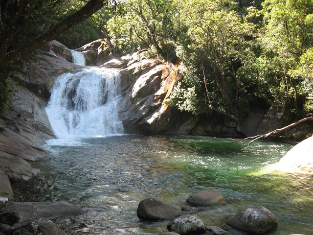
Tchupala Falls
Beautiful, short track through to Tchupala falls via rainforest.
 1.4
km
return
45
mins
1.4
km
return
45
mins
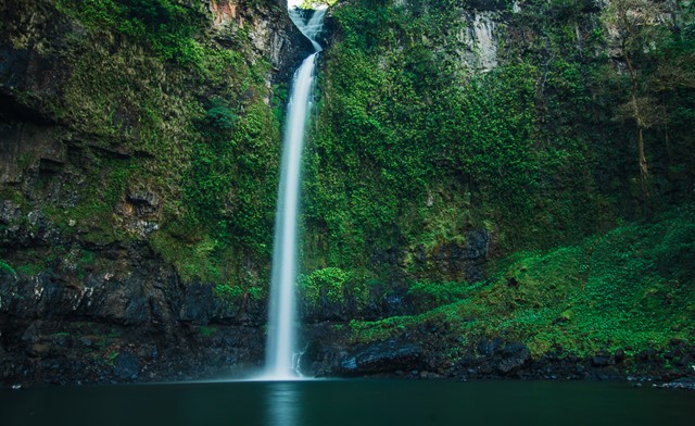
Wallicher Falls
Fantastic, short, easy walk to Wallicher Falls. Tchupala Falls is off the same track so do both while you're here.