Carnarvon Great Walk

Carnarvon National Park

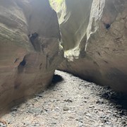
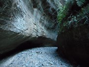
Walk the trails of the Carnarvon Great Wallk to experience a remote and beautiful landscape of towering sandstone cliffs, sweeping tablelands and shaded side-gorges.

The Carnarvon Great Walk links the Carnarvon Gorge and Mount Moffatt sections of Carnarvon National Park, an area of outstanding natural beauty and human history set within the highlands of the Central Queensland Sandstone Belt.

Lookouts
Picnic Facilities
Toilets
Scrambling or Climbing
Navigation Required
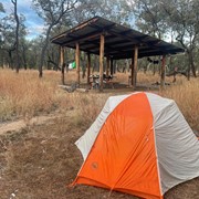
Camping Permitted
Arid or Desert
Eucalypt Forest
1198m
Maximum Elevation
2009m
Total Climb

Getting there

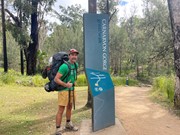
The walk starts at the Carnarvon Gorge Visitors Centre, about 246km north of Roma or 241km southeast of Emerald. From Roma, follow the Carnarvon about 160km north to the Gorge turnoff. From Emerald, head to Rolleston and then 61km to the Carnarvon turnoff.

Maps

https://parks.des.qld.gov.au/parks/carnarvon-great-walk/pdf/carnarvongw-topo.pdf

Route/Trail notes

The Walk consists of six sections.

R1 - Carnarvon Visitors Centre to Big Bend - 10km.  This section follows the main gorge walking track, where you'll walk with the day hikers.  There are several side tracks to Moss Garden, the Amphitheatre, Wards Canyon, the Art Gallery and Cathedral Cave.  

R2 - Big Bend to Gadd's Walkers camp - the DESI website lists this at 14.8 km, with a side track to the Battleship Spur Lookout (a must-do); you'll be looking at over 16 km.  The climb up is 600m, including a decent 60m scramble from Browinda Gorge up to the rest walk.

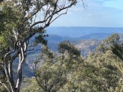
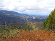
R3 - Gadd's to West Branch - 15.8km - the day starts with a steady climb up and old fire, where you'll be greeted with 360° views across the escarpment.  The day finishes off with a walk across open grasslands, finishing with a trek down the West Branch of the Maranoa River.

R4 - West Branch to Consuelo Tableland - 17.8km. The climbs on this section are far gentler. The walk up through the open country finishes in the tall woodland of the Consuelo Tableland as you cross from the west to the eastern side of the Great Dividing range, a highlight are tall trees through the Mahogany Forest.

R5 - Consuelo to Cabbage Tree - 13.8km. An easy walk along the Consuelo Tableland as walk through talk eucalypts and cycad underforest. 

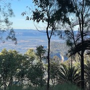
R6 - Cabbage Tree to Carnarvon Visitors Centre - 15.3km. Add the extra 1.4km to visit the Boolimba Bluff Lookout.  As you descend from the Consuelo Tableland, the forest changes again to a drier forest; about 1.5km in, you see the expansive views from the top of the tablelands and sandstone cliffs that seem to go on endlessly.  About 13km, you'll meet a well-maintained path and realise civilisation isn't far away. Perhaps some jubilation that you've made it, but perhaps some sadness that you adventure is over.


Permits/Costs

Camping Permits are required they cost $7.25/person/night (Sept 2024) bookings can be made here.

Other References

The DESI website provides excellent information.

Downloadable Maps can be found at the QTopo Website 

Comments

What a fantastic experience! The highlight for me was getting to the lookout at Battleship Spur and looking back down the length of the gorge.

It was hot weather, and we got into camp at 1-2 most days after taking a decent break in most mornings around the 10k mark. In cooler weather, you could easily walk a few sections in one go.

Sections 2&3 have some steep climbs, but the other days are mostly easy walking. West Branch has vehicle access so you do a lighter pack if someone was going to do a food drop for you at West Branch.

Craig on 30 Aug, 2024

Day one I started early and did all of the side tracks up to Big Bend... Moss Garden, Ampitheatre, Art Gallery, Cathedral (Wards Canyon was closed). Big Bend was all booked out so I pushed on towards Gadds. The hike up the Battleship Spur was really tough with my big 20kg backpack (I had a few moments where I had to stop and compose myself) and I was really tired but still had about 12 km to go.
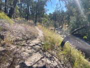
The hike into Gadds I got lost once. It's really important to follow the orange arrow markers but often you have your head down watching your step!
I just got to Gadds in time to set up camp before sundown and I was spent so a quick feed and off to sleep. There was noone else there.
Day 2 I was a little slow to get away and there was some big uphill climbs again but I got into West Branch at about 2.30pm and hung my clothes out to dry.
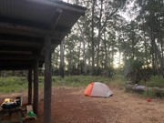
This is actually a proper campground that is accessible by car and there were a few groups there. The night was freezing. I don't know the exact temperature but I woke up about 2am shivering and there was frost on everything in the morning, the taps weren't working because they were frozen and the water left over in the pot I boiled for my coffee eventually froze solid. Cold.
I was sore and tired but got going to Consuelo and made good time so I kept going all the way to Cabbage Tree which is about 32km. The path from Consuelo to CT was poorly marked with the orange arrows at times... they go off into the bush weirdly but if you just stick to the main path you get to CT.
The final day is mostly downhill with some epic views along the way.
Pretty happy to make it back and my feet needed a rest!
A great walk but nowhere to swim in order to clean yourself so after 4 days I was pretty dirty!
To see a video of the hike on Youtube here's the link...
https://www.youtube.com/watch?v=yUxzKvYGn1Y

Hogey Bear on 21 Jun, 2024

Breathtaking, beautiful hiking!

WildflowerBell on 6 Jun, 2024

Amazing walk!

EchidnaScout on 7 Jul, 2021

A very rewarding walk. I've posted a full report of our experience here for anyone interested: https://www.davidbrewsterphotography.com/carnarvon-great-walk-2021

David Brewster on 12 Apr, 2021

Great walk. Very hard up Battleship spur with 17kg on ones back. Trail gets a little astray at times. Good map reading and attention to marker arrows essential.

Craig Buchan on 13 May, 2019

I loved this hike. I did it as a 4 day hike-I did section 1 on day 1, 2 on day 2 then sections 3 and 4 on day 3, sections 5 & 6 on day 4.

Definitely do the side Tracks the first day.

The climb up Battleship Spur on day 2 is challenging with a full pack. I'd think it would be brutal in hit weather-there isn't a lot of shade on much of the trail.

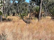
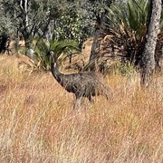
I saw emus and a lot of wild pigs.

The trail was very overgrown and hard to follow at times in the last section but it's otherwise very well defined.

sk on 13 Apr, 2015

Not a bad effort for a first attempt at a multi-day walk.

Very challenging, but remote, and very beautiful.

Thom on 6 Oct, 2012

Awesome walk, do the side trails on day 1

B_T on Sep, 2012

Where

Click here to load this map.

Nearby Walks

Done this walk?

This walk has been ticked 23 times

Aussie Bushwalking can keep track of your bushwalks.

Login/signup to tick this walk off.

Tick walks to keep track of where you've been. You must Login to tick walks. Accounts are 100% free so sign up if you don't have one.