
Menu
Popular Walks
-
Mt Ngungun
(1153 ticks) -
Mount Coolum
(871 ticks) -
Mt Cordeaux
(667 ticks) -
Twin Falls Circuit
(635 ticks) -
Purling Brook Falls Circuit
(611 ticks)
Parent Regions
Sub-Regions
- Amamoor State Forest
- Bellthorpe National Park
- Brisbane City Council Local Walks
- Brisbane Forest park D'Aguilar National Park
- Brisbane Valley Rail Trail
- Coombabah Lakelands Conservation Area
- Daisy Hill Conservation Park
- Eumundi Conservation Park
- Glass House Mountains National Park
- Glen Rock Regional Park
- Gold Coast
- Ipswich
- Jimna State Forest
- Karawatha Forest
- Kondalilla National Park
- Lamington National Park
- Main Range National Park
- Mapleton National Park
- Moggill Conservation Park
- Moogerah Peaks National Park
- Moreton Island National Park
- Mt Barney National Park
- North Stradbroke Island - Minjeeribah
- Parklands Conservation Park
- Springbrook National Park
- Sunshine Coast
- Tamborine National Park
- White Rock - Spring Mountain Conservation Estate
Summary
Boarding NSW and the pacific Ocean, it is not uncommon for hikes to have views of both worlds (ocean and hinterland). Hikes here are typically on the great dividing range.
Popular Walks
-
Mt Ngungun
(1153 ticks) -
Mount Coolum
(871 ticks) -
Mt Cordeaux
(667 ticks) -
Twin Falls Circuit
(635 ticks) -
Purling Brook Falls Circuit
(611 ticks)
Parent Regions
Sub-Regions
- Amamoor State Forest
- Bellthorpe National Park
- Brisbane City Council Local Walks
- Brisbane Forest park D'Aguilar National Park
- Brisbane Valley Rail Trail
- Coombabah Lakelands Conservation Area
- Daisy Hill Conservation Park
- Eumundi Conservation Park
- Glass House Mountains National Park
- Glen Rock Regional Park
- Gold Coast
- Ipswich
- Jimna State Forest
- Karawatha Forest
- Kondalilla National Park
- Lamington National Park
- Main Range National Park
- Mapleton National Park
- Moggill Conservation Park
- Moogerah Peaks National Park
- Moreton Island National Park
- Mt Barney National Park
- North Stradbroke Island - Minjeeribah
- Parklands Conservation Park
- Springbrook National Park
- Sunshine Coast
- Tamborine National Park
- White Rock - Spring Mountain Conservation Estate
History
Any interesting history for the region?
Features
What are the standout bushwalking features?
Access
How do you get there? Include all access points if there are many?
Maps
Which maps cover the region?
Accommodation
Where can I stay there? or near there?
Camping
Council Areas:
- Scenic Rim Regional
- Gold Coast City
- Logan City
- Redland City
- Ipswich City
- Lockyer Valley Regional
- Brisbane City
- Somerset Regional
- Moreton Bay Regional
- Sunshine Coast Regional
- Noosa Shire
Contact details
See Qld National parks website
Walks in South East Queensland

 100
m
return
100
m
return
 10
mins
10
mins
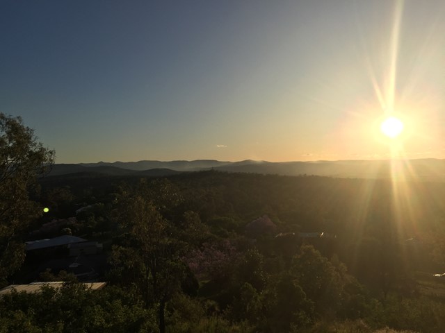
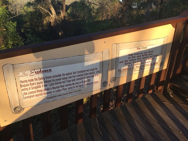
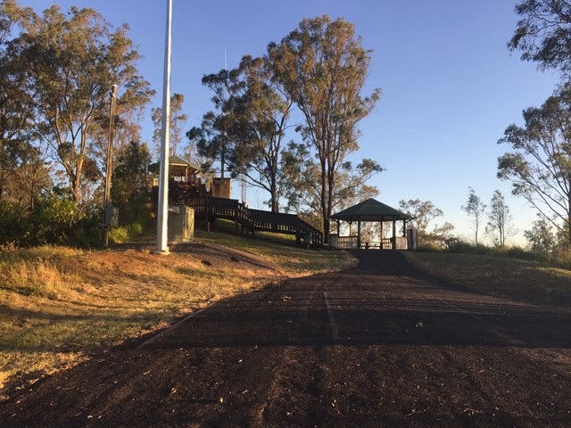
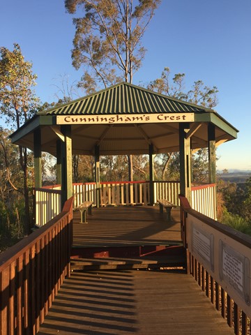
Cunningham's Crest Lookout
A short boardwalk with interpretive signage leads to the lookout which sits atop the Little Liverpool Range.
 4.2
km
return
90
mins
4.2
km
return
90
mins
Davis Hill
A short walk which climbs gradually along fire trail to the summit of Davis Hill (298m). Views from the summit are limited, and there is a communications mast at the top.
 3.6
km
return
90
mins
3.6
km
return
90
mins
Deer Reserve SF - T1
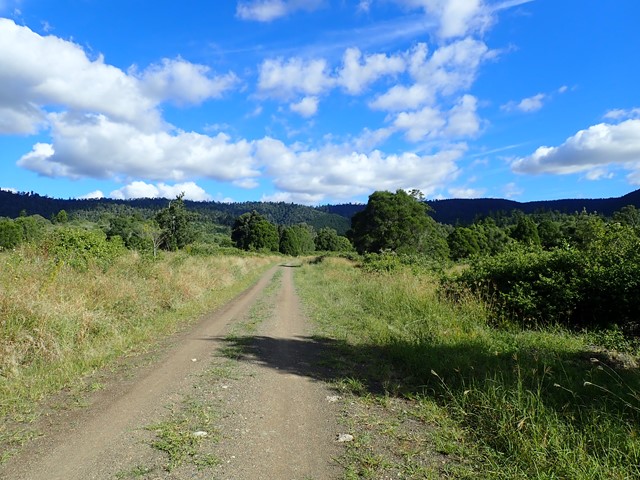
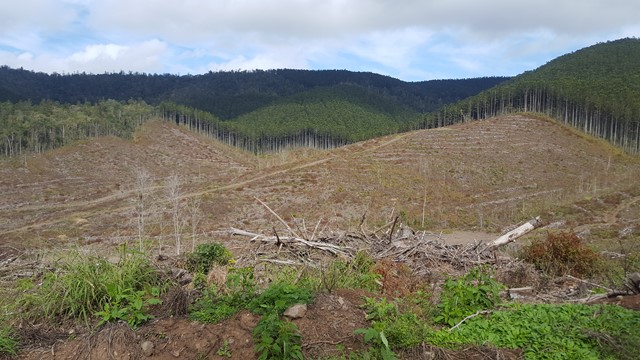
The northern half of Deer Reserve is a State Forest, containing native forest and hoop-pine plantations on steep mountainous slopes. It’s crisscrossed by management trails, which is perfect for hiking and mountain biking, provided you don’t mind hills.
 2.5
km
return
1
hr
2.5
km
return
1
hr
Denham Falls walk
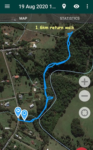
This walk leads to a viewpoint above Lip Falls and the swimming hole below it in the Denham Scenic Reserve. Originally, now closed, one hour return walk through rainforest down to the Denham Falls and then to Lip Falls.
No longer can you get down to the falls but it’s still a nice easy walk.
Better to call it "Denham waterfall" walk.
 2.5
km
return
30
mins
2.5
km
return
30
mins
Eddie Kornhauser Recreational Reserve
Flood plain parklands with dog off leash area, tidal water ponds and access from different neighborhoods. Network of concrete pathways.
 3.8
km
return
90
mins
3.8
km
return
90
mins
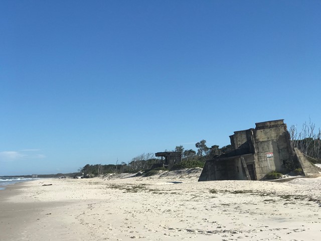
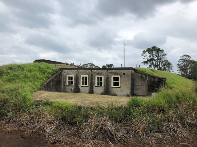
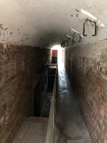
Fort Bribie Walk
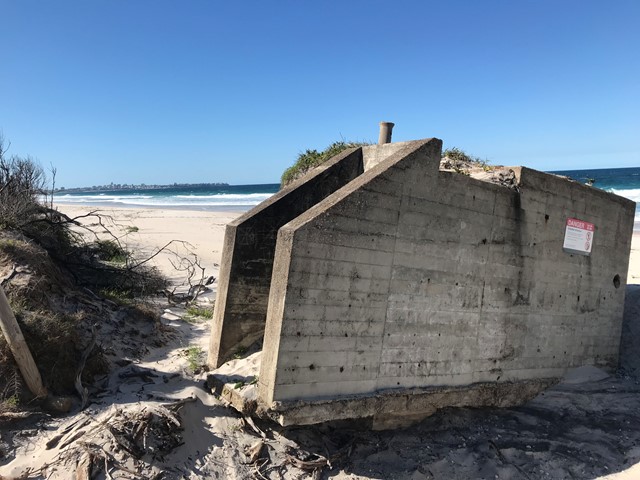
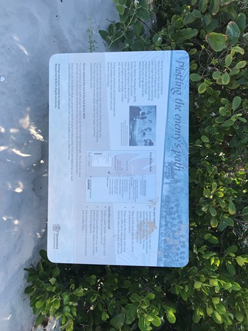
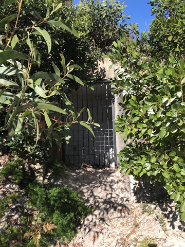
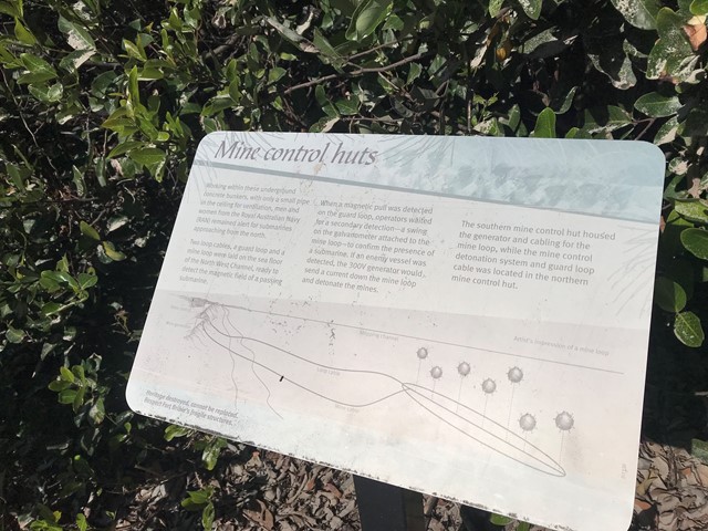
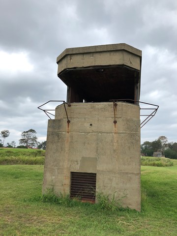
Take a self-guided walk through the remnants of heritage-listed Fort Bribie. See gun emplacements, mine control huts, army field camp foundations and searchlight buildings. Signs along the walk give an insight into Fort Bribie and the men and women who served here from 1941 to 1945. Track markers on the beach help to locate the walk's access points.
Bring mosquito repellent the bugs here are notoriously plentiful.
 1.5
km
return
1
hr
1.5
km
return
1
hr
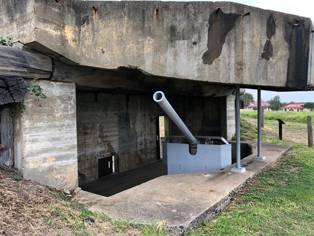
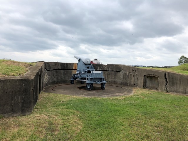
Fort Lytton
Fort Lytton is a fortress located on the southern banks of the Brisbane River, Fort Lytton National Park is the perfect place to discover a unique part of Brisbane’s past.
Only open on Sundays.
 1.8
km
return
35
mins
1.8
km
return
35
mins
Freeman's Lookout Track
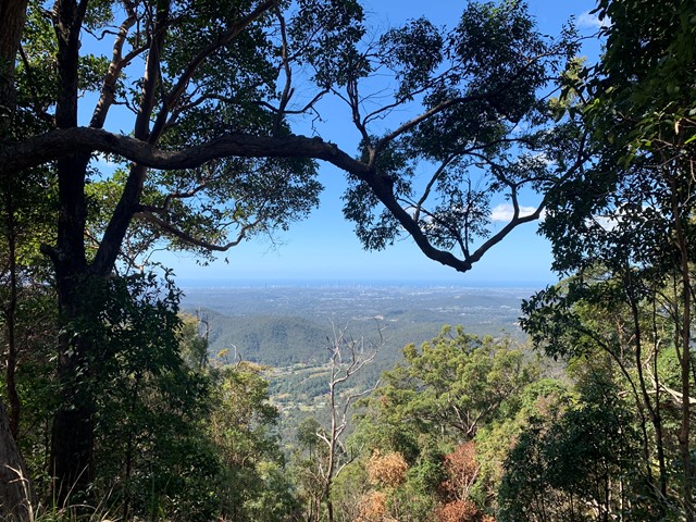
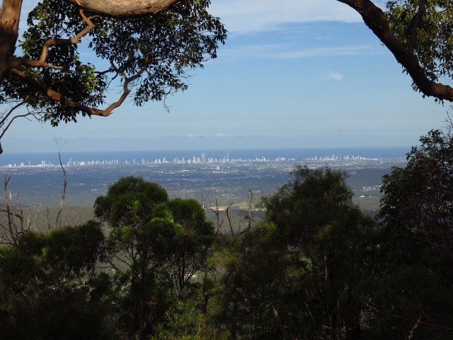
Access to Lower Beechmont Conservation Area from Freemans Rd, Lower Beechmont. Panoramic view out over the Gold Coast, north to Mt Tamborine and west to Canungra.
 3.1
km
return
45
mins
3.1
km
return
45
mins
Freshwater Xanthorroea Circuit
A short circuit walk in Freshwater National Park where many xanthorrhoea (grass trees) are on display.