
Menu
Popular Walks
-
Mt Ngungun
(1121 ticks) -
Mount Coolum
(850 ticks) -
Mt Cordeaux
(646 ticks) -
Twin Falls Circuit
(614 ticks) -
Purling Brook Falls Circuit
(593 ticks)
Parent Regions
Sub-Regions
- Amamoor State Forest
- Bellthorpe National Park
- Brisbane City Council Local Walks
- Brisbane Forest park D'Aguilar National Park
- Brisbane Valley Rail Trail
- Coombabah Lakelands Conservation Area
- Daisy Hill Conservation Park
- Eumundi Conservation Park
- Glass House Mountains National Park
- Glen Rock Regional Park
- Gold Coast
- Ipswich
- Jimna State Forest
- Karawatha Forest
- Kondalilla National Park
- Lamington National Park
- Main Range National Park
- Mapleton National Park
- Moggill Conservation Park
- Moogerah Peaks National Park
- Moreton Island National Park
- Mt Barney National Park
- North Stradbroke Island - Minjeeribah
- Parklands Conservation Park
- Springbrook National Park
- Sunshine Coast
- Tamborine National Park
- White Rock - Spring Mountain Conservation Estate
Summary
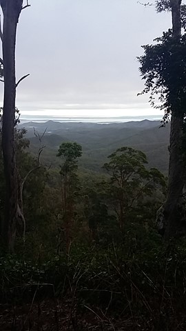
Boarding NSW and the pacific Ocean, it is not uncommon for hikes to have views of both worlds (ocean and hinterland). Hikes here are typically on the great dividing range.
Popular Walks
-
Mt Ngungun
(1121 ticks) -
Mount Coolum
(850 ticks) -
Mt Cordeaux
(646 ticks) -
Twin Falls Circuit
(614 ticks) -
Purling Brook Falls Circuit
(593 ticks)
Parent Regions
Sub-Regions
- Amamoor State Forest
- Bellthorpe National Park
- Brisbane City Council Local Walks
- Brisbane Forest park D'Aguilar National Park
- Brisbane Valley Rail Trail
- Coombabah Lakelands Conservation Area
- Daisy Hill Conservation Park
- Eumundi Conservation Park
- Glass House Mountains National Park
- Glen Rock Regional Park
- Gold Coast
- Ipswich
- Jimna State Forest
- Karawatha Forest
- Kondalilla National Park
- Lamington National Park
- Main Range National Park
- Mapleton National Park
- Moggill Conservation Park
- Moogerah Peaks National Park
- Moreton Island National Park
- Mt Barney National Park
- North Stradbroke Island - Minjeeribah
- Parklands Conservation Park
- Springbrook National Park
- Sunshine Coast
- Tamborine National Park
- White Rock - Spring Mountain Conservation Estate
History
Any interesting history for the region?
Features
What are the standout bushwalking features?
Access
How do you get there? Include all access points if there are many?
Maps
Which maps cover the region?
Accommodation
Where can I stay there? or near there?
Camping
Council Areas:
- Scenic Rim Regional
- Gold Coast City
- Logan City
- Redland City
- Ipswich City
- Lockyer Valley Regional
- Brisbane City
- Somerset Regional
- Moreton Bay Regional
- Sunshine Coast Regional
- Noosa Shire
Contact details
See Qld National parks website

 10
km
return
10
km
return
 3
hrs
3
hrs
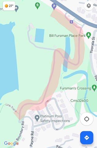
Enoggera Reservoir Circuit
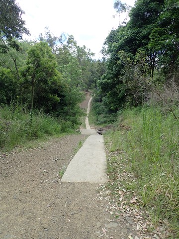
This is a great walk through mostly canopied forest that skirts around Enoggera Reservoir. There are some quite steep hills which will be a challenge if you are not very fit, but most of the walk is easy. Glimpses of the reservoir, lots of beautiful trees, the odd encounter with wildlife make for a very enjoyable couple of hours.
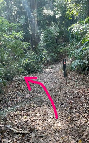
It is best to call into the Information Centre at Walk About Creek before starting this walk as they have detailed instructions on navigating the bit of suburb walking required to complete the circuit. It's also useful to have the topographical map as the hike isn't on marked trails - it would be difficult to get lost - but it's possible! If you are doing a circuit then just keep taking Left hand turns if going anti clockwise! After reaching the dam wall keep on the left until you reach the transport hub (The Gap), The parking area has an exit that leads to the Walkabout Creek area with proper walkways.
 4
km
return
90
mins
4
km
return
90
mins
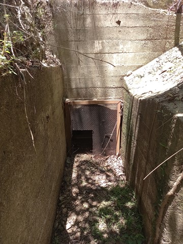
Enoggera Reservoir Tunnel
A short but rewarding walk to a piece of Brisbane's history. Built in 1928, along with an open viaduct, this tunnel moved water from Gold Creek Reservoir to Enoggera Reservoir. See https://historyoutthere.com/2018/09/23/the-secret-tunnel-to-australias-past/ for history.
 14
km
return
4
hrs
14
km
return
4
hrs
Holmans break
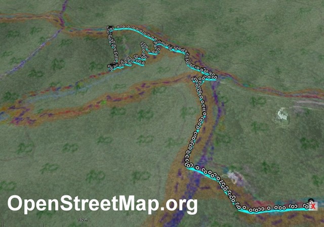
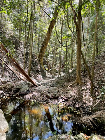
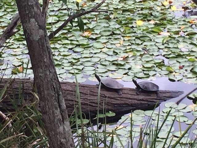
This is a beautiful walk around a large section of the bushland in which Enoggera Reservoir sits. You will walk through lots of varied vegetation, keep an eye out for goannas, lots of different birds and turtles sunning themselves on a log in the dam. A great way to spend 4 hours! I do recommend that you have a map - you can purchase the topographical map from Walkabout Creek.
Start out from the bottom carpark at Walkabout Creek, take the small track to the far right that follows Mt Nebo road. There is a very steep hill right in front of you! Follow this track for about 2 km, (turn around every now & again and you will catch glimpses of The Brisbane City skyline), The track will split - stay on the track that is to the right, still following Mt Nebo road, which is also on your right (you can't really see the road) for about another 1km. You will come to a bit of a clearing under the power lines - turn around and enjoy the view out over The Gap!
There are great views of Mt Cootha on your left and the mountain range in the distance (that I don't know the name of!). There is quite a steep descent down to a beautiful creek - take some time to enjoy a rest here as there is a VERY steep ascent ahead of you! It's probably about a 600 metre climb, which will bring you out under another power tower. Look over to the next tower - that is where you are heading! Continue along the trail for about another 1 km and you will come to a T junction, stay left for another couple hundred metres to another junction - go left again onto Fire Break 69. Don't forget to look over to your left when you reach the power tower and see how far you have come! Continue down Fire Break 69 until you reach another junction - this is McDonalds Loop. We went to the left and followed it down to the end where it hooks up to the Enoggera Reservoir loop - again we went left and followed the trail back along the reservoir to Walkabout Creek.
 17
km
5
hrs
17
km
5
hrs
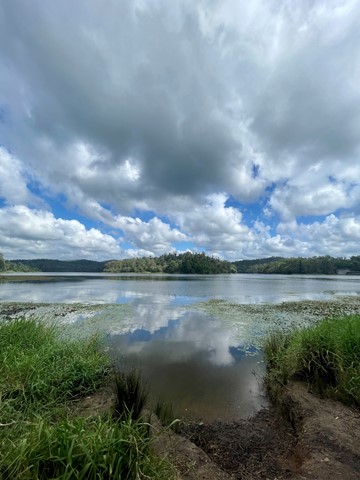
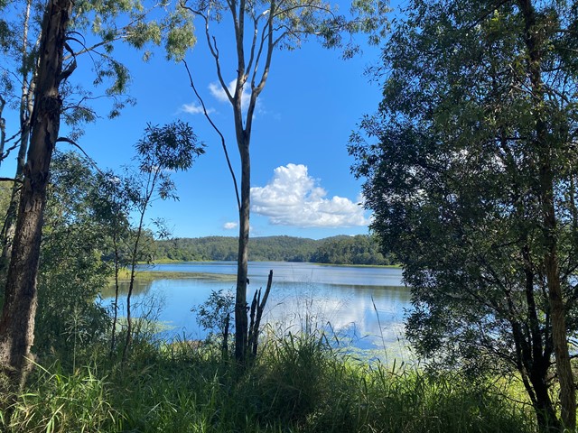
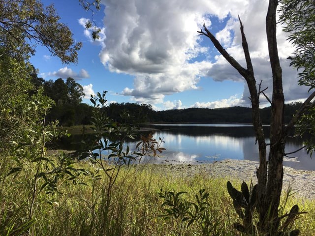
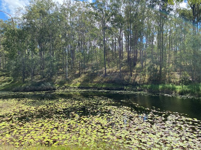
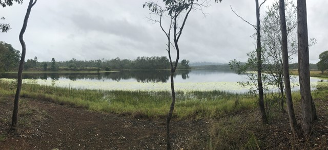
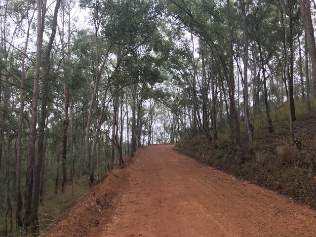
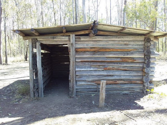
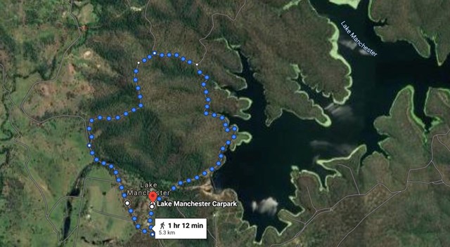
Lake Manchester loop
Starting and ending at the day use area, this is a clockwise loop in the hills around Lake Manchester through a conservation park adjacent to the D'Aguilar Range National Park (Brisbane Forest Park section).
 5.3
km
one-way
90
mins
5.3
km
one-way
90
mins
Lake Manchester Short Loop
A shorter way to see some of Lake Manchester without having to double back.
 15.4
km
one-way
4
hrs
15.4
km
one-way
4
hrs
Mt Glorious to Dundas Road
This is a fantastic walk which is actually the first leg of the annual Oxfam Walk. You do need two cars for this walk - park one car at Mt Nebo Road transfer station, Dundas Road and another at Miala picnic Grounds, Mt Glorious. We started from Miala and enjoyed spectacular views out towards Lockyear Valley before we gently wound our way down to the bottom of the valley. Make sure you enjoy a rest at the creek because ahead of you is a VERY steep walk out of the valley. This is the steepest hill I have ever walked and the trail was very slippery - it was actually easier to walk beside the trail, then we could use the trees to hold onto! The hill goes on FOREVER, but when you eventually reach the top you will have a real sense of achievement - and more sensational views!
More detailed information about this walk can b e found here: https://trailwalker.oxfam.org.au/wp-content/uploads/2014/12/BNE_map1.pdf
 1
km
return
30
mins
1
km
return
30
mins
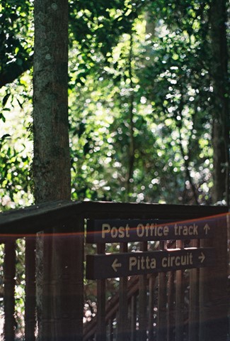
Pitta Circuit
Lovely walk through a Eucalyptus forest before entering a lovely cool rainforest. The track winds around onto a boardwalk which totally surrounds a strangler fig where the host has totally rotted away. A number of educational signs give some great information for the younger members of the family.
 6
km
3
hrs
6
km
3
hrs
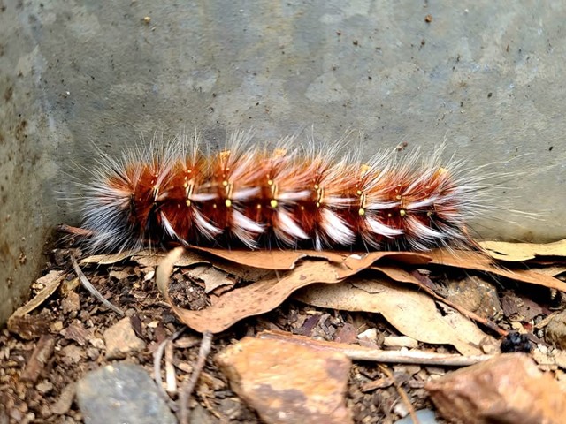
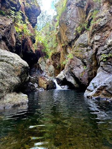
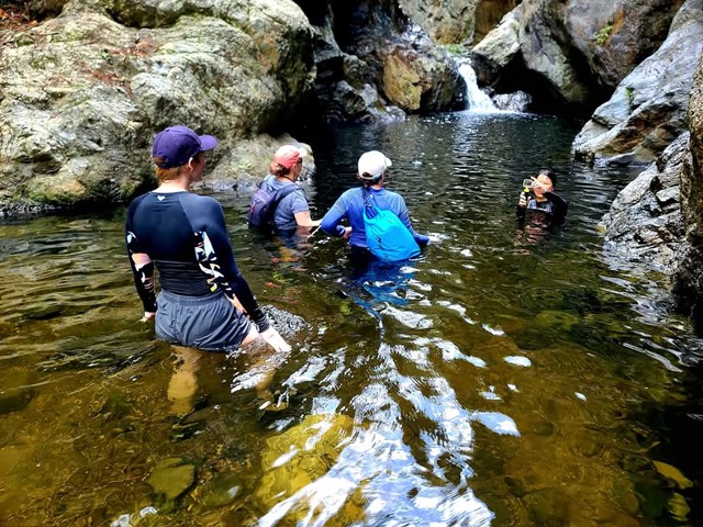
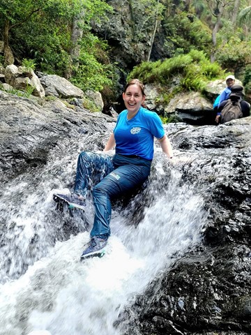
The Northbrook River Trail (Northbrook Gorges)
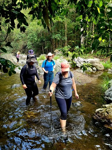
Northbrook Gorge walking and swimming. Beautiful scenery and vegetation. Make sure you pick a nice warm day and bring sturdy shoes your are willing to get wet. the gorges at the end are "gorge-ous", first one you can wade (keep right), second one you definetely in for a swim if you want to cross it.
Walks in Brisbane Valley Rail Trail
18
km
one-way
Benarkin to Linville- Part of BVRT
The Benarkin to Linville section is 18km, downhill. The only inclines are crossings of Blackbutt Creek. Initially the walk is through gum forest, with stands of hoop pine and stands of silky oak. Then it opens up and runs through farm land for the last 4 or 5 km. There are plenty of birds, notably many brown doves, and flocks of quail. There is a bellbird colony near 130 kilometric mark. Blackbutt is a pretty creek if running. There is a bit of rainforest on the banks. Historical railway spots and information are signed and very interesting. Surface is good - no slippery bits. There are three shelters along the way. MacNamara's Camp. about half way, has a toilet and water tank. Take your own water. And maybe insect repellent.