
Menu
Popular Walks
-
Mt Ngungun
(1117 ticks) -
Mount Coolum
(849 ticks) -
Mt Cordeaux
(646 ticks) -
Twin Falls Circuit
(614 ticks) -
Purling Brook Falls Circuit
(592 ticks)
Parent Regions
Sub-Regions
- Amamoor State Forest
- Bellthorpe National Park
- Brisbane City Council Local Walks
- Brisbane Forest park D'Aguilar National Park
- Brisbane Valley Rail Trail
- Coombabah Lakelands Conservation Area
- Daisy Hill Conservation Park
- Eumundi Conservation Park
- Glass House Mountains National Park
- Glen Rock Regional Park
- Gold Coast
- Ipswich
- Jimna State Forest
- Karawatha Forest
- Kondalilla National Park
- Lamington National Park
- Main Range National Park
- Mapleton National Park
- Moggill Conservation Park
- Moogerah Peaks National Park
- Moreton Island National Park
- Mt Barney National Park
- North Stradbroke Island - Minjeeribah
- Parklands Conservation Park
- Springbrook National Park
- Sunshine Coast
- Tamborine National Park
- White Rock - Spring Mountain Conservation Estate
Summary
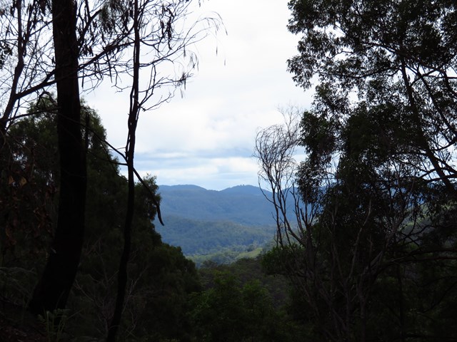
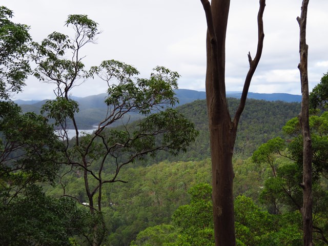
Boarding NSW and the pacific Ocean, it is not uncommon for hikes to have views of both worlds (ocean and hinterland). Hikes here are typically on the great dividing range.
Popular Walks
-
Mt Ngungun
(1117 ticks) -
Mount Coolum
(849 ticks) -
Mt Cordeaux
(646 ticks) -
Twin Falls Circuit
(614 ticks) -
Purling Brook Falls Circuit
(592 ticks)
Parent Regions
Sub-Regions
- Amamoor State Forest
- Bellthorpe National Park
- Brisbane City Council Local Walks
- Brisbane Forest park D'Aguilar National Park
- Brisbane Valley Rail Trail
- Coombabah Lakelands Conservation Area
- Daisy Hill Conservation Park
- Eumundi Conservation Park
- Glass House Mountains National Park
- Glen Rock Regional Park
- Gold Coast
- Ipswich
- Jimna State Forest
- Karawatha Forest
- Kondalilla National Park
- Lamington National Park
- Main Range National Park
- Mapleton National Park
- Moggill Conservation Park
- Moogerah Peaks National Park
- Moreton Island National Park
- Mt Barney National Park
- North Stradbroke Island - Minjeeribah
- Parklands Conservation Park
- Springbrook National Park
- Sunshine Coast
- Tamborine National Park
- White Rock - Spring Mountain Conservation Estate
History
Any interesting history for the region?
Features
What are the standout bushwalking features?
Access
How do you get there? Include all access points if there are many?
Maps
Which maps cover the region?
Accommodation
Where can I stay there? or near there?
Camping
Council Areas:
- Scenic Rim Regional
- Gold Coast City
- Logan City
- Redland City
- Ipswich City
- Lockyer Valley Regional
- Brisbane City
- Somerset Regional
- Moreton Bay Regional
- Sunshine Coast Regional
- Noosa Shire
Contact details
See Qld National parks website
Walks in South East Queensland

 1
km
return
1
km
return
 30
mins
30
mins
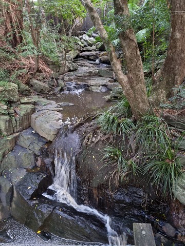
Kumbartcho Sanctuary
Kumbartcho is a Flora and Fauna Sanctuary incorporating walking tracks around, lake, gardens, bridges, forests and a public park, BBQ and playground
 4
km
return
40
mins
4
km
return
40
mins
Lagoon Creek Walk
A fully sealed track that follows Lagoon Creek from the corner of Pettigrew and Ferris Streets. It follows Lagoon Creek along till it reaches the Bruce Highway.
The highlight of the track is the main lagoon where at the right time you may see a platypus as well as ducks and turtles.
 200
m
return
15
mins
200
m
return
15
mins
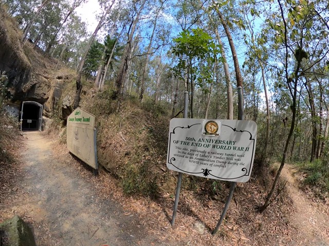
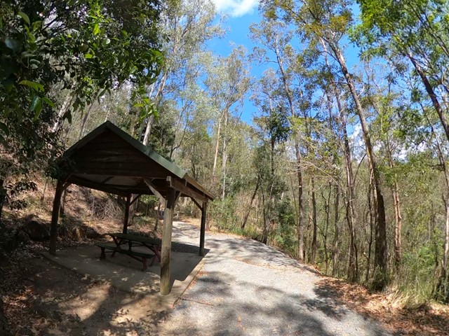
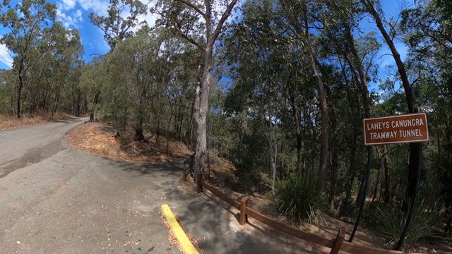
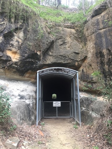
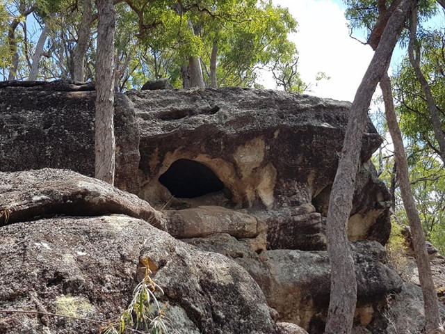
Lahey’s Tramway
Very short, easy walk. Just off the road so it’s very accessible. Informative sign at the bottom. You can’t go in to the tunnel though, but you can learn a bit about the history.
 7.68
km
return
2
hrs
7.68
km
return
2
hrs
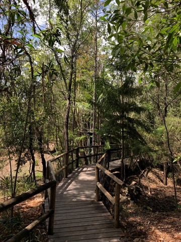
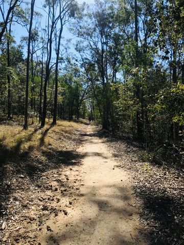
Lower Beechmont Conservation Area (Eastern Section)
The trails in this area are used by horse riders, mountain bikers, bushwalkers and nature lovers. This is a rugged, natural environment and you need to be well prepared and self reliant when in the reserve. Some of the trails link with those in Nerang Conservation Park.
 12
km
one-way
3
hrs
12
km
one-way
3
hrs
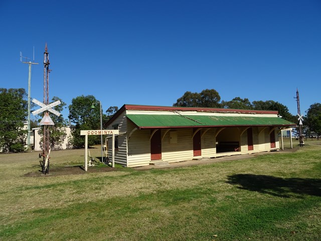
Lowood to Coominya Rail Trail
This walk is part of the Brisbane Valley Rail Trail, starts and finishes at the railway station. Coominya is a small town but has all services. A large and impressive rail bridge along the track but not accessible, a lower river crossing. The walk passes through farm lands so plenty of gates to open and shut but not a walk to complete in Summer months. The trail is well marked so maps are not required. Lowood is accessible after a turnoff at Fernvale which is situated on the Brisbane Valley Highway. Public amenities and car parking at both ends of the walk. No permits or costs for the walk.
 3
km
return
1
hr
3
km
return
1
hr
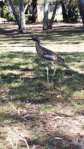
Melaleuca Wetland Reserve Walk (Coochiemudlo Island)
This walk takes you around half Coochiemudlo Island anti-clockwise. Relaxed atmosphere with beach views, half way through the walk will take you through the reserve where you can easily spot some Bush Stone-curlews.
 2.5
km
return
45
mins
2.5
km
return
45
mins
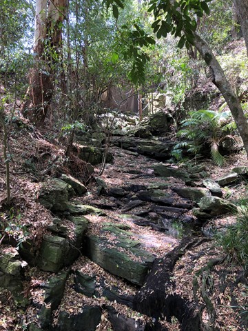
Melichrus Trail (Plunkett Conservation Park)
A short walk on relatively flat gradients through open forest with a mixture of swamp box, ironbark and spotted gum. The unusual soil type in this area promotes short grasses and sedge's that give a parkland type appearance. Keep an eye out for the plant Melichrus adpressus, a spiky native heath species that grows in the local area. This area is known for a good diversity of bird species best heard or seen early morning or late afternoon.
 11
km
one-way
4
hrs
11
km
one-way
4
hrs
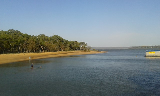
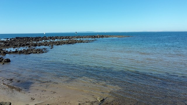
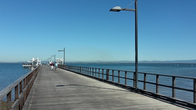
Moreton Bay Cycle Way (Shorncliffe to Woody Point section)
Enjoy the sea breeze while taking a stroll from the Frank Doyle Park (Shorncliffe) along the shoreline of Bramble Bay, across the Ted Smout Memorial Bridge and into Woody Point Pelican Park.
 11.5
km
one-way
4
hrs
11.5
km
one-way
4
hrs
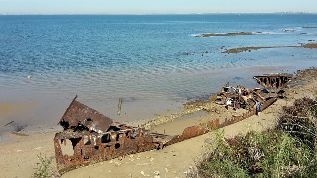
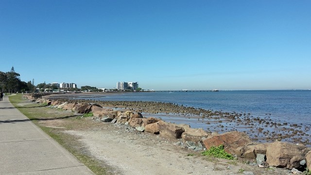
Moreton Bay Cycle Way (Woody Point to Scarborough section)
Coastal track along sheltered beaches with eye-popping ocean vistas and fascinating hertiage sites.
 3.3
km
return
90
mins
3.3
km
return
90
mins
Moreton Terrace Park
Lovely flat walk long boardwalk and sandy track taking around 1.5 hours return, through mangroves and out to Caboolture river mouth. Broad views across Moreton Bay, shady and easy. At the board walk end cross the dog off-leash area and you see the sandy path begin, follow your walk through the mangroves at high tide or take the beach, however, the track remains in the mangroves for the most. You end at the point of the Caboolture River.