Blackfellow Creek Glen Rock

South East Queensland

An easy but longer walk. Yet no hills so the little ones can go along on this hike.

Lookouts
Picnic Facilities
Toilets
Horses Permitted
Cycling Permitted
Eucalypt Forest
200m
Maximum Elevation
200m
Total Climb

Getting there

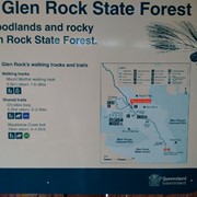
From the day use or camping area head to the look out track. This time ignor the turn off for look out and simply follow the track.

Maps

https://parks.des.qld.gov.au/parks/glen-rock/camping.html#casuarina_camping_area

Route/Trail notes

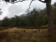
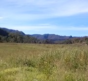
Fairly flat and easy , might just be overgrown here and there. Provides different angles of Glen Rock. Will come across Blackfellow creek waterhole and creek crossing. Just a pleasant walk alround.

Permits/Costs

Hiking free , camping as per Qld National Parks costs.

Other References

https://parks.des.qld.gov.au/parks/glen-rock/camping.html#casuarina_camping_area AND information centre on your left when arriving at day use / camping grounds.

GPS Tracks

  • No GPS available for this walk yet.

Comments

A pleasant enough walk for a winters day. Not much to see actually. Easy to follow. About 8 shallow creek crossings. A wide, unshaded, grassy track all the way. Two main features are Abbots Yards and Top Yards. The historic Top Yards mark the end of the trail. There is no sign or indication to say it is the end of the trail. Track just keeps going.

Jeff on 11 Aug, 2024

This is a long walk with little reward when you get to the stockyards. It took us 5hrs to do the 18kms due to all the time spent taking off shoes at the 13 creek crossings. One of the creek crossings goes well past the knees so prepare to get your pants wet on that one. Some very pretty scenery along the way and good photo opportunities at some of the creeks crossings. Great day use area when you get back to the car. This is a one time walk for us.

Paul on 30 Apr, 2022

This was a really lovely walk. The distance is long enough to stretch your legs and give you a few hours on the trail but its flat so easy. Multiple creek crossings to wear older shoes or be prepared to take them off repeatedly. The creeks were running well up to about knee height but easy to cross and so pretty. It was overcast and raining on and off so not too hot but a very exposed walk so could get really hot on a clear summer’s day.

Bobbe on 26 Jan, 2022

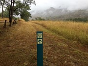
This is definitely an underrated walk. It's super easy, for sure, but at 16.5km it's a good one to get some distance in the legs especially if you're training for a big hike. It was raining when I walked it and honestly I think that improved the experience, it was quite beautiful. From the day use area head toward the camping area and back to the road (but inside the fence) to find the sign, you are following the shared trail the whole way and it's really easy to follow.

sarasvati on 12 Jul, 2020

An easy longer walk which had perfect weather for it on Saturday. Just nice and peaceful :-)

J on 25 May, 2019

Where

Click here to load this map.

Nearby Walks

Done this walk?

This walk has been ticked 5 times

Aussie Bushwalking can keep track of your bushwalks.

Login/signup to tick this walk off.

Tick walks to keep track of where you've been. You must Login to tick walks. Accounts are 100% free so sign up if you don't have one.