Christies Loop Glen Rock State Forest

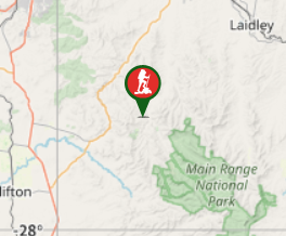
South East Queensland

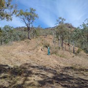
A 7.2km shared trail that starts off easy then head straight up the range before doing a loop coming back down again. Quite steep at times and rocky / gravel track. Does provide some nice views of Mt Philip and Glen Rock as you get higher up.

Lookouts
Picnic Facilities
BBQ
Toilets
Horses Permitted
Cycling Permitted
Eucalypt Forest
600m
Maximum Elevation
600m
Total Climb

Getting there

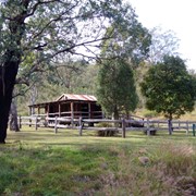
From the day use / camping area just back track on main road till you hit the cattle yard on left. Just 50m past tat you'll see a single gate. Cross the paddock in a straight line where you see another single gate, then simply follow the arrows/signs.

Maps

the camping map shows the trail  https://parks.des.qld.gov.au/parks/glen-rock/camping.html#casuarina_camping_area

Route/Trail notes

A at times steep track, quite rocky / gravel surface ( wear approriate footwear) that is shared with horse and mountain bike riders. It has a couple spots that will give you great views of the other side of the range ( Mt Philip and Glen Rock)

Permits/Costs

Hiking free , camping as per Qld National Parks website

Other References

https://parks.des.qld.gov.au/parks/glen-rock/camping.html#casuarina_camping_area   AND the info centre on left as you arrive at day use area

GPS Tracks

  • No GPS available for this walk yet.

Comments

Great walk, Nice views. This walk starts walking through gates and a cow paddock. the first 2.2kms is purely uphill some parts are a harsh incline. rocky, gravely, loose dirt.. sliding will happen. it levels out then you head down with steep declines over the same type of terrain. overall a great walk. wear good shoes.

Stellar on May, 2024

My watch said that this walk was 7.2km and took about 2.5hours but we took the steep incline pretty slowly. The views are lovely and the first couple of kms get the heart started before easing off and heading back down returning to the car.

Bobbe on 26 Mar, 2022

Great walk, well signed. Didn’t see anyone the whole way which we loved.

Highest part of the loop is a saddle: looked like the peaks either side would not have been too complex if you had time, although off-track (raining and had a shoe blow out the day we did this walk!).

A bit steep and scrabbly in parts: fun for adults but younger kids would struggle.

AndrewD on 2 Jun, 2019

Nice workout on this loop, requires some fitness as some steep sections. Rewarded with great views of the other side of the range.

J on 25 May, 2019

Where

Click here to load this map.

Done this walk?

This walk has been ticked 6 times

Aussie Bushwalking can keep track of your bushwalks.

Login/signup to tick this walk off.

Tick walks to keep track of where you've been. You must Login to tick walks. Accounts are 100% free so sign up if you don't have one.