Mermaid Mountain

D'Aguilar National Park

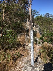
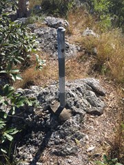
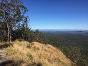
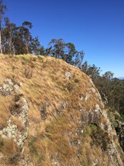
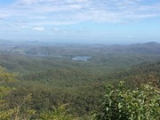
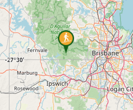
Bush walk from Mt Crosby (town) to Mermaid mountain in Brisbane Forest Park. Lots of uphill tracks and great view of Lake Manchester and surrounding hills from the top.
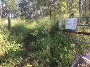
Entrance for walk from Wirrabara Road, which is off Mount Crosby Road.
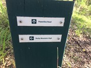
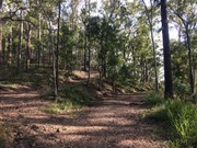
Start on the Powerline Road firetrail then turn left onto Rocky Mountain High Break. After about 9kms you will reach the view!
Finally, return to Wirrabara Road via the same path in reverse.

Lookouts
Bird Watching
Eucalypt Forest

Comments

Great walk, nice little area with a great view of Lake Manchester. Lots of spiders though and probably wouldn't be great for the middle of summer.

Hannah on 13 Oct, 2022

Started and finished the walk from Haven Road.

Lahs on 17 Jun, 2022

We came in from the Lake Manchester Road, via Little Mermaid Mountain and made a round trip of it of about 12km. Trekking poles recommended for the steep descent. Good walk.

Janette on 18 Jul, 2021

Easy with a bit of challenge. Very few signage but the track is obvious

Lara on 12 Jul, 2021

Great walk, beautiful views and perfect for a casual group walk.

Chantelle on Jul, 2021

This hike has a number of short steep sections which, combined with the length, make it a little challenging but still totally achievable, and the views make it more than worthwhile! As others have noted the closer you get to the mountain the more sparse the signage, but if you have an offline maps app (maps.me or similar) and have studied the maps prior you shouldn't have any troubles.

Lewis on 6 Jun, 2021

I started from the Lake Manchester Day use area so I could combine it with a walk around the dam. Was a long walk, took me around 6 hours return with constant walking. I turned off from the dam walk just at Light Line road (however there is a small track just after that road that starts off as a creek bed that is a lot more direct). From there it get pretty steep! There are parts of the walk where you using your hands to ascend, and keep in mind this is a fire road, so it's pretty crazy just how steep it gets. After getting to the top, turn left to walk to the lookout. The lookout has a nice view of Lake Manchester and all the way out to Main Range.

Vonsnrub on 9 Aug, 2020

Beautiful eucalypt fire trails, met the owner of the later part of the track after you leave Moggil Conservation Park through the last gate, nice bloke. Saw no spiders as others have mentioned below.

Angus Small on 21 May, 2020

Ticked off Mermaid Mountain and Little Mermaid Lookout. Total 20km and 7 hours including some back tracking to find Mikes phone after he dropped it. The first time we attempted this one we did barely half and almost died of heat exhaustion after diverting down a hill in the wrong direction and having to climb back up. Gradual for large sections and has steep inclines throughout. Even a little scrambling before the final summit. Enjoy this one because its a short drive. Sarah and Mike

Sarah on 2 May, 2020

Great walk, but lots of spider webs on some parts of the track! Nearly turned back but glad I didn't - fantastic views

Donnelle Brooks on 25 Apr, 2020

Long gradual walk with plenty of steep inclines. We started at Wirrabara Road and followed signs for Rocky Mountain High. We then kept on the main path and sure enough, after around 9km, we made it to the beautiful view at the top. The path was very overgrown for one stretch and we dodged many cobwebs/spiders.

Whicheverway on 28 Mar, 2020

This is a really underrated track, amazing views without technical terrain, may challenge the fitness bit in an enjoyable way

Peter Hill on 19 Aug, 2018

Started at Scrub rd entrance on Mt Nebo rd and ended on Lake Manchester rd at Light Line rd entrance (private property). Very hot and humid, lots of steep sections once on Mermaid Mt Break.

Anonymous on 12 Nov, 2016

Total trekking time with break was about 3hrs.

Good walk with nice views from each lookout. Lots of butterflies this time of year and was also cool to see all the Acacias releasing there seeds.

Zach on 30 Oct, 2016

Great mountain with interesting views of brisbane and Ipswich

zakky on 29 Jun, 2016

Great mountain with interesting views of brisbane and Ipswich

zakky on 29 Jun, 2016

Nice view about 9km in. No signage and many forks in the road so very hard to keep track of where you are going and easy to forget your path ;0) I would do this walk again but lack of signage is annoying!!!

Handi on 11 May, 2014

Nice view about 9km in. No signage and many forks in the road so very hard to keep track of where you are going and easy to forget your path ;0) I would do this walk again but lack of signage is annoying!!!

Handi on 11 May, 2014

This hill is certainly challenging going up and down but certainly worth it.

goldielover on 12 Jan, 2013

Where

Click here to load this map.

Nearby Walks

Done this walk?

This walk has been ticked 40 times

Aussie Bushwalking can keep track of your bushwalks.

Login/signup to tick this walk off.

Tick walks to keep track of where you've been. You must Login to tick walks. Accounts are 100% free so sign up if you don't have one.