Middle Kobble bush camp walk

D'Aguilar National Park

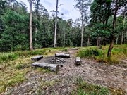
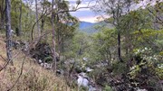
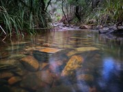
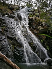
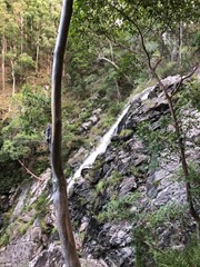
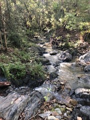
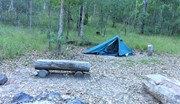
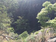
Remote bush camping in an open grassy area next to Kobble Creek, in the remote northern section of the park. A short walk takes you to the top of the Kobble Creek waterfall. Keep an eye out for the prehistoric-looking Lepidozamia (cycads) on your walk to the bush camp. Skinks and keelbacks (freshwater snakes) can be seen basking on the rocks at the top of Kobble Creek waterfall. Bottlebrush plants flower along the creek beside the bush camp in spring.


Getting there

From Mount Glorious Road, the campsite is accessed by walking 4.7km along the
Lepidozamia track and Middle Kobble fire break. The Lepidozamia track entrance is an
hour drive from Walkabout Creek in The Gap. Allow 3-4 hours for the predominantly
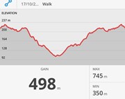
uphill walk out, ascending 350m in elevation with steep sections. An alternative route
returns via North Kobble Creek fire break back onto the Lepidozamia track.

Maps
Available from Walkabout Creek information centre

Route/Trail notes
An easy trail to follow. Some of the turn offs can be hidden.

Permits/Costs
Bush camping permit required.

Other References

Comments

Great time to visit, the falls are flowing.

JFoss on 9 Apr, 2021

Easy to combine with North Kobble or South Kobble. The walk to it is along fire trails the entire way. The waterfall is located about 50m north of the camp and has a small path leading to it.

MDWL on 3 Dec, 2020

Have hiked both directions out of the camp, going clockwise is definitely the easier option. Not much water in the creek, so would suggest taking extra water. For a quick overnight camp, this is a great place to go.

JFoss on 20 Sep, 2020

Definitely left me and my niece puffed! But all in all, it was a good walk for sure. Would recommend probably best suited to those with a moderate fitness level, especially when going up all of the steep inclines!

Make sure to pack plenty of water and to have well gripped shoes as well - these are a must. Also don't be fooled if you cant find the 'waterfall', its a tad off of the track. Follow the small track next to the creek through and past the campsite :)

One final comment, if you want to save yourself struggling back up, would go down the middle kobble way.

Took around 4hrs to complete, which included our lunch break as well.

tee_adventurer on 16 May, 2020

A brilliant dry forest walk - the fire break makes it easy to follow and a good challenge added with the steep hills. Would suggest going clockwise - easier to go down very steep continuous sections rather than up. Take some snacks to enjoy at “water fall” (completely dry when we went) with a great view.

Glang on 1 Oct, 2019

Did the walk in Winter so the waterfall wasn’t flowing, still lovely views though. Nice wide track, probably better for 4WDs than people, a bit steep in some places, easy to slip over if you don’t have good grip on your shoes.

Karla on 3 Aug, 2019

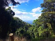
Walked in from mt glorious road up lepidozamia break and to took the circuit around to middle kobble creek camping. Cheeky ascents but great views of the glass house.

Chris Park on 7 Apr, 2019

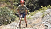
went here again and abseiled the waterfall

gizmobazz on 13 Oct, 2018

Walked in via Lepidozamia Break and the south section of the Middle Kobble Break loop. Stayed overnight at Middle Kobble Bush Camp. The falls were dry but there were some small pools in the creek. Saw a pair of red-tailed black cockatoos in the trees above the camp site. The following morning we hiked out via the north section of the loop and back to where the car was parked at the Lepidozamia Break trail head. Some steep trails to ascend and descend, but you are rewarded with interesting flora and some amazing views out to Moreton Island.

Bunya Nutz on 22 Sep, 2018

Decided to overnight solo at Middle Kobble Bush Camp in March 2018. Walked in via the southern loop and out via the northern loop. Recent wet weather had caused the track to become quite overgrown in sections so had to take care in case of snakes - none were spotted except for a large dead python in the middle of the track. The entire walk is along a wide 4wd track so is quite easy to navigate however the trail is very steep in sections and requires a reasonable level of fitness especially on the way out. The recent rain had filled the creek which was a good source of extra water. Campsite is a semi open area with a fire pit and log seats. The waterfall is located 5 minutes North-East of the campsite and with plenty of water flowing was quite spectacular. Be very careful whist navigating the waterfall area as it is a steep drop to the bottom. It took 1.5hrs to hike in from Lepidozamia Road gate and just over 2hrs out with overnight pack. One of the better campsites in the National Park - well worth visiting.

dortwilder on 24 Mar, 2018

The walk in and out has some challenges and is quite steep in places.
I chose to do the full circuit loop so as not to retrace my steps.
For me personally i think i chose best as although the climb up north is arduous, it was well worth it as i was rewarded with some beautiful scenery. I was also unaware of the water tanks atop the ridge which may help for future explorations.
Note: The walk out took me exactly 3 hours to complete.
Thoroughly beautiful place. I loved it very much.
cheers Gizmo......
once again its on my utube channel

gizmobazz on 26 Jan, 2018

Good walk after rain when the falls are flowing.

mika28au on 16 Oct, 2017

Great walk through beautiful surrounds . We did the loop, going right at the AS0371 marker (as per the QLD Parks & Wildlife Service topographical map), this took us 3 hours & was 11 km on my Map my Walk ap & 12 km on a Fitbit. There are challenging parts of this walk - a couple of steep descent and a very steep climb just after the bush camp - definitely not a walk for the unfit. Make sure you walk out to the waterfall, even though it wasn't flowing the view is beautiful.

Lots of beautiful scenery, bird calls and the odd glimpse of the very bright yellow Regent Bowerbird - loved every minute!

Deb on 17 Oct, 2015

If you go in via the north loop, note that AS0372 is wrongly marked on the topographic map. It is just before the north kobble break turnoff, not afterwards. Otherwise well maintained paths and easy to navigate with the map from the walkabout creek information centre.

guy taking his kids on 22 Jun, 2015

Access for this track is via an unsigned fire access trail, fairly steep down hill walk making for a much longer trek out, allow at least 3 hours for the hike back.

As others have mentioned, I too stumbled across a roughly 2m long python, along with a small brown snake under some rocks on the second day so keep an eye out!

mattp on 5 Dec, 2012

We did the loop track, longest (and steepest) section down then visited the falls and walked back. A medium sized python sunbaked on the track quite unfazed by us. There was water in the pools at the top of the falls which was clear and lovely! Wanted to walk down the side track to the bottom of the falls themselves (looks quite pretty down there) but did not due to the long grass and not wanting to be bitten by snakes!

A really lovely walk, took 3 hours in all - not quite as steep as I thought it would be - would be a nice overnight stay to see the bottom of the falls.

asterope on 30 Oct, 2011

Mainly easy to follow track. Some of the turn offs can be hidden. Make sure you bring map and compass. In the late afternoon a pair of Wedgetail Eagles circle overhead and roost somewhere near the Wivenhoe Lookout. Also came across a snake in the middle of the track.
Along the track you get fleeting views of the coastline. As you proceed along the track near the 'proceed at own risk' sign, better views can be had.
This track is better suited to bush camping than a day walk.


http://www.youtube.com/user/TheKendo72

Boris Zoubakin on Jul, 2010

A great walk with a steep descent a good lookout at peak 489 on map. A steep walk out. do not expect water in the creek.

Laurence Hallam on 14 Jan, 2010

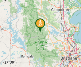
Where

Click here to load this map.

Nearby Walks

Done this walk?

This walk has been ticked 47 times

Aussie Bushwalking can keep track of your bushwalks.

Login/signup to tick this walk off.

Tick walks to keep track of where you've been. You must Login to tick walks. Accounts are 100% free so sign up if you don't have one.