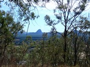
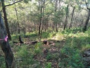
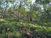
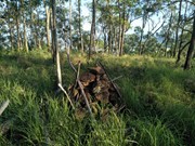
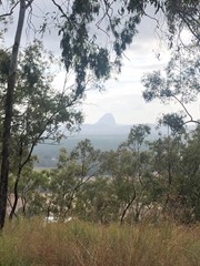
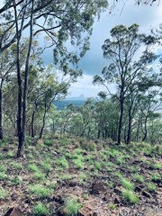
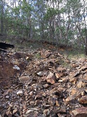
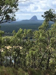
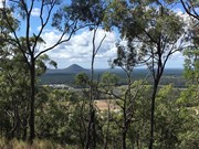
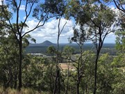
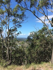
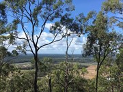
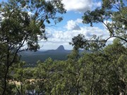
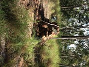
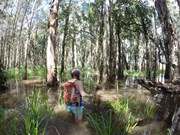
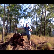
Mt. Mike as it is known is twice as tall as its neighbour Mt Elimbah with a fast but steep ascent through eucalypt forest nested on scree and leaf litter-covered slopes. The views from the top are not great but what can be seen is the extensive horticulture on the plains below, particularly of strawberries and pineapples.

Lookouts
Scrambling or Climbing
No Dogs Permitted
No Camping Permitted
Eucalypt Forest
203m
Maximum Elevation
150m
Total Climb

Getting there:

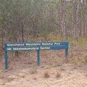
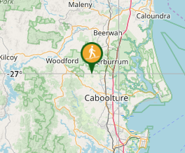
Take the Steve Irwin Way from the Bruce Highway to the Beerburrum. Take the Beerburrum Road south to Elimbah, where you turn right into Smiths Road. Turn left onto Old Gympie road and immediately right into Alcock Road, which joins Boden Road and then turn left into King Road. Park on the grass verge opposite the Glass House Mountains NP - Mt Miketeebumulgrai sign (approx. 320 King Road).

Maps:

None found.

Route/Trail notes:

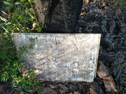
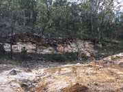
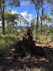
Behind the National Park sign is a track that leads to a scar from an old quarry. To the right is a 'pink flagged' track that takes you through the scrub and boulder/rock field and directly to the top. It is fairly steep but not to the extent of a scramble and would likely be very slippery when wet. At the top is a cairn and a board to write your initials on.

Return by the same route.

Permits/Costs:

None.

Other References

The Peak Baggers Guide to the Sunshine Coast.

Kill two birds with one stone and climb Mt Elimbah on the same day, as it is just 6km up the road.

GPS Tracks

Comments

A large gum tree has fallen over the path halfway up the mountain, easy to get around/over the tree to continue the hike though. It looks like someone has cleared or flattened some tall grass at the top of the mountain which is nice compared to how it was. Some of the pink ribbon markers are starting to fade now

Tanya Q on 12 Oct, 2024

An important summit for anyone hoping to collect all of the GHM summits. I made a 3-min video with drone footage and maps here: https://youtu.be/WLtbKJERKkU

Richard Pattison on 13 Oct, 2023

Some pink markers which help you keep on track, a stone cairn at the top but limited views, very loose rocky ground most of the way up so take care descending.

Bribie 61 on 3 Oct, 2021

Wild track but good exercise

Hui Xiao on 8 Sep, 2020

Had a go at Mt Mike on same day as Mt Elimbah, I can see why the recommendation to do both. Track is narrow but easy enough to follow and plenty of pink tape, but very steep and goes straight up, ie no zig-zagging across the hill. That's fine on the way up, stop to catch your breath as necessary. However, coming down with the steepness, loose rocks, leaf litter etc it's very slippery and I saw a busted ankle coming up. It's a little-used track, I was solo walking, figured discretion is the better part and turned back part way. Might try again with someone with me.

Jim Craigen on 2 Jul, 2020

Lots of loose rocks but path easy to follow with pink tape. A nice short and secluded hike.

JayWalker on 21 Mar, 2020

Done this the same morning as Mt Elimbah. Pretty sure I won't be back in a hurry. Was a rather hard hike to the top, when you can find your way that is. The pink markers were pretty hard to find and really makes you look to where your walking. Yes, the views at the top aren't much but was great to have made it all the same. Take plenty of mozzie spray, there were heaps of them at the top.

Darren on 15 Feb, 2020

Great walk, not too difficult and lovely if obstructed views from the top

Bobbe on 13 Jan, 2020

Easily the worst Glass House Mountain of all eleven. It is a decent enough climb if you're looking for some cardio, albeit quite crumbly in places so keep this in mind. The disappointment here is that there is more effort involved than reward as the views from the top are elusive due to the trees.

Still essential if you want to complete all (open) Glass House Mountains.

If you have a drone, bring it!

basalamant on 2020

Very enjoyable walk. Well marked.

Sarah King on 27 Oct, 2019

Easy to follow the pink ribbons
A lot of loose rocks
Not the best view but a nice walk
1hr return

Kmxfitness on 18 Aug, 2019

This one is a real bush bash! Follow the instructions here on how to find the track. Some of the pink ribbons are harder to find as you get closer to the top, but just keep heading up. Lots of loose rocks and plenty of opportunities to slip. Take note where you popped up to the summit so you can follow the same track down.

Chris M on 2 May, 2019

Watch out for unstable rocks when stepping on them. Had to walk a bit further from the summit to get a nice view due to all the trees. Take mozzie spray and a marker to add your name to the board up top :)

Hannah MC on 25 Apr, 2019

Start of track is behind the sign, essentially a creek washout until it looks more like a track, otherwise pick any point in front of the mountain and walk up, you will find the pink track markers fairly easily, otherwise not a real issue, just walk up uphill.

Brad on 19 Apr, 2019

Lots of loose rocks and ground cover. View isn't too bad

Callum Edwards on 2 Feb, 2019

Bit hard to keep on the path, but doesn't seem to matter so much. Just head up, and when you're done, head down. A nice little walk.

Stephen Pinel on 27 Jan, 2019

Parked at the strawberry packong shed and walked through area recently burnt in bush fire.
Pink ribbons and pink spray on rocks made the way obvious, even after the fire.
It's not a particularly easy climb as a lot of the rocks on the climb are loose, it's a climb and one where when u think you must be making progress, don't look up, just keep going another couple of minutes or you'll just get depressed!!!
Regrowth on trees means already it's not a great look out, but it's one of the ghm so it had to be done!!

NautiWill on 19 Jan, 2019

Hiked this and two other small Glasshouse Peaks in a morning.

It was my least favourite of the three.

There’s been a fire which means no pink markers remain to the summit. However I think this also means the view is better at the summit as there’s less trees than comments indicate.

I just keep walking up the hill until I came to the summit from the national park sign on the road.

There was no parking and it was tricky pulling over to park due to long grass.

I wouldn’t rush back to this one.

https://www.wikiloc.com/hiking-trails/mt-miketeebumulgrai-31745821

Juiced Pixels on 30 Dec, 2018

I'd like to mention that if you follow the GPS link for parking that was left in the comments, your gps will direct you to someone's driveway and require you to go off road. It is easy to drive by the sign for this hike, so if you pass Sunray Strawberries on your left, you've gone too far. Easiest to park on South side of King Rd just before Sunray Strawberries. The hike itself is easy to follow as there are pink ribbons everywhere. Wouldn't recommend this for younger kids as adults will need their hands for scrambling over loose rocks. The summit has peekaboo views with a large cairn built in the middle.

Wanderingfox77 on 17 Jun, 2018

I really like this quiet area of the Glass House Mountains. Driving out to this with nice views of 'Mike' and the 'Twins-West & East'.
I parked not in front of a house on the right of theMountain.
Walking through the track following the pink ribbons all the way to the top. I am not sure why people get lost on this one as its quite easy to follow the tape.Up to the large Cairn and whiteboard on top.....no one to be seen anyhere on the Mountain. Different then any GHM I have done before. Bit of a slide on descent so take your time!

KidBear on 4 Jun, 2018

Where

Click here to load this map.

Nearby Walks

Done this walk?

This walk has been ticked 95 times

Aussie Bushwalking can keep track of your bushwalks.

Login/signup to tick this walk off.

Tick walks to keep track of where you've been. You must Login to tick walks. Accounts are 100% free so sign up if you don't have one.