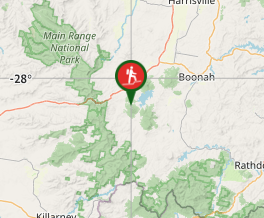
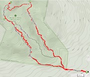
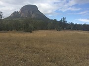
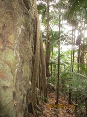
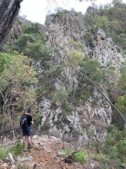
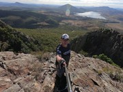
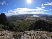
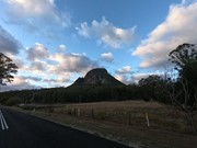
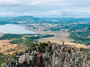
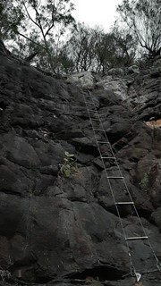
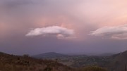
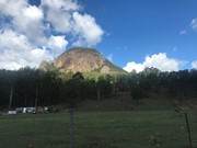
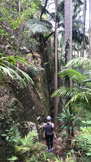
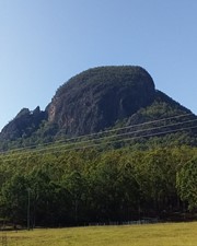
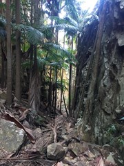
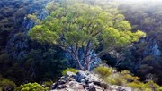
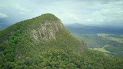
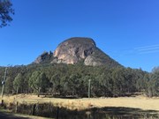
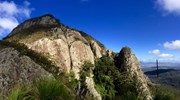
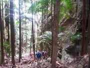
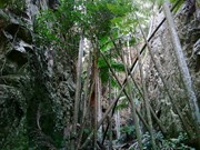
A walk up to the top of Mt Greville circa 770m. Up the waterfall gorge, then visit viewing platform rock slab near top of waterfall gorge. Alternatively, ascend via SE Ridge. Continue to summit then return via Palm Gorge.

Waterfalls
Lookouts
Bird Watching
Scrambling or Climbing
Navigation Required
No Dogs Permitted
Eucalypt Forest
767m
Maximum Elevation
610m
Total Climb

Getting there

 From Aratula drive towards Cunningham's Gap and turn off at the Spicers Gap Rd. Follow this road for about 8 km( it does become dirt for a while) then turn into Mt Greville Rd find the start after about 800m driving or so along Mt Greville Rd.

Maps

Sun maps Mt Edwards

Route/Trail notes

From the gate walk uphill to the sign posts about 400m, there are three alternatives Waterfall Gorge, South East Ridge and Palm Gorge. This walk goes up SE Ridge and comes down Palm Gorge.

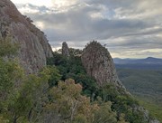
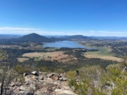
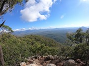
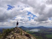
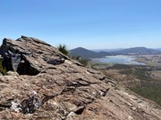
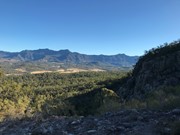
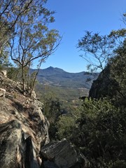
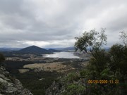
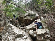
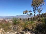
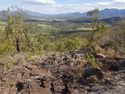
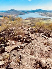
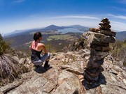
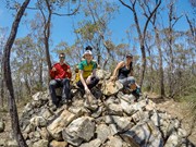
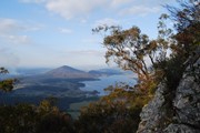
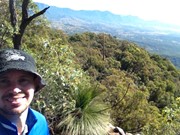
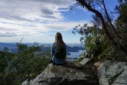
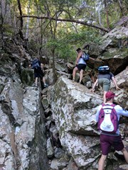
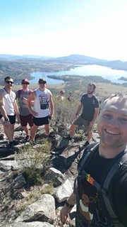
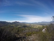
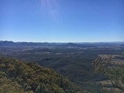
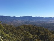
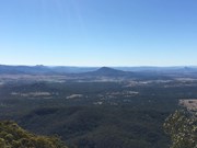
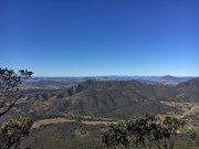
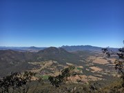
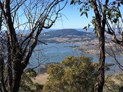
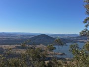
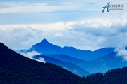
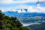
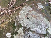
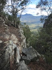
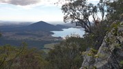
Follow the rough track up SE ridge lots of scree at the bottom and a few cairns on the way up. There are some rocky slabs to scramble on and through and if you lose the rough trail then keep heading up through the grass trees. Eventually you will come to a second wide rocky slab with great views of the southern Fassifern valley and the southern Mountains of the Main Range, Mt Ballow, Mt Barney, Mt Edwards, Mt Moon, Mt Maroon and Moogerah Dam. There is a lower rocky slab with the same view. Keep tracking up to the left through the Grass Trees till you enter forest again near another cairn note a well trevelled footpath that descends into Palm Gorge, it is about 30m up from the cairn for easier access. Keep following the trail up hill to the summit where there are good views to the North and views of the Ramparts of The Main Range and Mistake and Little Liverpoool Mountains.

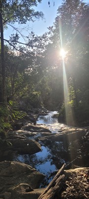
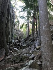
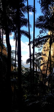
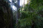
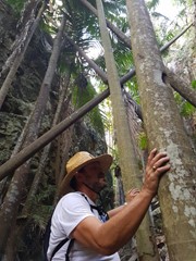
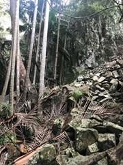
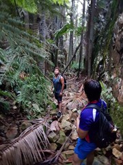
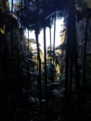
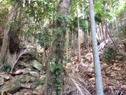
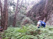
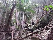
On the Descent look for a rough trail that heads up hill about 10 min from the summit. it leads to the head of a steep rocky Gorge that has a stunning view of Spicers Peak framed in its middle. About 10 min again from here locate the cairn and footpad that descends into Palm Gorge. Just keep following this down and take your time. There are loose rocks and slippery palm fronds on the ground but is well worth it. Pictures are necessary just to prove how beautiful this place is. Follow the rough footpad all the way back to the signposts and turn downhill to the carpark.

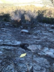
Altenate walks can include going up Waterfall Gorge and Traversing to the start of Palm Gorge across the Rock slab very enjoyable after summitting!

Permits/Costs

There is no camping in the Park.

Other References

Take A walk in the Sout East Queensland ; Chapman.

Comments

Not technical but pretty tiring if you're not relatively fit. We went up Palm Gorge and also back Palm Gorge cause we got lost on the way down. We eventually found a track on the way back, turned out it was the same one we went up hahaha. Good views though!

jesse on 9 Sep, 2018

Up via waterfall gorge. Easy to follow (there were intermittent small pink markers). Came down via palm gorge. Great hike.

JayWalker on 26 Aug, 2018

A good hour south west of Brisbane is this gem of a walk. The route my party took was up the aptly named Palm Gorge and back down South East Ridge though having seen the base of Waterfall Gorge, I'd love to explore that route one day.

It is a decent slog up Palm Gorge but the atmosphere and scenery are really something. I felt a little like I'd stepped into a fantasy novel. It is a bit loose underfoot in places but as you are climbing up an ever narrowing gorge, there is plenty to hold onto.

From the top of that gorge which takes about an hour at a steady pace, it's about another 30 mins to the top. I felt the experience of climbing that gorge was worth the trip in itself as the views are not as good as those offered from the nearby Cunningham's Gap but it is still decent.

The way down through South East Ridge, it pays to keep your eyes peeled as it is possible to wander away from the actual track as the triangle markers can be a little tricky to spot. If you head parallel to the gorge route that is roughly the correct direction and the track becomes pretty well defined once you are off the plateau and heading down.

It is a little rough underfoot and scrambly on the way down so a bit of care is needed but takes about an hour or a bit under and is very manageable.

All in all quite a unique walk well worth checking out as it offers a number of circuits to mix things up. Probably one to avoid in the heat of a summer's day as it is fully exposed to the elements on the plateau area. Likewise if it has been raining heavily as the track would turn into a mud pit though it was and remains very dry out there. As others have noted, checking for ticks afterward is a must.

In summary, good workout, great experience in the Palm Gorge, decent enough views and unique circuits make it a must do.

Matty Vee on Aug, 2018

Went up SE Ridge. Easy to follow. One and a quarter hours to the top. No difficult climbing like the Glasshouses Mtns. Fantastic 180* panoramic views of the surrounding countryside on the way up. Enjoyed lunch on the summit with views of Lake Moogerah. Went back by Palm Gorge winding my way through lots of rocks and Palm Trees. Palm Gorge turn off, to the right, is a fair way down the SE Ridge track. Two stone steps are the indication you're on the right track. Got back to the car in about 3 hrs.

Jeff on 8 Jul, 2018

Up palm gorge. Tried to come down SE ridge but could not find the path. Back down palm gorge, which is one of the most beautiful I've seen so far in QLD. Next time would ascend via SE ridge and down waterfall gorge.

JayWalker on 7 Jul, 2018

We went up Palm Gorge and came back the SE Ridge. Track was fairly easy to follow, particularly up Palm Gorge where the only way you could really go wrong is if you try to traverse the sheer cliffs on either side of you. View at the top isn't as spectacular as Edwards, but coming back via SE ridge you are treated to an excellent view half way down with a panoramic 180 degree view. The walk wasn't overly difficult, took just over an hour to reach the top.

Vonsnrub on 3 Jun, 2018

A lovely challenge, with the incline starting straightway from the carpark. Take your photos from the top of the south ridge before reaching the summit. A nice window looking north-west from the summit but bush in other directions. Lovely scramble down through fern gorge. Took around 3.5 hours with lots of stops for photos :)

Samantha on 10 May, 2018

Hi, it's Harry the Hiker. My dad and I completed this hike in just under 3 hours, with a detour to waterfall gorge.
Climbing up palm Gorge was excellent, and the best hike I have done so far.
There are some areas of rock scrambling on this hike.

Harry the Hiker on 28 Apr, 2018

Driving up to greville was great with the morning sun shinning on the rock face and this mountain looks different from every aspect. We arrived at the car pack mid morning and getting ready to head off when we ran into 'harry the hiker' and his Dad.
Harry a young man of 8 and his dad gave great advise to ascend Palm Gorge and descent SE Ridge ( we were originally looking the other way around).
Palm Gorge was a steady hike up and took about 1 hour to get out and head onto the true peak. Made the peak in another 20 minutes and on the way down enjoyed the great view from SE Ridge.
Next time Waterfall Gorge.
We really enjoyed this hike and looking at returning soon for this and Mt Edward !

KidBear on 28 Apr, 2018

Loved this hike. waterfall gorge was very slippy going up after the rain we have had despite it not raining for a week prior. Everything is covered in moss. Made for a interesting hike!

jennersm on 4 Mar, 2018

I started this walk in the dry and about half an hour in it teemed with rain, made the walk even more dangerous as the rocks were extremely slippery...I don't know how I didn't slip over! Other than it being massively slippery it was a enjoyable trek....would like to do it again in fair weather

Andrew.P on 23 Feb, 2018

4 of us hiked early at 4:30 am. I found challenging hike up via Palm Gorge loose rocks and slippery palm leaves narrow rocks and steady ascend. Beautiful view from the top of gorge. nice hike further up to the summit. Lovely view of the lake Moogerah from the summit. On our way back we wanted to use waterfall gorge but got lost for 1 hour trying to figure out the way. turned back to the top of gorge and re-centre ourself to the arrow signpost on the rock. Safely returned back to the base and found that out we descend via south east ridge. yay...

Mark Aryal on 17 Feb, 2018

great climb/walk and got me doing more bushwalking :)

JosephineC on Feb, 2018

4.5 hours total time with a half hour meditation break and plenty of time spent playing with the drone on the rocky slab between the gorges. Ascended up waterfall gorge which was a great rock hopping challenge, lots of lose foliage and debris when I passed through so it wasn't quite so serene at the time.
Reaching the top of the gorge headed across to the lower northern vantage point over moogera which was fantastic, views here better than the summit in my experience.
Found the top of the waterfall gorge trail difficult to follow so followed the top of the gorge back until it met with the south ridge trail along the main bare slab between the gorges. Easy summit from here.
Summit I found lacking in views - perhaps overgrown or I missed the right lookout. Very large cairn on top identifies the summit.
Descended via south east ridge - amazing views across the top of waterfall gorge here, there is an obvious outcrop to your left as the trail eases on the way down DO NOT MISS IT. Views back to the mountain along the gorge are spectacular.
Probably wouldn't say it's a class 4 to be honest, it is very challenging, it doesn't have a lot of technical scrambling but the trails are quite faint and it requires some good navigation and thinking to find your way from the top of waterfall gorge.

Peter Hill on 28 Jan, 2018

We took a chance with the weather....BOM predicting rain/storm in the morning. Got to park, obviously people took notice....it was empty. First time in a few months that any of our walks did not include other groups. So up Palm gorge, interesting, as their were no tracks on the rocks, due to rain earlier. In some areas whole areas up to 2 meters started to move as we walked on them....and sometimes the boots sunk into holes....Interesting...another challenge. Took about 45mins, got onto se ridge, with plenty of track to follow. Very nice views, especially over the lake. Humid, cloudy day. On top, resting on the rocks had hundreds of flying ants of various types. They definitely liked us having lunch. Pleasant trip down SE ridge. Total time....3hrs. Very narrow gorge on the east going down the side of the mountain for a long way looks interesting, will check it out on the maps for possible future trip. Met one couple in car park....sleep in day for everyone else...Nice hike :)

Legs eleven - Dave on 7 Oct, 2017

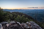
Very enjoyable climb and worth the drive from Brisbane. Not a hard climb by any means but the view is stunning from the top especially at sunrise.

Ryan on 16 Sep, 2017

Up SE Ridge
Down Waterfall Gorge
About 4 hours with lots of breaks
Nice views at various places - the view from the summit wasn't as good as some vantage points on the waterfall gorge walk. Views from SE ridge were also great.
Might try Palm Gorge up next time and SE ridge down.

Juiced Pixels on 6 Aug, 2017

Up SE Ridge and down Palm Gorge.

Nik on Aug, 2017

Beautiful walk up Palm Gorge down SE ridge, easy going hike with ample views of lake moggerah and surrounding peaks.

courtlalala on 5 Jul, 2017

was a great walk, decided on waterfall gorge to the top which was worth it for the extra view points and then went palm gorge down which was a fun track

Gary on 2 Jul, 2017

Where
Click here to load this map.
Nearby Walks

Done this walk?

This walk has been ticked 330 times

Aussie Bushwalking can keep track of your bushwalks.

Login/signup to tick this walk off.

Tick walks to keep track of where you've been. You must Login to tick walks. Accounts are 100% free so sign up if you don't have one.