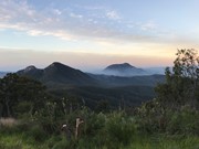
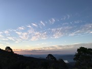
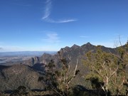
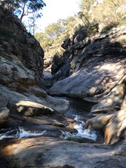
An awesome day out taking in these two spectacular locations, enjoying the amazing views of Mt Barney from Montserrat Lookout, and exploring the Portals. There are a couple of leg-burning climbs involved, but the rewards are worth it.
Getting there
Start at Cleared Ridge carpark at the top of Waterfall Creek Rd (steep and rough 4WD track). If you don't have a 4WD, it is possible to get within about 500 metres of the carpark with an AWD with high clearance, but the last section involves driving over some seriously large rocks.
Maps
World Wide Maps - Mt Barney
Route/Trail notes
Leaving the carpark, walk through the stile then along a wide fire trail/National Parks road for a few hundred metres before coming to a sign that points downhill to the right towards the Upper Portals. This is a steep road (seeming steeper on the way back up!) that runs next to a gully, then eventually flattens out and comes to a T-junction in a cleared area, with a sign pointing to the Upper Portals to the left and saying "Private property - no access" pointing right. Turn right (you will only be on private property for a few hundred metres) and cross Yamahra creek. You will need to take your shoes off, as there are no stepping stones. Proceed along an old road up to a disused cattle yard on the left and turn left up the hill (you can turn before or after the cattle yard as both tracks join and then proceed up the ridge). Note: if you cross another little creek/tributary and end up at some buildings (Grace's Hut), you've gone too far.
What is sometimes a slashed track becomes a footpad a few hundred metres along. It follows the crest of the ridge upwards through sclerophyl forest (gaiters or long pants recommended given the risk of snakes), and although fallen trees get in the way it's easy enough to pick up the trail. After about 45 to 60 minutes it reaches the summit, which is a large bare rock with a great views of Mt Barney to the East and some views of the Ballow Massif to the West.
Head South to find a cleared camping area, then there is another footpad (easy to find) heading East and down the mountain. This way is quite steep, but there are no exposed sections at all. After about 45 minutes you will see (and hear) the Yamahra/Mt Barney Creeks confluence. The footpad seems to peter out at this point, but if you track diagonally right it isn't too steep and you will reach the bank of Mt Barney Creek. Hop across the creek (if the level is low enough) and look for another footpad on the right bank going downstream. A large treefall at time of writing (12/9/20) makes this difficult at first but then the path becomes much clearer. A couple of hundred metres downstream you'll find the spectacular Upper Portals.
Backtrack upstream to the confluence and cross Barney Creek again, where you will see a very obvious track/road, which follows Yamahra Creek. This is a pleasant and undulating couple of kilometres with creek crossings and some nice hoop pine rainforest. It eventually returns you to the Upper Portals/Private Property sign, where you retrace your steps back up what now seems an impossibly steep track (I counted 24 pitches) to the carpark.
Permits/Costs
None.
Other References
Take a Walk in South East Qld by John and Lyn Daly
GPS Tracks
- No GPS available for this walk yet.



 10.5
10.5 5
5
Comments