- Mt Barney West Peak (Mt Barney National Park)
- Mt Barney East peak south east ridge (Mt Barney National Park)
- Mt Barney East Peak via SE Ridge, traverse North Pinnacle to Leaning Peak, descend to Barney Gorge and Lower Portals (Mt Barney National Park)
- Mt Barney North Peak (Mt Barney National Park)
- Mt Barney via Logans Ridge and return via Gorge (Mt Barney National Park)
Menu
A walk to the actual summit of Mt Barney (West Peak is higher than East Peak). It's got views, not as crowded as East Peak, and quicker to get to from Rum Jungle.
Getting there
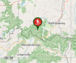
Start at the Rum Jungle campsite in the Saddle area.
Maps
QTopo
Route/Trail notes
It's best to use a GPS device or app, because although there are footpads, there's no path as such. Directly west of the campsite there are some large slabs. Carefully make your way up these, then when the slope flattens a little (about 100 metres) start to contour to the right (roughly west-norwest). You should find some blue or yellow tape markers along the way, though you will need to choose your route between the markers, contouring gradually upwards and westwards and using gullies to gain height where necessary. There is no real exposure involved (despite what the Bushpeople's Guide says).
After gradually climbing for 500 or 600 metres, you eventually reach a point almost directly north of the summit at an altitude of about 1250 to 1300 metres. At this point swing left (south) and head (roughly) straight up. After about 200 or 300 metres you should reach your goal, marked by a cairn. For the return journey, retrace your steps. Once you get back facing east it's pretty easy to find Rum Jungle.
Permits/Costs
Permits are needed to camp in the Saddle area.
Other References
No guide books give any really useful directions, as far as I can find. Another Aussie Bushwalking article talks about contouring to the left once over the first slabs, but that way appears to involve a bit of exposure.
GPS Tracks
- No GPS available for this walk yet.
Where


 2
2 90
90
Comments