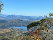
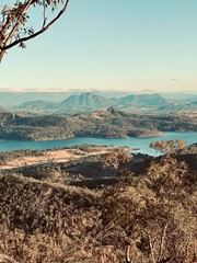
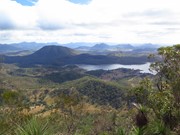
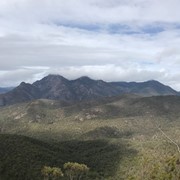
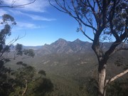
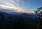
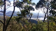
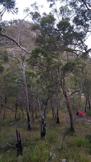
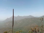
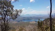
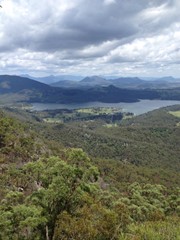
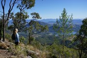
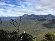
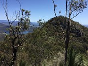
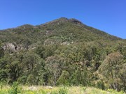
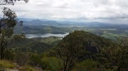
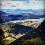
A challenging half day circuit walk of Mount May with great views of the surrounding mountains.

Lookouts
Swimming
Scrambling or Climbing
Navigation Required
No Dogs Permitted
Camping Permitted
Eucalypt Forest
840m
Maximum Elevation
608m
Total Climb

Getting there:

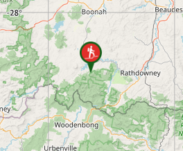
Coming from Boonah turn right off the Boonah - Rathdowney Rd onto Burnett Creek Rd, then left into Newman Rd (gravel) then turn right into Waterfall Creek Rd up to the Waterfall Creek campground.

Maps:

QTopo: 9441 - 423

Route/Trail notes:

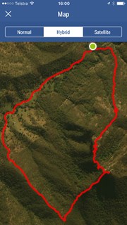
Just before the large red 4WD sign, to the left the start of the trail is easily seen.  Follow an eroded footpad up the Northern/North-eastern ridge.  After 30-45 minutes you will reach a low cliff; bear right until you find a break that can be climbed without too much difficulty.  Back on the footpad the track continues to follow the ridge, flattening out a little.  A few hundred metres from the cliff line you just climbed keep your eye out for a cairn of rocks (*25/04/2023 couldn't find the cairn*) leaning against a gumtree on the left of the track.  This will be important later in the walk.  The track then starts to get steeper again and crosses several rock slabs as it climbs towards the summit of the North peak.  It will take one to one and a half hours to reach this point.

After admiring the views to the West and North, retrace your steps back down the ridge to the rock cairn.  Turn right (roughly Easterly) then head down the side of the ridge.  On this part of the mountain footpads are much less distinct than the summit track, but if you keep heading downhill bearing Southeast you will come to a gully with a few rock pools after about 15 minutes from the cairn.  Follow the gully left (downstream if the water is running) until you come to a 10metre cliff and waterfall (usually only a trickle).  From this point, follow the ridge up (roughly south) until, after another 20 to 30 minutes, you reach the Southern peak summit ridge, where the track again becomes more distinct.  Follow the ridgeline for about 100 metres until you find some more open areas with great views of Mt Barney and Mt Ballow.  It will have taken about two and a half hours to reach this point.

The descent follows the Southwestern ridge from the Southern summit.  It is quite steep, involving some climbing and scrambling, but there is no real exposure (take it from someone quite nervous about big drops!), then after about thirty minutes you will reach Waterfall Creek Rd.  

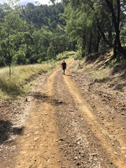
Turn right and head downhill approximately 3.5km back to the campground, crossing through a couple of gates (the road passes through private property).  Curiously, this is probably one of the trickiest parts of the walk, given how steep the road is, with gravel on top of rock making slipping a definite concern.

At the last creek crossing just before getting back to the campground turn right and walk upstream about 50m to a beautiful gorge with a rock pool (deep enough for a swim) and waterfall.

Circuit can be done in either direction but note that the northern ridge is recommended for ascent only due to loose rocks and scree.

Permits/Costs:

None.

Other References/Comment:

Most guidebooks describe the direct route between the North and South peaks, involving some significant exposure.

Comments

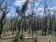
The previous comment nearly put us off doing this walk. Glad we ignored it and went anyway! We had done this walk a couple of times before and the path was no worse than we remembered from several years ago. If anything the bushfires at the start of the year mean there is less vegetation at the moment. Given that this is not a maintained or marked trail it is still reasonable easy to follow. The descent route from South peak has not been impacted by fires at all.

Heather T on 16 May, 2020

Attempted this two months after the January bushfires. It’s currently extremely difficult. The entrance is obscured by multiple fallen trees. The trail is very rarely visible, lots of bush bashing to get up the main part of the mountain. Didn’t get to either peak once we had rock scrambled to about 750m, exhausted and concerned about losing our orientation to the camp ground so turned back. Snakes, fallen trees, etc. Would not recommend until the trail is remarked.

ct__ on 20 Mar, 2020

A really fun if slightly exhausting walk with a constant steep incline. Views are excellent from both peaks. Clockwise is definitely the way to go. The southern peak track has more scrambling sections which would be fun to go up however you would not want to go down the north track which is consistently loose underfoot. This feels like a proper bush hike.

Tim on 21 Oct, 2019

Great all-rounder, with beautiful views + excellent cardio.

Aggy on 22 Sep, 2019

1st climb since broke my leg and tore ACL in May 2019 - great to be back :)

Aggy on 26 Aug, 2019

Camp site on Waterfall Creek Road is easy to find and BIG RED SIGN 🛑 park then you leg it left and up... consistently steep and a bit rocky to run 🏃🏻‍♂️ in places but overall good little double summit to be had by all. The view of Barney and his mates is just 😍⛰⛰⛰⛰ AWESOME 👏🏻

MP__Ultra on 6 Jul, 2019

Went in the clockwise direction. Completed this on a great mild day but it was still sweating it on the climb up. Track is visible 95% of the way, very loose in sections, a bit scratchy to find at the first summit and the second summit. Completed it in 3 1/2 hours with a few drink stops. Exposed in some areas but nothing too hard.

MickeyO on 31 May, 2019

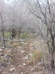
I wouldn't say this was a physicaly hard walk but it was tricky to navigate. There is a track but it easy to lose. Once you reach the second peak the track is straight forward. great views of main range and Moogerah peaks on the first peak the best views of Mt Barney I.ve seen from the second. fun rock scrambleing through the saddle with a little exposure.
Jamie Johnston on 6 May, 2019

Interesting and challenging hike. Recommend going in a clockwise direction starting from the trail on your left just before the red sign in the campgrounds. Difficult to find a track in some parts particularly on the saddle between the two peaks. Pre downloaded a GPS which was handy though to be used more as a general guide then strictly followed. Be wary of a steep descent along a ridge line after the Southern peak and that the 4x4 track runs through private property with a bunch of cows and bulls.

JayWalker on 17 Feb, 2019

Did the circuit starting from the camping ground, going up the northern ridge , across both peaks, down the back of the mountain and via the 4WD track back out.

I did this as an overnight, starting at 3pm in the afternoon. It was far too hot on the way up with a pack in January - 36 degrees when I started. But other than that was nice walk and the campsite in the saddle between the North and South peaks is quite nice.

Dan456 on 19 Jan, 2019

As others have said start it in the carpark and follow a long dirt road until you reach a fence running perpendicular to the road with no gate . That is your sign to look to the left and follow that track up the spine of the mountain to the peak. Nice climb, reminded me of Flinders peak with great views at/near the top. Now heed my warning, go back the way you came, the round trip is perilous and exceedingly difficult to follow. We got shot off onto the wrong ridge and had a hell of a time getting back down. Lots of rock hopping, lantana, cliff faces. Nothing appears to be attached to the side of that mountain, it's all just hanging their precariously, everything you use to steady yourself disintegrates or collapses, or slides down the cliff with you attached to it. There was no pleasure in it at all, 10/10 would not attempt that track again, gets used too infrequently to be obvious.

Vonsnrub on 19 Dec, 2018

Amazing walk/climb. I did it alone, took ages due to being extra cautious to be safe and following gpx track as there was no track to be seen between the first and second peaks. Did the round trip, back tracking to go up the second peak. Steep descent. 4wd track part sucks, get someone to pick you up there, lol.

Caro on 1 Dec, 2018

Hugely undee rated and not as hard as I've heard others claim. Path was clear and not tricky to find after the start at the camp ground at the start of the FWD track.
It is very steep and challenging for the fitness.

Peter Hill on 8 Sep, 2018

From the camping ground it is fairly easy to work out where the start of the track is and it is generally very well defined all the way. There are a couple of spots where the surface is just rock, so here you may need to look around a bit to find the trail. It is a steep climb up to the first peak, but after that it seemed to be easier. There was a brief respite from climbing when you go down into saddle before ascending other peak. This involved a bit of rock climbing in places. Descent starts very steeply but then settles down to a pretty straight forward walk down to the dirt road which you follow back to the camp ground. Nice scenery all the way up and back. A really good walk. Took us about three hours and I measured it at 7.5 kms or so.

jamiehay51260 on 1 Sep, 2018

Download the GPS route! I'm not sure how we would have managed if we didn't have it (although was funny when we skipped over some detours in the route). Very very hard to find the start of the track, I don't think many people have been up there in a while so it was very overgrown in a lot of parts. I found this steep hike harder than Beerwah! Much prefer solid rock and scrambling, the loose rock and dirt was tricky. We bouldered around a few bits and that was great. Coming down was very hard on the knees and quads, ouch! The walk back down the road was heaps easier, you'll motor along there.

sarasvati on 18 May, 2018

First 3/4 of the trail is fairly easy to follow, get's a bit faint towards the top but you can just zig zag on the way down to find the trail again

Peteski on 31 Dec, 2017

Great little walk, took us about 3.5 hours for the loop with a few short breaks, nice views at the top and some pretty rest stops along the way. Two comments: 1. Highly recommend downloading the GPS track on this page to your google maps and using it to navigate, made the walk a breeze, allowing us to easily follow the track the whole way around (if unsure how to do this just google how to load a gpx file to google maps), and 2. Finding the track start was a bit tricky- walk to southern end of the reserve, turn left and walk along the southern side of the creek for about 30-40metres, then cross the creek and walk straight up the fairly steep northern side. There isn't much of a track at the beginning near the creek but you'll easily see it about 100m up at the top of the little ridge near a small lookout. Enjoy!!

Wallaby Jack on 3 Nov, 2017

Energetic 4 hour walk with some scrambling, quite steep and faint trail in parts. Great views from south summit including to Mt Barney. To do the walk clockwise (recommended) start from waterfall creek reserve camp ground and walk up the rock face to the left of the 4WD track. The SES were searching for 3 hikers lost overnight when we arrived, thankfully found by the time we finished the walk.

Wig on 30 Jul, 2017

An excellent walk. Definitely recommend it!

I left from the track just to the left of the 4WD Only Sign at about 6am (first light). Great views of the sun rising on the way and plenty of wallabies about. I definitely would recommend taking a GPS as the tracks are not particularly well defined and there are plenty of false tracks that will lead you to absolute no where (sometimes quite dangerous). I had a GPS and followed this track:

https://www.aussiebushwalking.com/qld/mt-barney/mount-may/mt-may-north-south-peak-circuit.gpx

The track is quite accurate, but coming from the south peak to the north peak there is absolutely no track and very cliffy. Very good views and no one else there the day I went.

I have climbed a lot of mountains in south east Queensland and I reacon this hike is Queenslands best kept secret.

AngusG on 24 Jul, 2017

Started from the end of the 4WD track and completed the circuit with both peaks. Great climb with stunning views of Mt Barney and Maroon dam! :)

courtlalala on 6 Jul, 2017

Where

Click here to load this map.

Nearby Walks

Done this walk?

This walk has been ticked 151 times

Aussie Bushwalking can keep track of your bushwalks.

Login/signup to tick this walk off.

Tick walks to keep track of where you've been. You must Login to tick walks. Accounts are 100% free so sign up if you don't have one.