- Isolated Peak and Toms Tom (Mt Barney National Park)
- Mt Barney East Peak via SE Ridge, traverse North Pinnacle to Leaning Peak, descend to Barney Gorge and Lower Portals (Mt Barney National Park)
- Mt Barney North Peak (Mt Barney National Park)
- Mt Barney via Logans Ridge and return via Gorge (Mt Barney National Park)
- Mt Barney via Gorge and down Peasants Ridge (Mt Barney National Park)
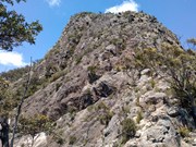
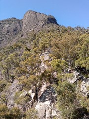
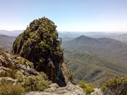
The ridge from Barney waterfall leading to Leaning Peak. One of the hardest bushwalk in the area. A rope is mandatory to abseil of the peak. A rewarding climb.
Getting there
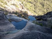
from Lower Portals carpark follow the track to lower portals and bypass them by taking the steep track on the right up to the saddle and back down the creek. Rock hop upstream until you reach barney waterfall (trickle) on your left. Scramble up to the top on the left of the waterfall, cross the waterfall on the right side. The ridge starts here.
Route/Trail notes
1. follow the bushy ridge until some open slabby sections are reached.
2. Scramble up for about 100m or so finding LLR until a new bushy section is reached.
3. From here either follow easy grade 4 rock leading right and up or jump left on a juggy wall (cleaner climbing but harder) to a ledgy area below an exposed blank wall.
4. From here the route traverses left on a bushy ledge until you find a low angle easy juggy ramp leading up and right, or alternatively climb straight up on grade 10 rock but runout.
5. Keep climbing up until a bushy gully on the left leads up to a bouldery move to exit on a shaded ledgy area
6. Carefully scramble over blocks and thin exposed ridge for 50m until top of a notch. Downclimb into the saddle over a chockstone with big exposure either sides and back to the ridge.
7. (crux) From a belay tree (optional), climb up trending left to a black boy and ledge on grade 4:
a) keep climbing up (grade 5/6) with a couple of trees as protection or solo until easy ground, or
b) traverse left, sling solid tree and climb up easy grade but exposed over big drop.
8. Walk to the summit.
DESCENT: from Leaning Peak summit walk to the opposite side towards North Peak and scramble down until you find rapping chains. Rap for 25m to a saddle. From here walk towards North Peak until you descent via North Ridge faint track (few tricky steep sections to downclimb where the rope could help). Cross Rocky creek and join Logan's ridge track to Yellowpinch carpark (two cars at either ends saves you a long hike back to the car).
NOTE: this is just one descent option. Other options include returning back via Short Leaning Ridge or Eagles Ridge.
TIME: allow 10-11 hrs or more car to car and carry enough water (last water can be found at moonlight slabs above Barney waterfall).
Permits/Costs
Nil
Other References
http://www.thecrag.com/climbing/australia/mt-barney/area/11783557
GPS Tracks
Where



 Short Leaning Ridge (GPX)
 10
10 6
6
Comments